Statistics:
- Length:
- 382 km (Wagin to Pingelly: 99 km)
- Termini:
- Northern: Toodyay Rd (SR50), Toodyay
- Southern: Albany Hwy (SR30), Cranbrook
- Suburbs, Towns & Localities Along Route:
- Wagin, Piesseville, Highbury, Dumberning, Narrogin, Hillside, Cuballing, Yornaning, Popanyinning, West Pingelly, Pingelly and East Pingelly
Route Numbering:
- Current: 120
- Multiplexed with: 107
- Road Authority Internal Classification: 1
- M031 (Wagin to Brookton)
- M037 (Wagin)
General Information:
Located in the wheatbelt region of Western Australia, State Route 120 is a rural highway connecting some of the oldest European settlements in the state.
Servicing agricultural properties, commercial, industrial and residential areas, the route runs parallel with the Perth-Albany railway corridor for most of its entire length.
Multiplexes along the route include:
- State Route 107, for 1 km, Wagin.
History:
- 1949: Great Southern Highway name gazetted. 2
- 2001: Link Road (Narrogin Bypass) named Pioneer Drive. 3
- November 2016: Stage 2 (the southern section) of Narrogin Bypass opened to traffic. 4
Click or tap here for the former alignment between Wagin to Pingelly

Advance Directional Sign:
Westbound AD sign on Arthur Road (SR107 / SR120) as you approach Reeve Street (Great Southern Hwy) / SR120 split, in Wagin. August 2008.
Image © Paul Rands

Arthur Road / Reeve Street Intersection:
Westbound on the corner of Reeve Street and Arthur Road in Wagin. SR107 travels straight from here and SR120 travels right from here. August 2008.
Image © Paul Rands
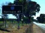
Black Distance Sign:
Northbound on Reeve Street (Great Southern Highway) at Wagin, just after the SR107 split. August 2008. This sign has since been replaced.
Image © Paul Rands
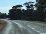
Black Town Sign:
Old black sign announcing the town of Piesseville, August 2008. This sign has since been replaced.
Image © Paul Rands
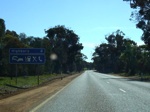
Services Sign:
Services sign approaching the town of Highbury, August 2008.
Image © Paul Rands
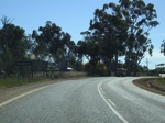
Black Town Sign:
Old black sign announcing the town of Highbury. August 2008. This sign has since been replaced.
Image © Paul Rands
Black Town Sign:
Old faded black sign announcing the town of Narrogin, August 2008. This sign has since been replaced.
Image © Paul Rands

NEW Advance Directional Sign:
AD sign at Narrogin, approaching Federal St, November 2016.
Image © Terry Siva
Trailblazer:
SR120 trailblazer near Pingelly, April 2009.
Image © Paul Rands
Services Sign:
Sign indicating services available in Pingelly, April 2009.
Image © Paul Rands
Entering Pingelly:
Entering the town of Pingelly, April 2009.
Image © Paul Rands
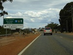
Advance Directional Sign:
AD sign approaching Review Street in Pingelly, April 2009.
Image © Paul Rands
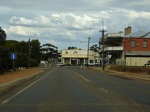
Pingelly Town Centre:
Looking southeast in Pingelly's main street (Parade St), April 2009.
Image © Paul Rands

Quadrant St & North Bannister-Pingelly Rd Junction:
Looking south at the corner of Parade St (SR120), Quadrant St & North Bannister Rd in the Pingelly town centre, April 2009.
Image © Paul Rands
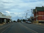
Pingelly Town Centre:
Looking south in Pingelly's main street (Parade St), April 2009.
Image © Paul Rands
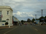
Pasture Street Intersection:
Corner of Parade St (SR120) and Pasture St in Pingelly, April 2009.
Image © Paul Rands
Distance Sign:
RD sign as you leave Pingelly, April 2009.
Image © Paul Rands
Hotham River:
Great Southern Hwy as it crosses Hotham River near Popanyinning, April 2009.
Image © Paul Rands
Services Sign:
Sign indicating the available services in the town of Popanyinning, April 2009.
Image © Paul Rands
Entering Popanyinning:
Looking south as you enter the town of Popanyinning, April 2009.
Image © Paul Rands
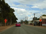
Popanyinning Town Centre:
Looking southwest as you travel along Francis St (SR120) in Popanyinning, April 2009.
Image © Paul Rands
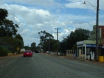
Popanyinning Town Centre:
Looking southwest as you travel along Francis St (SR120) in Popanyinning, April 2009.
Image © Paul Rands
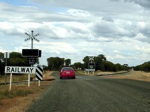
Railway Crossing:
The level crossing on the southern side of Popanyinning's town centre, with a view straight along the railway line, April 2009.
Image © Paul Rands

Yornaning Road Intersection:
Black fingerboard at the corner of Great Southern Hwy and Yornaning Rd in Yornaning, April 2009.
Image © Paul Rands
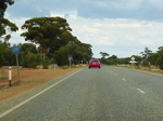
Trailblazer:
SR120 trailblazer in the Yornaning area, April 2009.
Image © Paul Rands
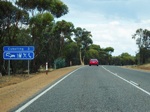
Services Sign:
Sign indicating services available in Cuballing, April 2009.
Image © Paul Rands
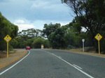
70 km/h zone Ahead:
WA speed limit change ahead warning signs as you approach the town of Cuballing, April 2009.
Image © Paul Rands
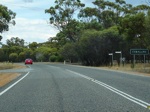
Black Town Name Sign:
Old black sign indicating the town of Cuballing, April 2009. This sign has since been replaced.
Image © Paul Rands
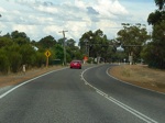
Cuballing Town Centre:
Southbound on Ridley St (SR120) in Cuballing, April 2009.
Image © Paul Rands
Cambell Street Intersection:
Corner of Ridley St (SR120) & Campbell St in Cuballing, April 2009. The shopping precinct is on the right hand side of this junction.
Image © Paul Rands
Cuballing Town Centre:
Southbound on Ridley St (SR120) in Cuballing, April 2009.
Image © Paul Rands
Entering Narrogin:
Looking southbound as you enter Narrogin, April 2009.
Image © Paul Rands
Distance Sign:
RD sign on the Great Southern Hwy, on the outskirts of Narrogin. April 2009. Click or tap here for a photo of this location by Paul Rands from August 2008, featuring a black sign.
Image © Paul Rands
Services Sign:
Southbound services sign as you approach the town of Highbury. August 2008.
Image © Paul Rands
Entering Highbury:
Southbound as you enter the small town of Highbury. August 2008.
Image © Paul Rands
Highbury:
Travelling through the Highbury town centre, August 2008.
Image © Paul Rands
Black Town Sign:
Faded southbound sign announcing the village of Piesseville, August 2008. This sign has since been replaced.
Image © Paul Rands
Piesseville Town Centre:
Southbound approaching Piesseville-Tarwonga Road. August 2008.
Image © Paul Rands
Black Fingerboard:
Southbound through the intersection with Ballagin Road between Piessevile and Wagin, August 2008. This sign has since been replaced.
Image © Paul Rands
Services Sign:
Services sign as you approach the Wagin area, August 2008.
Image © Paul Rands
Entering Wagin:
Looking southeast as you enter the town of Wagin near Ballagin Street (former SR120), August 2008.
Image © Paul Rands
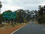
Advance Directional Sign:
Southbound on Great Southern Hwy (Reeve St) in Wagin approaching the T-junction with Arthur Road (SR107). SR120 duplexes left into Wagin's town centre at this junction, April 2009.
Image © Paul Rands
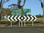
Fingerboard Assembly:
Southbound on the corner of Great Southern Hwy (Reeve St) and Arthur Road (SR107) in Wagin. SR120 duplexes left into Wagin's town centre at this junction, August 2008.
Image © Paul Rands
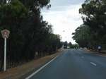
Trailblazer:
TD356 trailblazer, which uses the older wording "Tourist Way" as you enter into Wagin on Arthur Road, April 2009. SR107 is also duplexed along here.
Image © Paul Rands
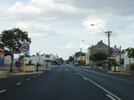
Wagin Town Centre:
Entering the town of Wagin, April 2009. Note the unusual 40 km/h speed limit.
Image © Paul Rands

Advance Directional Sign:
AD sign on Tudhoe St (SR107 / SR120) in Wagin approaching Tudor St (SR120), April 2009. SR120 turns right at the Tudor St junction.
Image © Paul Rands
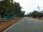
Reassurance Directional Sign:
Distance sign, looking southwest as Great Southern Hwy leaves Wagin, April 2009.
Image © Paul Rands
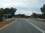
Parkeyerring Lake:
Great Southern Hwy as it crosses Parkeyerring Lake near Wagin, April 2009.
Image © Paul Rands
1 WA Government, Main Roads Western Australia, Road Information Mapping System.
2 WA Government, Western Australia Government Gazette, Land Act 1933-1948 - Naming of Great Southern Highway (per 5852/48), 8 April 1949.
3 Shire of Narrogin.
4 Infrastructure Magazine, Second stage of Narrogin link complete, 28 November 2016.


