Road Photos & Information: Western Australia
Coolgardie-Esperance Highway, South Coast Highway, South Western Highway, Robertson Drive, Forrest Highway, Old Coast Road, Dawesville Bypass, Mandurah Road, Ennis Avenue, Patterson Road, Rockingham Road, Stock Road, Leach Highway, Kwinana Freeway, Canning Highway, Great Eastern Highway, Morrison Road, Great Northern Highway, Brand Highway and North West Coastal Highway
Midland to Muchea
Statistics:
- Length:
- 2941 km (Midland to Muchea: 37 km)
- Termini:
- Northern: Great Northern Hwy (NH1 and NH95), Mundabullangana (near Port Hedland)
- Southern: Eyre Hwy (NH1) and Coolgardie-Esperance Hwy (NR94), Norseman
- Suburbs, Towns & Localities Along Route:
- Middle Swan, Upper Swan, Bullsbrook and Muchea
Route Numbering:
- Current: 1
- Multiplexed with: 95 203 360
- Road Authority Internal Classification: 1
- H004 (Muchea to Geraldton)
- H006 (Middle Swan to Muchea)
General Information:
National Route 1 is a mostly somewhat coastal route in Western Australia. In some cases it travels quite close to the coast and the Indian and Southern Oceans and at other times it is further inland, but still generally following the coastline.
The quality of the route varies from rural 2 lane highway to multi-lane suburban arterial road and also freeway standard.
Multiplexes along the route include:
- National Highway 95, for 35 km, between Middle Swan and Muchea
- Tourist Drive 203, for 15 km, between Middle Swan and Upper Swan
- Tourist Way 360, for 28 km, between Upper Swan and Muchea
History:
- Great Northern Highway & Brand Highway:
- 1975: The Brand Highway was completed. 2
- 1976: Brand Highway opened by Premier Charles Court. 2
- February 1998: Work starts on reconstruction and widening of a 2.7 km section of Great Northern Highway from the RAAF Base entrance at Bullsbrook to Rutland Road. 3
- July 2008: Completion of a major reconstruction of a 1.7 km section of Great Northern Highway between Apple Street and Shell roadhouse north of West Swan Road in Upper Swan. The 5 month project, included widening of the Highway from 7 metres to 11 metres with the addition of 2 metre sealed shoulders. The works also included a 3 metre wide asphalt surfaced truck bay opposite Ginger's Roadhouse, capable of accommodating up to three B-Double road trains.
- October 2008: Reconstruction of a 1.9 km section of the Great Northern Highway from West Swan Road South to Haddrill Road at Upper Swan.
Click or tap here for the former alignment between Midland and Muchea
Midland to Muchea
Muchea to Midland

Advance Directional Sign:
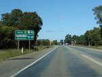
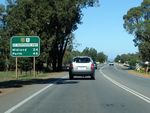
Southbound approaching the road train assembly area and Apple Street in Upper Swan, April 2016. Click or tap here for a photo of this location by Paul Rands from May 2008.
Image © Paul Rands
1 WA Government, Main Roads Western Australia, Road Information Mapping System.
2 WA Government, State Records Office of Western Australia.
3 WA Government, Media Statements, Main Roads contract awarded to Brierty Contractors to widen Great Northern Highway, 17 February 1998.
2 WA Government, State Records Office of Western Australia.
3 WA Government, Media Statements, Main Roads contract awarded to Brierty Contractors to widen Great Northern Highway, 17 February 1998.


