Statistics:
- Length:
- 2941 km (Como to Midland: 20 km)
- Termini:
- Northern: Great Northern Hwy (NH1 and NH95), Mundabullangana (near Port Hedland)
- Southern: Eyre Hwy (NH1) and Coolgardie-Esperance Hwy (NR94), Norseman
- Suburbs, Towns & Localities Along Route:
- South Perth, Victoria Park, Burswood, Lathlain, Rivervale, Belmont, Ascot, Redcliffe, Perth Airport, South Guildford, Guildford, Woodbridge and Midland
Route Numbering:
- Current: 1
- Multiplexed with: 94 6 203
- Road Authority Internal Classification: 1
- H005 (Victoria Park to Woodbridge)
- H013 (Como to Victoria Park)
General Information:
National Route 1 is a mostly somewhat coastal route in Western Australia. In some cases it travels quite close to the coast and the Indian and Southern Oceans and at other times it is further inland, but still generally following the coastline.
The quality of the route varies from rural 2 lane highway to multi-lane suburban arterial road and also freeway standard.
Multiplexes along the route include:
- National Highway 94, for 9 km, between South Guildford and Burswood
- State Route 6, for 6 km, between Victoria Park and Como
- State Route 51, for 3 km, between Guildford and Woodbridge.
- Tourist Drive 203, for 3 km, between Guildford and Middle Swan
History:
- Great Eastern Highway & Great Eastern Highway Bypass:
- February 1997: Great Eastern Hwy / Orrong Rd new intersection opened.
- June 1997: Eastern Gateway Project officially opened by the then Premier Richard Court. As part of the works, the Great Eastern Highway had been widened, facilities for pedestrians and cyclists had been upgraded and bus shelters had been improved. Other elements of the project included extensive landscaping, new flowerbeds, lawn areas extended and limestone retaining walls built. 2
- June 2011: Work started on the upgrade of Great Eastern Highway between Kooyong Road and Tonkin Highway to increase capacity and safety. 3
Click or tap here for the former alignment between Como and Midland

Advance Directional Sign:
AD sign on Canning Hwy (NR1 / SR6) at Victoria Park, approaching the interchange with Causeway (SR5) and Great Eastern Hwy (NR1 / NH94). December 2007.
Image © Paul Rands

Supplemental Advance Directional Sign:
Supplement AD sign for the upcoming Graham Farmer Fwy (SR8). Eastbound at Victoria Park approaching Causeway (SR5). December 2007.
Image © Paul Rands

Intersection Directional Sign:
ID sign for the Causeway intersection, at Victoria Park, near the official terminus of NH94. December 2007.
Image © Paul Rands

Advance Directional Sign:
AD sign for Shepperton Road (SR30) at Burswood. December 2007.
Image © Paul Rands

Advance Directional Sign:
AD sign at Burswood near the Burswood Casino approaching Bolton Av, April 2016. Click or tap here for a photo of this location by Paul Rands from July 2009.
Image © Paul Rands

Victoria Park Drive Intersection:
Corner of Great Eastern Hwy (NH94 / NR1) and Victoria Park Dr at Burswood, April 2016. Click or tap here for a photo of this location by Paul Rands from July 2009.
Image © Paul Rands

Advance Directional Sign:
AD sign at Burswood approaching Graham Farmer Fwy (SR8), April 2016.
Image © Paul Rands

Graham Farmer Fwy / Orrong Road Interchange:
Intersection with Graham Farmer Freeway and Orrong Road at Burswood. December 2007.
Image © Paul Rands

Graham Farmer Fwy / Orrong Road Interchange:
Intersection with Graham Farmer Freeway and Orrong Road at Burswood, April 2016.
Image © Paul Rand
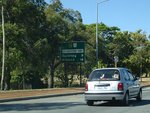
Distance Sign:
Traveling northeast from the Graham Farmer Fwy / Orrong Rd interchange at Rivervale, December 2007.
Image © Paul Rands

Advance Directional Sign:
AD sign at Belmont approaching Belgravia St (SR55) and Stoneham St (SR55), April 2016.
Image © Paul Rands

Belgravia Street & Stoneham Street:
Great Eastern Hwy (NR1 / NH94) at the junction with Belgravia St (SR55) and Stoneham St (SR55) at Belmont, April 2016.
Image © Paul Rands

Belgravia Street & Stoneham Street:
Great Eastern Hwy (NR1 / NH94) at the junction with Belgravia St (SR55) and Stoneham St (SR55) at Belmont, April 2016.
Image © Paul Rands

Advance Directional Sign:
AD sign approaching Gt Eastern Hwy (unnumbered) at Ascot, April 2016.
Image © Paul Rands

Advance Directional Sign:
Heading northeast at South Guildford. Approaching the split of Great Eastern Hwy (NR1) and Great Eastern Hwy Bypass (NH94). December 2007.
Image © Paul Rands

Intersection Directional Sign:
Heading northeast at South Guildford. This is the split of Great Eastern Hwy (NR1) and Great Eastern Hwy Bypass (NH94). December 2007.
Image © Paul Rands

Trailblazer:
Trailblazer at South Guildford near Kalamunda Road, December 2007.
Image © Paul Rands

Kalamunda Road Intersection:
Great Eastern Hwy and Kalamunda Rd in South Guildford, looking northeast, December 2007.
Image © Paul Rands

Helena River:
Crossing the Helena River at South Guildford, December 2007.
Image © Paul Rands

Black AD Sign:
Old black advance directional sign approaching James Street. This is where NR1 picks up the SR51 duplex. December 2007.
Image © Paul Rands

James Street Intersection:
Corner of James Street and Great Eastern Hwy at Guildford, outside the railway station, December 2007.
Image © Paul Rands

Trailblazer Assembly:
Approaching Meadow Street Guildford, December 2007, eastbound.
Image © Paul Rands

Trailblazer Assembly:
Located after the Meadow Street intersection in Guildford, December 2007, eastbound.
Image © Paul Rands
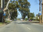
Approaching Terrace Rd:
Approaching the junction with Terrace Road in Guildford, December 2007.
Image © Paul Rands
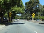
Corner of Terrace Road and Great Eastern Highway:
Looking north at Guildford, December 2007.
Image © Paul Rands

Approaching Terrace Road:
East St (Great Eastern Highway) as you approach Terrace Road (TD203) in Guildford. November 2008.
Image © Paul Rands

Terrace Road Intersection:
Corner of East Street and Terrace Road in Guildford. SR51 and NR1 turn right here and picks up TD203 multiplex. November 2008.
Image © Paul Rands

Intersection Directional Sign:
ID sign facing East Street as NR1 and SR51 turns right at Terrace Road in Guildford. November 2008.
Image © Paul Rands
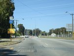
Trailblazers:
Trailblazer assemblies on James Street (Great Eastern Highway) showing the SR51 duplex through Guildford. November 2008.
Image © Paul Rands

Advance Directional Signs:
AD sign assembly on Great Eastern Hwy approaching Morrison Rd in Woodbridge. NR1 and TD203 turn off at Morrison Rd. November 2008.
Image © Paul Rands

Morrison Road Intersection:
Corner of Great Eastern Hwy and Morrison Rd in Woodbridge. TD203 and NR1 turns left here. November 2008.
Image © Paul Rands

Morrison Road & Archer Street:
Great Eastern Hwy (SR51) at Midland at the Morrison Rd and Archer St, June 2009. The NR1 duplex starts here.
Image © Paul Rands

Intersection Directional Sign:
ID sign assembly at the corner of Morrison Rd (NR1) and Archer St in Midland, June 2009.
Image © Paul Rands
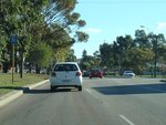
Woodbridge:
NR1 / SR51 trailblazer as Great Eastern Hwy passes through Woodbridge, June 2009.
Image © Paul Rands
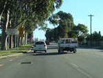
Length Limit Sign:
Length limit sign for the level crossing on Devon St in Woodbridge, June 2009.
Image © Paul Rands

Approaching Guildford Grammar Prep School:
Great Eastern Hwy (SR51 / NR1) approaching the entrance with Guildford Grammar Prep School in Guildford, June 2009.
Image © Paul Rands

Black Advance Directional Sign:
Old black AD sign on Great Eastern Hwy (SR51 / NR1) at Guildford, approaching Terrace Rd (TD203), June 2009. SR51 / NR1 turns left at this junction.
Image © Paul Rands

Trailblazer Assembly:
Trailblazers on Great Eastern Hwy (SR51 / NR1) at Guildford, approaching Terrace Rd (TD203), June 2009. SR51 / NR1 turns left at this junction.
Image © Paul Rands

Terrace Road Intersection:
Great Eastern Hwy (SR51 / NR1) at Guildford, at the intersection with Terrace Rd (TD203), June 2009. SR51 / NR1 turns left at this junction.
Image © Paul Rands
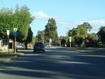
Trailblazer Assembly:
Trailblazers on Great Eastern Hwy (SR51 / NR1) at Guildford, after Terrace Rd (TD203), June 2009.
Image © Paul Rands

Approaching Meadow Street:
Great Eastern Hwy (SR51 / NR1) (James St) at Guildford near Olive St, as the route approaches Meadow St (SR52), June 2009.
Image © Paul Rands

Trailblazer Assembly:
Trailblazers on Great Eastern Hwy (SR51 / NR1) (James St) at Guildford, approaching Meadow St (SR52), June 2009.
Image © Paul Rands

Approaching Johnson Street:
Great Eastern Hwy (SR51 / NR1) (James St) as it approaches Johnson St (NR1) in Guildford, June 2009. The SR51 duplex ends at this junction.
Image © Paul Rands

Advance Directional Sign:
AD sign near Kimberley St at Belmont, approaching Hardey Rd and Resolution Dr, April 2016.
Image © Paul Rands

Advance Directional Sign:
AD sign at Belmont approaching Belgravia St (SR55) and Stoneham St (SR55), April 2016.
Image © Paul Rands

Belgravia Street & Stoneham Street:
Great Eastern Hwy (NR1 / NH94) at the junction with Belgravia St (SR55) and Stoneham St (SR55) at Belmont, April 2016.
Image © Paul Rands

Belgravia Street & Stoneham Street:
Great Eastern Hwy (NR1 / NH94) at the junction with Belgravia St (SR55) and Stoneham St (SR55) at Belmont, April 2016.
Image © Paul Rands

Supplemental Advance Directional Sign:
Supplemental AD sign at Rivervale for the Orrong Rd / Graham Farmer Fwy (SR8) interchange, June 2009.
Image © Paul Rands

Advance Directional Sign:
AD sign at Rivervale for the Orrong Rd / Graham Farmer Fwy (SR8) interchange, June 2009.
Image © Paul Rands

Orrong Rd / Graham Farmer Fwy Interchange:
Great Eastern Hwy (NR1 / NH94) at the Orrong Rd & Graham Farmer Fwy (SR8) interchange at Rivervale, June 2009.
Image © Paul Rands

Orrong Rd / Graham Farmer Fwy Interchange:
Great Eastern Hwy (NR1 / NH94) at the Orrong Rd & Graham Farmer Fwy (SR8) interchange at Lathlain, April 2016.
Image © Paul Rands

Distance Sign:
RD sign after the Orrong Rd & Graham Farmer Fwy (SR8) interchange at Lathlain, June 2009.
Image © Paul Rands

Advance Directional Sign:
AD sign at Lathlain approaching Bolton Av & Victoria Pk Dr, June 2009.
Image © Paul Rands
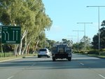
Advance Directional Sign:
AD sign with lane allocations at Burswood approaching Craig Street, June 2009.
Image © Paul Rands

Shepperton Road, Causeway & Canning Highway Interchange:
Great Eastern Hwy at Burswood approaching the interchange with Shepperton Rd (SR30), Causeway (SR5) and Canning Hwy (SR6), June 2009.
Image © Paul Rands

Shepperton Road, Causeway & Canning Highway Interchange:
Great Eastern Hwy at Burswood at the interchange with Shepperton Rd (SR30), Causeway (SR5) and Canning Hwy (SR6), June 2009.
Image © Paul Rands

Trailblazer Assembly:
SR6 / NR1 trailblazer at Victoria Park at the interchange with Causeway (SR5), Great Eastern Hwy (NH94 / NR1) and Shepperton Rd (SR30), June 2009.
Image © Paul Rands
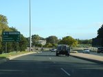
Distance Sign:
RD sign at Victoria Park, June 2009.
Image © Paul Rands

Intersection Directional Sign:
ID signs on Canning Hwy (NR1 / SR6) at Victoria Park, facing Berwick St, April 2016.
Image © Paul Rands
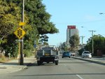
Approaching Way Road:
Canning Hwy (SR6 / NR1) approaching Way Rd at South Perth, June 2009.
Image © Paul Rands
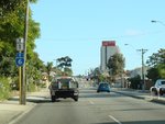
Trailblazer Assembly:
SR6 / NR1 trailblazer at South Perth, approaching Way Rd, June 2009.
Image © Paul Rands
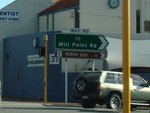
Way Road Intersection:
Corner of Canning Hwy (SR6 / NR1) and Way Rd at South Perth, June 2009.
Image © Paul Rands
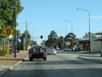
Approaching Douglas Avenue:
Canning Hwy approaching Douglas Av at South Perth, June 2009.
Image © Paul Rands
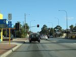
Trailblazer Assembly:
SR6 / NR1 trailblazer at South Perth near Douglas Av, June 2009.
Image © Paul Rands
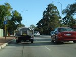
Trailblazer Assembly:
SR6 / NR1 trailblazer at South Perth after the junction with Douglas Av, June 2009.
Image © Paul Rands
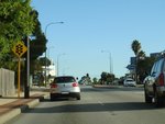
Approaching South Terrace:
Canning Hwy (SR6 / NR1) approaching South Tce at South Perth, June 2009.
Image © Paul Rands
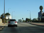
Trailblazer Assembly:
SR6 / NR1 trailblazer at South Perth near South Terrace, June 2009.
Image © Paul Rands
1 WA Government, Main Roads Western Australia, Road Information Mapping System.
2 WA Government, Media Statements, Official opening of Eastern Gateway project, 13 June 1997.
3 WA Government, Media Statements, Works commence on Great Eastern Highway upgrade, 25 June 2011.


