Statistics:
- Length:
- 2941 km (Muchea to Eneabba: 223 km)
- Termini:
- Northern: Great Northern Hwy (NH1 and NH95), Mundabullangana (near Port Hedland)
- Southern: Eyre Hwy (NH1) and Coolgardie-Esperance Hwy (NR94), Norseman
- Suburbs, Towns & Localities Along Route:
- Muchea, Chittering, Bambun, Breera, Gingin, Granville, Boonanarring, Beermullah, Red Gully, Regans Ford, Yathroo, Mimegarra, Cataby, Badgingarra and Warradarge
Route Numbering:
- Current: 1
- Road Authority Internal Classification: 1
- H004 (Muchea to Geraldton)
General Information:
National Route 1 is a mostly somewhat coastal route in Western Australia. In some cases it travels quite close to the coast and the Indian and Southern Oceans and at other times it is further inland, but still generally following the coastline.
The quality of the route varies from rural 2 lane highway to multi-lane suburban arterial road and also freeway standard.
History:
- Brand Highway:
- 1975: The Brand Highway was completed. 2
- 1976: Brand Highway opened by Premier Charles Court. 2
- 1984: Gingin bypassed on western side of town by the current alignment of the Brand Highway. 2
- 2007: Passing lanes constructed 12 km south of Cataby, 40 km north of Gingin. 3
- June 2007: Two more passing lanes completed on Brand Highway south of Cataby. 4
Click or tap here for the former alignment between Muchea and Enabba
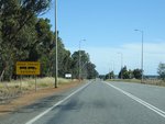
Road Trains Entering Sign:
Sign warning of roads trains crossing the road, as you approach Gingin, November 2008.
Image © Paul Rands
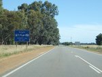
Services Sign:
Southbound approaching the town of Gingin. November 2008.
Image © Paul Rands
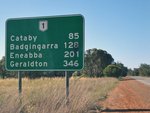
Distance Sign:
Northbound RD sign after the Honeycomb Road intersection at Gingin. November 2008.
Image © Paul Rands

Advance Directional Sign:
AD sign at Gingin approaching Gingin Brook Rd, April 2016.
Image © Paul Rands

Gingin Brook Road:
Corner of Brand Hwy (NR1) and Gingin Brook Rd at Gingin, April 2016.
Image © Paul Rands

Intersection Directional Sign:
ID sign facing Gingin Brook Rd at Gingin, April 2016.
Image © Paul Rands

Advance Directional Sign:
AD sign at Gingin approaching Gingin Brook Access Rd, April 2016.
Image © Paul Rands

Gingin Brook Road:
Corner of Brand Hwy (NR1) and Gingin Brook Access Rd at Gingin, April 2016.
Image © Paul Rands

Distance Sign:
Northbound RD sign at Gingin, April 2016.
Image © Paul Rands

Trailblazer:
Incorrect NH1 trailblazer at Boonarring, April 2016.
Image © Paul Rands

Intersection Directional Sign:
ID sign facing Mogumber Rd West at Orange Springs, April 2016.
Image © Paul Rands

Orange Springs Road:
Corner of Brand Hwy (NR1) and Orange Springs Rd at Orange Springs, April 2016.
Image © Paul Rands

Road Ends Sign:
Unusual road ends sign on Orange Springs Rd at Orange Springs, approaching Brand Hwy (NR1), April 2016.
Image © Paul Rands

Intersection Directional Sign:
ID sign facing Orange Springs Rd at Orange Springs, April 2016.
Image © Paul Rands

Services Sign:
Services sign at Orange Springs for Regans Ford, April 2016.
Image © Paul Rands

Regans Ford:
Brand Hwy (NR1) entering the town of Regans Ford, April 2016.
Image © Paul Rands

Moore River:
Brand Hwy (NR1) at Regans Ford crossing the Moore River via Regans Ford, April 2016.
Image © Paul Rands

Harris Street:
Corner of Brand Hwy (NR1) and Harris St at Regans Ford, April 2016.
Image © Paul Rands

Advance Directional Sign:
AD sign at Regans Ford approaching Dandaragan Rd, April 2016.
Image © Paul Rands

Dandaragan Road:
Corner of Brand Hwy (NR1) and Dandaragan Rd at Regans Ford, April 2016.
Image © Paul Rands

Reassurance Directional Sign:
Distance sign at Regans Ford, April 2016.
Image © Paul Rands

Services Sign:
Services sign at Yatheroo for Cataby, April 2016.
Image © Paul Rands

Birds Warning Sign:
Unusual birds warning sign at Yatheroo, April 2016.
Image © Paul Rands

Entering Cataby:
Brand Hwy (NR1) as it enters to the town of Cataby, April 2016.
Image © Paul Rands

Advance Directional Sign:
AD sign at Cataby, approaching Cataby Rd, April 2016.
Image © Paul Rands

Intersection Directional Sign:
ID sign at the Cataby Rd intersection at Cataby, April 2016.
Image © Paul Rands

Intersection Directional Sign:
ID sign at the Caro Rd intersection at Cataby, April 2016.
Image © Paul Rands

Reassurance Directional Sign:
Distance sign at Cataby, April 2016.
Image © Paul Rands

Trailblazer:
NR1 trailblazer at Cooljarloo, April 2016.
Image © Paul Rands

Advance Directional Sign:
AD sign approaching Bibby Rd at Badgingarra, April 2016.
Image © Paul Rands

Intersection Directional Sign:
ID sign facing Bibby Rd at Badgingarra, December 2012.
Image © Paul Rands
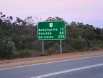
Reassurance Directional Sign:
Distance sign at Badgingarra near Bibby Rd, December 2012.
Image © Paul Rands

Services Sign:
Services sign at Badgingarra, April 2016.
Image © Paul Rands

Advance Directional Sign:
AD sign approaching Meagher Dr at Badgingarra, April 2016.
Image © Paul Rands

Meagher Drive:
Corner of Brand Hwy (NR1) and Meagher Dr at Badgingarra, April 2016.
Image © Paul Rands

Northwest Road:
Corner of Brand Hwy (NR1) and Northwest Rd at Badgingarra, April 2016.
Image © Paul Rands

Distance Sign:
Reassurance directional sign at Badgingarra, April 2016.
Image © Paul Rands

Hill River:
Brand Hwy (NR1) crossing Hill River at the town of Hill River, April 2016.
Image © Paul Rands

Watheroo Road:
Corner of Brand Hwy (NR1) and Watheroo Rd at Hill River, April 2016.
Image © Paul Rands

Advance Directional Sign:
AD sign at Boothendarra approaching Jurien East Rd, April 2016.
Image © Paul Rands

Jurien East Road:
Corner of Brand Hwy (NR1) and Jurien East Rd at Boothendarra, April 2016.
Image © Paul Rands

Intersection Directional Sign:
ID sign facing Jurien East Rd at Boothendarra, April 2016.
Image © Paul Rands

Reassurance Directional Sign:
Distance sign at Boothendarra, April 2016.
Image © Paul Rands

Entering Warradarge:
Brand Hwy (NR1) as it enters the town of Warradarge, April 2016.
Image © Paul Rands

Advance Directional Sign:
AD sign approaching Coorow-Green Head Rd at Warradarge, April 2016.
Image © Paul Rands

Intersection Directional Sign:
ID sign facing Coorow-Green Head Rd at Warradarge, December 2012.
Image © Paul Rands

Coorow-Green Head Road:
Corner of Brand Hwy (NR1) and Coorow-Green Head Rd at Warradarge, April 2016.
Image © Paul Rands

Reassurance Directional Sign:
Distance sign at Warradarge, April 2016.
Image © Paul Rands

Services Sign:
Services sign at Warradarge for Eneabba, April 2016.
Image © Paul Rands
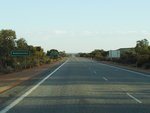
Warradarge:
Brand Hwy (NR1) as it enters the town of Warradarge, December 2012.
Image © Paul Rands
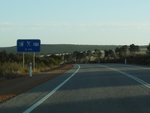
Services Sign:
Services sign in Warradarge, December 2012.
Image © Paul Rands

Advance Directional Sign:
AD sign approaching Coorow-Greenhead Rd in Warradarge, December 2012.
Image © Paul Rands

Coorow-Greenhead Road:
Corner of Brand Hwy (NR1) and Coorow-Greenhead Rd in Warradarge, December 2012.
Image © Paul Rands

Coorow-Greenhead Road:
Corner of Brand Hwy (NR1) and Coorow-Greenhead Rd in Warradarge, April 2016.
Image © Paul Rands

Coorow-Greenhead Road:
Corner of Brand Hwy (NR1) and Coorow-Greenhead Rd in Warradarge, December 2012.
Image © Paul Rands

Reassurance Directional Sign:
Distance sign at Warradarge, April 2016.
Image © Paul Rands
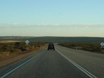
Boothendarra:
Brand Hwy (NR1) as it passes through the Boothendarra area, December 2012.
Image © Paul Rands
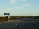
Jurien East Road:
Corner of Brand Hwy (NR1) and Jurien East Rd at Boothendarra, December 2012.
Image © Paul Rands
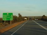
Distance Sign:
RD sign at Boothendarra, December 2012.
Image © Paul Rands

Watheroo Road:
Brand Hwy (NR1) at Hill River at the junction with Watheroo Rd, April 2016. Click or tap here for a photo of this location with old black fingerboard by Paul Rands from December 2012.
Image © Paul Rands
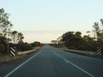
Hill River:
Brand Hwy (NR1) as it crosses Hill River at Hill River, December 2012.
Image © Paul Rands
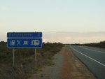
Services Sign:
Services sign at Badgingarra, December 2012.
Image © Paul Rands

Advance Directional Sign:
AD sign approaching Northwest Rd at Badgingarra, April 2016.
Image © Paul Rands

Northwest Road:
Corner of Brand Hwy (NR1) and Northwest Rd at Badginagarra, April 2016.
Image © Paul Rands

Northwest Road:
Corner of Brand Hwy (NR1) and Northwest Rd at Badginagarra, April 2016.
Image © Paul Rands
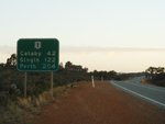
Distance Sign:
RD sign at Badgingarra, December 2012.
Image © Paul Rands
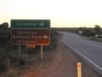
Advance Directional Sign:
AD sign approaching Bibby Rd in Badgingarra, December 2012.
Image © Paul Rands
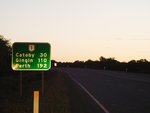
Distance Sign:
RD sign at Badgingarra, December 2012.
Image © Paul Rands

Advance Directional Sign:
AD sign at Cataby approaching Cataby Rd, April 2016.
Image © Paul Rands

Services Sign:
Services sign at Cataby, April 2016.
Image © Paul Rands

Reassurance Directional Sign:
Distance sign at Cataby, April 2016.
Image © Paul Rands

Advance Directional Sign:
AD sign at Regans Ford, approaching Dandaragan Way, April 2016.
Image © Paul Rands

Intersection Directional Sign:
ID sign facing Dandaragan Way at Regans Ford, April 2016.
Image © Paul Rands

Advance Directional Sign:
AD sign at Orange Springs approaching Orange Springs Rd, April 2016.
Image © Paul Rands

Intersection Directional Sign:
ID sign facing Orange Springs Road traffic at Regans Ford. November 2008.
Image © Paul Rands

Reassurance Directional Sign:
Distance sign at Orange Springs, April 2016.
Image © Paul Rands
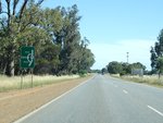
Bypassed Town Sign:
Bypassed town sign showing the bypassed town of Gingin, November 2008. The town was bypassed in 1984.
Image © Paul Rands
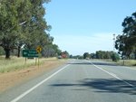
Advance Directional Sign:
Southbound advance directional sign for the intersection with Dewar Road, November 2008.
Image © Paul Rands
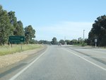
Advance Directional Sign:
Southbound at Gingin as the Brand Hwy approaches the intersection with Gingin Brook Road. November 2008.
Image © Paul Rands
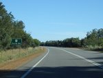
Distance Sign:
Southbound RD after Gingin Brook Road at Gingin, November 2008.
Image © Paul Rands
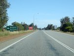
Advance Directional Sign:
AD sign in Brand Hwy approaching Honeycomb Rd at Gingin, November 2008.
Image © Paul Rands
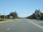
Honeycomb Road Intersection:
Southbound at the corner of Brand Hwy and Honeycomb Rd in Gingin, November 2008.
Image © Paul Rands
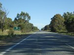
Distance Sign:
Southbound RD sign as you leave the Gingin area, November 2008.
Image © Paul Rands
1 WA Government, Main Roads Western Australia, Road Information Mapping System.
2 WA Government, State Records Office of Western Australia.
3 WA Government, Ministerial Media Statements, Works progressing on upgrading South Western Highway, 23 November 2005.
4 WA Government, Media Statements, Passing lanes to improve safety on Brand Highway, 19 June 2007.


