Statistics:
- Length:
- 11 km
- Termini:
- Northern: Karrinyup Rd (SR76) and Cedric St (unnumbered), Stirling
- Southern: Thomas St (SR61), Shenton Park
- Suburbs, Towns & Localities Along Route:
- Shenton Park, Subiaco, Daglish, Floreat, Jolimont, Wembley, Churchlands, Woodlands, Osborne Park, Innaloo and Stirling
Route Numbering:
- Current: 64
- XX
General Information:
State Route 64 is a western suburban Perth route. It's mix of divided and undivided road, servicing residential, commercial and light industrial areas.
The Stephenson Avenue section of the route is also known as Stirling Link Road. 1
History:
- 5 December 1994: Stirling Link Road (Stephenson Avenue) opened to traffic. 2
Click or tap here for the former alignment between Shenton Park and Stirling

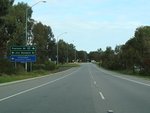
Intersection Directional Sign:
ID sign on Scarborough Beach Rd (SR75) at Osborne Park at the junction with Stephenson Av (SR64), July 2009.
Image © Paul Rands
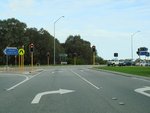
Advance Directional Sign:
AD sign on Stephenson Av in Osborne Park approaching Jon Sanders Rd and Pearson St (SR64), July 2009.
Image © Paul Rands
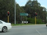
Jon Sanders Drive & Pearson Street Junction:
Corner of Stephenson Av (SR64), Pearson St (SR64) and Jon Sanders Dr in Osborne Park, July 2009.
Image © Paul Rands
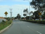
Jon Sanders Drive & Pearson Street Junction:
ID sign at the corner of Stephenson Av (SR64), Pearson St (SR64) and Jon Sanders Dr in Osborne Park, July 2009.
Image © Paul Rands
Approaching Liege Street:
Pearson St (SR64) approaching Liege St (former SR64) at Woodlands, July 2009.
Image © Paul Rands

Approaching Hale Road & Bishop Hale Grove:
Pearson St (SR64) as it approaches Hale Rd and Bishop Hale Gr at Churchlands, July 2009.
Image © Paul Rands
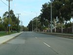
Trailblazer:
SR64 trailblazer on Pearson St (SR64) after Hale Rd and Bishop Hale Gr at Churchlands, July 2009.
Image © Paul Rands
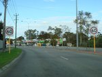
Churchlands Area:
SR64 as it enters the shopping precinct at Churchlands, July 2009.
Image © Paul Rands
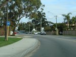
Trailblazer:
SR64 trailblazer on Selby St (SR64) after Flynn St roundabout at Wembley, July 2009.
Image © Paul Rands
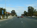
Grantham Street Intersection:
Corner of Selby St (SR64) and Grantham St (SR72) at Wembley, July 2009.
Image © Paul Rands
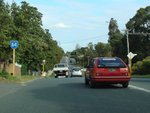
Trailblazer:
SR64 trailblazer on Selby St (SR64) near Winmarley St, after the Grantham St (SR72) intersection at Wembley, July 2009.
Image © Paul Rands
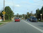
Approaching The Boulevard:
Selby St (SR64) at Wembley approaching The Boulevard, July 2009.
Image © Paul Rands
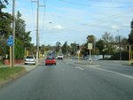
The Boulevard:
Corner of Selby St (SR64) and The Boulevard at Wembley, July 2009.
Image © Paul Rands
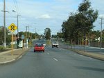
Approaching Cambridge Street:
Selby St (SR64) at Wembley approaching Cambridge St, July 2009.
Image © Paul Rands
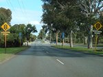
Approaching Underwood Avenue & Hay Street:
Selby St (SR64) at Jolimont, approaching Underwood Av (SR65) and Hay St (SR65), July 2009.
Image © Paul Rands
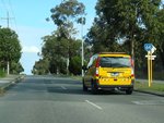
Trailblazer:
SR64 trailblazer at Shenton Park, after the junction with Underwood Av (SR65) and Hay St (SR65), July 2009.
Image © Paul Rands
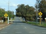
Approaching Nash Street:
Selby St (SR64), approaching the unnumbered section of Selby St and Nash St (SR64) at Daglish, July 2009.
Image © Paul Rands
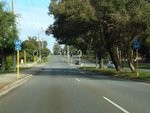
Trailblazer:
SR64 trailblazer at the unnumbered section of Selby St and Nash St (SR64) at Daglish, July 2009.
Image © Paul Rands
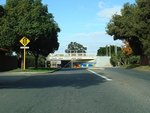
Approaching Railway Road & Nicholson Road:
Nash St (SR64) at Daglish, approaching Railway Rd and Nicholson Rd (SR64), July 2009.
Image © Paul Rands
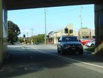
Railway Road & Nicholson Road Intersection:
Nash St (SR64) at Daglish, at the junction with Railway Rd and Nicholson Rd (SR64), July 2009.
Image © Paul Rands
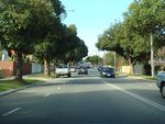
Subiaco:
SR64 as it makes its way through Subiaco, July 2009.
Image © Paul Rands
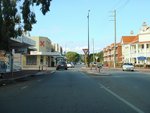
Derby Road Roundabout:
Corner of Nicholson Rd (SR64) and Derby Rd in Subiaco, July 2009.
Image © Paul Rands
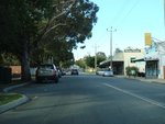
Subiaco:
SR64 as it makes its way through Subiaco, July 2009.
Image © Paul Rands
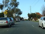
Approaching Rokeby Road:
Nicholson Rd (SR64) near Arthur St in Subiaco, as SR64 approaches Rokeby Rd (SR64), July 2009.
Image © Paul Rands
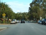
Approaching Thomas St:
Rokeby Road (SR64) approaching Thomas Street (SR61) at Subiaco, July 2009.
Image © Paul Rands
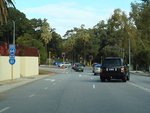
End State Route 64:
Trailblazer showing the end of SR64 approaching the junction with Thomas St (SR61) at Subiaco, July 2009.
Image © Paul Rands
1 City of Stirling, Minutes, Stirling Link Road, Scarborough Beach Road, Liege Street Right Turn Movements, March 1999.
2 City of Stirling, Minutes, Stirling Link Road - Official Opening, November 1994.


