Statistics:
- Length:
- 11 km
- Termini:
- Northern: Karrinyup Rd (SR76) and Cedric St (unnumbered), Stirling
- Southern: Thomas St (SR61), Shenton Park
- Suburbs, Towns & Localities Along Route:
- Shenton Park, Subiaco, Daglish, Floreat, Jolimont, Wembley, Churchlands, Woodlands, Osborne Park, Innaloo and Stirling
Route Numbering:
- Former: 64
- XX
General Information:
State Route 64 is a western suburban Perth route. It's mix of divided and undivided road, servicing residential, commercial and light industrial areas.
The Stephenson Avenue section of the route is also known as Stirling Link Road. 1
There are several streets surrounding the current route that were once part of State Route 64, including Liege Street, Scarborough Beach Road, Odin Road and Cedric Street between Mitchell Freeway and Odin Road.
History:
- 5 December 1994: Stirling Link Road (Stephenson Avenue) opened to traffic. 2
This page concentrates on the former alignment between Shenton Park and Stirling

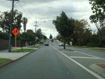
Between Talbot Road & Blackbutt Road:
Leige St (former SR64) looking northbound between Talbot and Blackbutt Roads, Woodlands, July 2009.
Image © Paul Rands

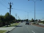
Approaching Scarborough Beach Road:
Northbound on Liege St near the Scarborough Beach Rd (SR75) intersection, Woodlands, July 2009.
Image © Paul Rands

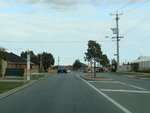
Odin Road:
Northbound on Odin Rd at Innaloo, April 2009.
Image © Paul Rands

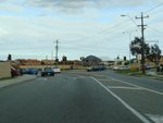
Approaching Cedric Street & Beatrice Street:
Northbound on Odin Rd approaching the unnumbered section of Odin Rd, and also Cedric St and Beatrice St in Innaloo, April 2009.
Image © Paul Rands

Freeway Green Intersection Directional Sign:
Freeway green ID sign and black topknot at the corner of Odin Rd (SR64), Cedric St (SR64) and Beatrice St at Innaloo, April 2009.
Image © Paul Rands

Approaching Ellen Stirling Drive:
Cedric St (SR64) approaching Ellen Stirling Dr at Innaloo, April 2009.
Image © Paul Rands

Advance Directional Sign:
AD sign on Cedric St (SR64) approaching Mitchell Fwy (SR2) at Innaloo, April 2009.
Image © Paul Rands

Freeway Green Prohibition Sign:
Older freeway green prohibition sign at the Mitchell Fwy interchange at Innaloo, April 2009.
Image © Paul Rands

Mitchell Freeway Interchange:
Cedric St (SR64) at the interchange with Mitchell Fwy (SR2) in Innaloo, April 2009.
Image © Paul Rands

Mitchell Freeway Interchange:
Cedric St (SR64) at the Mitchell Fwy (SR2) interchange at Innaloo, April 2016.
Image © Paul Rands

Mitchell Freeway Interchange:
Cedric St (SR64) at the Mitchell Fwy (SR2) interchange at Innaloo, April 2016.
Image © Paul Rands

Southbound at Woodlands:
Liege Street looking southbound near the Woodlands Retirement Village, July 2009.
Image © Paul Rands

Near Talbot Road:
Southbound on Liege St near Talbot Rd in Woodlands, July 2009.
Image © Paul Rands

Pearson Street Intersection:
Corner of Liege St (former SR64) and Pearson St (SR64) at Woodlands, July 2009.
Image © Paul Rands
1 City of Stirling, Minutes, Stirling Link Road, Scarborough Beach Road, Liege Street Right Turn Movements, March 1999.
2 City of Stirling, Minutes, Stirling Link Road - Official Opening, November 1994.


