Statistics:
- Length:
- 2941 km (Mandurah to Rockingham: 32 km)
- Termini:
- Northern: Great Northern Hwy (NH1 and NH95), Mundabullangana (near Port Hedland)
- Southern: Eyre Hwy (NH1) and Coolgardie-Esperance Hwy (NR94), Norseman
- Suburbs, Towns & Localities Along Route:
- Mandurah, Greenfields, Silver Sands, Meadow Springs, San Remo, Madora Bay, Lakelands, Singleton, Golden Bay, Secret Harbour, Karnup, Baldivis, Port Kennedy, Warnbro, Waikiki and Cooloongup
Route Numbering:
- Current: 1
- Road Authority Internal Classification: 1
- H002 (Greenfields (Mandurah to Palmyra))
- M074 (Lake Clifton to Greenfields (Mandurah))
General Information:
National Route 1 is a mostly somewhat coastal route in Western Australia. In some cases it travels quite close to the coast and the Indian and Southern Oceans and at other times it is further inland, but still generally following the coastline.
The quality of the route varies from rural 2 lane highway to multi-lane suburban arterial road and also freeway standard.
History:
- Mandurah Road and Ennis Avenue:
- 1986: Mandurah Bypass completed. 2
- December 2014: Completion of a second left-turn lane from Grange Drive into Ennis Avenue at Cooloongup. 3
- 1 February 2015: Completion of the upgrade to the intersection of Ennis Avenue with Willmott Drive at Waikiki. This work included a new acceleration lane for traffic turning right out of Willmott Drive onto Ennis Avenue and traffic signals to control Ennis Avenue northbound and southbound, turning right into Willmott Drive and Willmott Drive turning right onto Ennis Avenue. 3
- April 2015: Work commences on upgrades at the corner of Ennis Av and Port Kennedy Dr. The work includes converting the T-junction into a new 'seagull' configuration, with traffic signals controlling all right-turn movements and giving priority to Ennis Avenue traffic. The works also include extending the deceleration lane on Ennis Avenue southbound by 400 m. 4
- June 2015: Completion of the upgrade at the corner of Ennis Av & Port Kennedy Dr at Port Kennedy. 5

Approaching Pinjarra Road:
Northbound at the intersection with Pinjarra Road, Mandurah, April 2008.
Image © Paul Rands

Approaching Pinjarra Road:
Northbound at the intersection with Pinjarra Road, Mandurah, April 2008.
Image © Paul Rands

Advance Directional Sign:
Eastbound AD sign on Pinjarra Rd at Mandurah approaching Mandurah Bypass (NR1), April 2008.
Image © Paul Rands

Intersection Directional Sign:
Eastbound ID sign on Pinjarra Rd at Mandurah at the junction with Mandurah Bypass (NR1), April 2008.
Image © Paul Rands
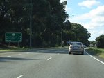
Distance Sign:
RD sign on Mandurah Bypass (NR1) at Mandurah after the Mandurah Tce intersection, April 2008.
Image © Paul Rands

Supplemental Advance Directional Sign:
Supplemental AD sign approaching Mandjoogoordap Dr (SR19) at Mandurah, December 2012.
Image © Paul Rands

Advance Directional Sign:
AD sign approaching Mandjoogoordap Dr (SR19) at Mandurah, December 2012.
Image © Paul Rands

Intersection Directional Sign:
ID sign at the roundabout with Mandjoogoordap Dr (SR19) at Mandurah, December 2012.
Image © Paul Rands

Mandjoogoordap Rotary:
The roundabout (Mandjoogoordap Rotary) with Mandjoogoordap Dr (SR19) at Mandurah, December 2012.
Image © Paul Rands

Advance Directional Sign:
AD sign approaching Mandjoogoordap Dr (SR19) at Mandurah, December 2012.
Image © Paul Rands

Gordon Road Intersection:
Northbound at the intersection with Gordon Road in Mandurah, December 2007.
Image © Paul Rands

Exiting the Peel Region:
Tourist orientated sign at Madora Bay indicating we are leaving the Peel Region, northbound, December 2007.
Image © Paul Rands

Thank You Sign:
Northbound sign at Madora Bay thanking people for visiting Mandurah. December 2007.
Image © Paul Rands
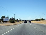
Welcome To The Fun Coast:
Northbound at Singleton is this sign indicating we've entered the Fun Coast. December 2007.
Image © Paul Rands
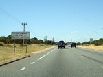
Speed Cameras Sign:
Northbound sign indicating the use of speed cameras in WA, Singleton, December 2007.
Image © Paul Rands

Advance Directional Sign:
Northbound sign approaching Singleton Beach Road at Singleton, December 2007.
Image © Paul Rands

Singleton Beach Road Intersection:
Looking northbound at Singleton, December 2007.
Image © Paul Rands

Approaching Dampier Drive:
Northbound at Golden Bay approaching Dampier Drive, December 2007.
Image © Paul Rands

Trailblazer:
Reassurance marker approaching Dampier Drive at Golden Bay, December 2007, northbound.
Image © Paul Rands

U-Turn / Lane Allocation Signs:
Northbound at Dampier Drive, Golden Bay, December 2007.
Image © Paul Rands

Advance Directional Sign:
Sign for Secret Harbour and Anstey Road, December 2007, northbound at Secret Harbour.
Image © Paul Rands

Advance Directional Sign:
Northbound AD sign on Ennis Avenue approaching Stakehill Road in Karnup, December 2007.
Image © Paul Rands
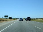
Distance Sign:
Northbound reassurance distance sign northbound at Karnup, December 2007.
Image © Paul Rands

Intersection Directional Sign:
ID sign facing westbound traffic from Stake Hill Road at Baldivis, January 2009.
Image © Tim Cole

Advance Directional Sign:
AD sign for Port Kennedy Drive at Port Kennedy, December 2007.
Image © Paul Rands

Port Kennedy Drive Intersection:
The junction of Ennis Avenue and Port Kennedy Drive at Port Kennedy. Northbound, December 2007.
Image © Paul Rands

Advance Directional Sign:
Northbound AD sign approaching the interchange with Safety Bay Road (SR18) at Warnbro. December 2007. Safety Bay Road used to be the connector to the southern end of the Kwinana Freeway (SR2).
Image © Paul Rands

Safety Bay Drive:
The grade separated interchange between Ennis Av and Safety Bay Rd at Warnbro, December 2007, northbound.
Image © Paul Rands
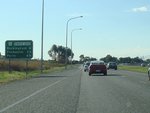
Distance Sign:
RD sign at Waikiki, after the interchange with Safety Bay Rd (SR18), June 2009.
Image © Paul Rands

Approaching Elanor Drive & Grange Drive:
Ennis Av (NR1) at Cooloongup approaching Elanor Dr and Grange Dr, June 2009.
Image © Paul Rands

Approaching Elanor Drive & Grange Drive:
Ennis Av (NR1) at Cooloongup approaching Elanor Dr and Grange Dr, June 2009.
Image © Paul Rands

Elanor Drive & Grange Drive:
Ennis Av (NR1) at Cooloongup at Elanor Dr and Grange Dr, June 2009.
Image © Paul Rands

Advance Directional Sign:
AD sign at Waikiki approaching Safety Bay Rd (SR18), June 2009.
Image © Paul Rands

Safety Bay Road Interchange:
Intersection directional sign on Ennis Av (NR1) at Waikiki at the Safety Bay Rd (SR18) interchange, June 2009.
Image © Paul Rands

Advance Directional Sign:
AD sign at Port Kennedy approaching Port Kennedy Road, June 2009.
Image © Paul Rands

Port Kennedy Road:
Corner of Ennis Av (NR1) and Port Kennedy Rd in Port Kennedy, June 2009.
Image © Paul Rands

Port Kennedy Road:
ID sign assembly at the corner of Ennis Av (NR1) and Port Kennedy Rd in Port Kennedy, June 2009.
Image © Paul Rands

Approaching Stake Hill Road:
Southbound on Ennis Avenue approaching Stake Hill Road at Baldivis. January 2009.
Image © Tim Cole
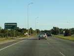
Distance Sign:
Reassurance directional sign at Karnup, June 2009.
Image © Paul Rands
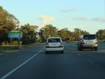
Anstey Road:
Corner of Mandurah Rd (NR1) and Anstey Rd at Karnup, June 2009.
Image © Paul Rands
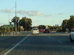
Approaching Dampier Drive:
AD sign at Karnup approaching Dampier Dr, June 2009.
Image © Paul Rands
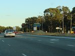
Dampier Drive:
Corner of Mandurah Rd (NR1) and Dampier Dr at Karnup, June 2009.
Image © Paul Rands
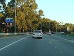
Advance Directional Sign:
AD sign at Karnup approaching Paganoni Rd, June 2009.
Image © Paul Rands
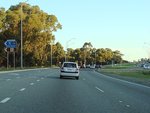
Paganoni Road:
Corner of Ennis Av (NR1) and Paganoni Rd at Karnup, June 2009.
Image © Paul Rands
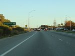
Approaching Singleton Beach Road:
AD sign on Mandurah Rd (NR1) at Karnup approaching Singleton Beach Rd, June 2009.
Image © Paul Rands
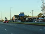
Singleton Beach Road:
Mandurah Rd (NR1) at Karnup at the junction with Singleton Beach Rd, June 2009.
Image © Paul Rands
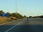
Radio Station Sign:
Sign detailing local radio stations, Lakelands, June 2009.
Image © Paul Rands
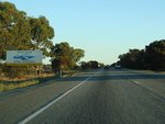
Entering The Peel Region:
Mandurah Rd as it enters the Peel Region tourism area at Lakelands, June 2009.
Image © Paul Rands
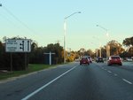
Approaching Meadow Springs Drive:
Mandurah Rd (NR1) approaching Meadow Springs Dr at Meadow Springs, June 2009.
Image © Paul Rands
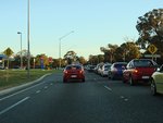
Meadow Springs Drive:
Mandurah Rd (NR1) at the junction with Meadow Springs Dr at Meadow Springs, June 2009.
Image © Paul Rands
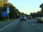
Services Sign:
Services sign at Meadow Springs, on Mandurah Rd (NR1) approaching Mandurah Tce and Mandurah Bypass (NR1), June 2009.
Image © Paul Rands

Intersection Directional Sign:
ID sign on Mandurah Bypass at Meadow Springs, approaching Gordon Rd, June 2009.
Image © Paul Rands

Approaching Gordon Road:
Flashing warning signs approaching the traffic lights for Gordon Rd at Meadow Springs, June 2009.
Image © Paul Rands

Advance Directional Sign:
AD sign approaching Mandjoogoordap Dr (SR19) at Greenfields, December 2012.
Image © Paul Rands

Advance Directional Sign:
AD sign approaching Mandjoogoordap Dr (SR19) at Greenfields, December 2012.
Image © Paul Rands
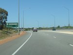
Distance Sign:
Reassurance directional sign at Greenfields, December 2012.
Image © Paul Rands

Approaching Allnut Street & Murdoch Drive:
Mandurah Bypass approaching Allnut St and Murdoch Dr at Greenfields, June 2009.
Image © Paul Rands

Approaching Allnut Street & Murdoch Drive:
Mandurah Bypass approaching Allnut St and Murdoch Dr at Greenfields, December 2012.
Image © Paul Rands

Intersection Directional Sign:
ID sign on Mandurah Bypass (NR1) at the junction with Allnut St and Murdoch Dr at Greenfields, December 2012.
Image © Paul Rands
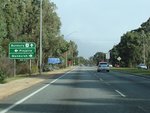
Advance Directional Sign:
AD sign on Mandurah Bypass (NR1) approaching Pinjarra Rd at Greenfields, August 2009.
Image © Paul Rands
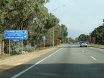
Supplemental Advance Directional sign:
Supplemental AD sign on Manduarah Bypass (NR1) at Greenfields, approaching Pinjarra Rd, August 2009.
Image © Paul Rands
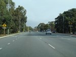
Approaching Pinjarra Road:
Older style traffic signal warning signs as you approaching Pinjarra Rd at Greenfields, August 2009.
Image © Paul Rands
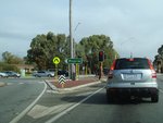
Pinjarra Road:
Corner of Mandurah Bypass (NR1) and Pinjarra Rd at Greenfields, August 2009.
Image © Paul Rands
1 WA Government, Main Roads Western Australia, Road Information Mapping System.
2 South West Focus Conference, Main Roads WA Linking the South West, May 2007.
3 WA Government, Main Roads Western Australia, Completed Projects, Ennis Avenue Intersection Upgrades.
4 WA Government, Main Roads Western Australia, Ennis Avenue-Port Kennedy Drive Intersection Upgrade, April 2015.
5 WA Government, New intersection opens in Port Kennedy, 22 June 2015.


