Statistics:
- Length:
- 2941 km (Binningup to Mandurah: 75 km)
- Termini:
- Northern: Great Northern Hwy (NH1 and NH95), Mundabullangana (near Port Hedland)
- Southern: Eyre Hwy (NH1) and Coolgardie-Esperance Hwy (NR94), Norseman
- Suburbs, Towns & Localities Along Route:
- Myalup, Preston Beach, Lake Clifton, Herron, Bouvard, Dawesville, Wannanup, Falcon, Erskine, Halls Head, Dudley Park and Coodanup
Route Numbering:
- Current: 1
- Road Authority Internal Classification: 1
- H057 (Bunbury to Lake Clifton)
- M074 (Lake Clifton to Greenfields (Mandurah))
General Information:
National Route 1 is a mostly somewhat coastal route in Western Australia. In some cases it travels quite close to the coast and the Indian and Southern Oceans and at other times it is further inland, but still generally following the coastline.
The quality of the route varies from rural 2 lane highway to multi-lane suburban arterial road and also freeway standard.
History:
- Forrest Highway:
- 30 June 1995: Work started on the extension of dual carriageway from Springhill Road near Binningup to the Myalup turnoff. 2
- 17 June 1996: Dual carriageway section from Harvey to Myalup opened to traffic. 3
- 1997: Duplication of the Preston section of the Old Coast Road, about 50 kilometres north of Bunbury. 4
- 2000: The dual carriageway of Old Coast Road was extended up to Lake Clifton. 5
- September 2009: Completion of construction works for intersection with Forrest Hwy (SR2) and Peppermint Grove Rd at Lake Clifton.
- June 2014: Forrest Highway name extended and as a result of a Landgate decision, now runs from the end of Kwinana Freeway near Mandurah to the Eelup Roundabout in Bunbury, renaming Australind Bypass and one section of Old Coast Road. The decision to rename 57 km of the road was made to clear up confusion caused by the road's three names. 6
- Old Coast Road, Dawesville Bypass and Mandurah Road:
- 1878: Ferry across Peel Inlet at Mandurah discontinued. 7
- 1894: Construction of first bridge over Peel Inlet at Mandurah. 7
- 17 April 1953: Replacement bridge over Peel Inlet at Mandurah opened by then Minister for Works, John Tonkin. The bridge is 184 m long and 6.7 m wide, and the concrete piles used in construction are each 18.3 m long and weigh 10.10 tonnes. 7
- 1969: Old Coast Road seal completed. 8
- 1986: Mandurah Bypass completed. 8 A new bridge over the estuary opened as part of the bypass. 9
- 1989: A 7.2 kilometre-long second carriageway through Halls Head and Falcon was opened to traffic. 10
- 2000: Construction of the dual carriageway Dawesville Bypass around eastern Dawesville. 5
- July 2001: Opening of Dawesville Bypass. 3
Click or tap here for the former alignment between Binningup and Mandurah
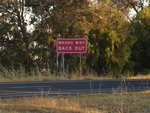
Old Wrong Way Sign:
Old style WA wrong way sign at Myalup near the roadhouse and Taranto Road, December 2007. There was once several of these between Bunbury and Myalup, however most along the route are of the current WA style and feature the words 'GO BACK' instead of 'BACK OUT'. This sign has since been replaced and also no longer a standard sign in WA.
Image © Paul Rands

Advance Directional Sign:
Northbound AD sign approaching Myalup Beach Road in Myalup. April 2016.
Image © Paul Rands

Advance Directional Sign:
Northbound AD sign approaching Myalup Beach Road in Myalup. April 2008.
Image © Paul Rands

Myalup Beach Road:
Northbound through the intersection with Myalup Beach Road, April 2008.
Image © Paul Rands

Advance Directional Sign:
AD sign at Myalup approaching the junction with Settlers Roadhouse, November 2012.
Image © Paul Rands

Settlers Roadhouse Junction:
Forrest Hwy (NR1) at Myalup at the entrance to Settlers Roadhouse, December 2012.
Image © Paul Rands

Advance Directional Sign:
Advance directional sign and standard intersection warning sign assembly with road name at Myalup. Looking northbound approaching Forestry Road, the turn off to the town of Harvey. November 2012. Click or tap here for a photo of this location by Paul Rands from December 2007.
Image © Paul Rands

Forestry Road Intersection:
Northbound in Myalup at the Forestry Road intersection, November 2012. Click or tap here for a photo of this location by Paul Rands from December 2007.
Image © Paul Rands
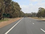
Distance Sign:
Northbound RD sign at Myalup after Forestry Road, November 2012. Click or tap here for a photo of this location by Paul Rands from December 2007.
Image © Paul Rands
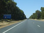
Police Speed Limit Reminder:
Sign heading northbound at Myalup reminding motorists of police monitoring of the speed limit. December 2007. This sign has since been removed.
Image © Paul Rands
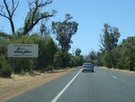
Tourism Sign:
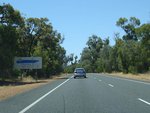
Sign indicating you are leaving the Southwest region of Western Australia, December 2007 at Preston Beach.
Image © Paul Rands
Tourism Sign:
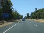
Sign denoting you have entered the Peel Region of WA, December 2007 at Preston Beach.
Image © Paul Rands
Local Radio Stations Sign:
Northbound sign indicating the radio stations available in the area, in this case it's the then 2 Mandurah stations: 6MM and Coast FM. December 2007 at Preston beach. This sign has since been removed.
Image © Paul Rands

Supplemental Advance Directional Sign:
Supplemental AD sign at Preston Beach as you approach Preston Beach Road and Johnston Road, November 2012.
Image © Paul Rands

Advance Directional Sign:
Northbound AD sign at Preston Beach as you approach Preston Beach Road and Johnston Road, November 2012.
Image © Paul Rands

Waroona Turn Off:
Northbound approaching the intersection with Peppermint Grove Road at Lake Clifton, November 2012. Click or tap here for a photo of this location by Paul Rands from August 2009.
Image © Paul Rands

Waroona Turn Off:
Northbound near the intersection with Peppermint Grove Road at Lake Clifton, August 2009.
Image © Paul Rands

Intersection Directional Sign:
ID sign at the junction with Preston Beach Rd at Preston Beach, December 2012.
Image © Paul Rands

Intersection Directional Sign:
ID sign at the junction with Peppermint Grove Rd, November 2012.
Image © Paul Rands
Distance Sign:
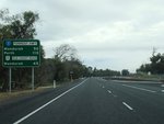
Northbound RD sign after the Peppermint Grove Road junction at Lake Clifton, August 2009.
Image © Paul Rands

Variable Message Sign:
VMS between Peppermint Grove Rd and Forrest Hwy (SR2) at Lake Clifton, September 2009.
Image © Tim Cole

Supplemental Advance Directional Sign:
Supplemental services related advance directional sign approaching the Forrest Hwy (SR2) junction at Lake Clifton, November 2012. Click or tap here for a photo of this location by Paul Rands from August 2009.
Image © Paul Rands

Advance Directional Sign:
Advance directional sign approaching the Forrest Hwy (SR2) junction at Lake Clifton, December 2012.
Image © Paul Rands

Intersection Directional Sign:
ID sign at the corner Old Coast Rd (NR1), Forrest Hwy (NR1) and Forrest Hwy (SR2) at Lake Clifton, December 2012.
Image © Paul Rands

Old Bunbury Road Turn Off:
Northbound approaching Old Bunbury Road, which joins this section of highway with the South Western Highway (SR20). December 2007. Old Bunbury Road was once a main road in the area.
Image © Paul Rands

Old Bunbury Road Intersection:
Northbound at the intersection with Old Bunbury Road in Lake Clifton, December 2007.
Image © Paul Rands
Tourism Sign:
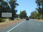
Northbound at Lake Clifton is this sign indicating boundary to the Mandurah Region, December 2007.
Image © Paul Rands
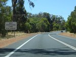
Older Overtaking Lane Ahead Sign:
Northbound at Preston is this older style WA overtaking lane ahead sign. December 2007.
Image © Paul Rands
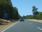
Roadwise Sign:
Northbound at Bouvard you pass this sign indicating the local authorities working with the state government department of road safety. December 2007.
Image © Paul Rands
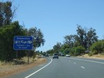
Services Sign:
Northbound entering the Dawesville area. December 2007.
Image © Paul Rands

Old Coast Road Intersection:
Northbound at Dawesville at the southern end of the Dawesville Bypass. Here the old alignment passes through the town of Dawesville and through traffic uses the dual carriageway which eventually takes you to Mandurah. December 2007.
Image © Paul Rands

Port Bouvard Bridge:
Northbound approaching the Port Bouvard Bridge over the Dawesville Channel, December 2007.
Image © Paul Rands

Approaching the Peelwood Pde Intersection:
Northbound at Halls Head near the shopping centre, December 2007.
Image © Paul Rands

Lane Allocation Sign:
Northbound sign at Halls Head outside shopping centre indicating which lanes go where. December 2007.
Image © Paul Rands

Lane Changes Prohibited Sign:
Sign banning lane changes on the Mandurah Estuary Bridge. April 2008, northbound.
Image © Paul Rands

Strong Cross Winds sign:
Warning sign at the southern end of the Mandurah Estuary Bridge warning of strong winds on the bridge. Northbound, December 2007.
Image © Paul Rands

Mandurah Estuary Bridge:
Northbound crossing the Mandurah Estuary Bridge, April 2008.
Image © Paul Rands
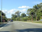
School Crossing:
Flashing light setup outside the local Catholic school in Dudley Park. Similarly laid out like South Australia's school crossing installations. April 2008.
Image © Paul Rands
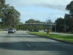
Dudley Park:
Mandurah Bypass (NR1) as it passes through Dudley Park, August 2009.
Image © Paul Rands
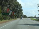
Leslie Street:
Mandurah Bypass at the junction with Leslie St at Dudley Park, August 2009.
Image © Paul Rands
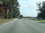
Leslie Street:
Mandurah Bypass at the junction with Leslie St at Dudley Park, August 2009.
Image © Paul Rands
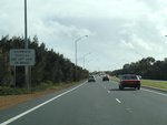
Overwidth Vehicles Sign:
Sign ordering overwidth vehicles to use the left lane on the Mandurah Estuary Bridge at Dudley Park, August 2009.
Image © Paul Rands
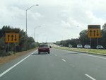
Lane Warning Signs:
Lane direction warning signs for Mandurah Estuary Bridge was changed, Dudley Park, August 2009.
Image © Paul Rands
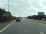
Lane Changes Prohibition Sign:
Signs banning lane changes on the Mandurah Estuary Bridge at Dudley Park, August 2009.
Image © Paul Rands
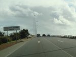
Mandurah Estuary Bridge:
Mandurah Bypass as it crosses Mandurah Estuary Bridge at Dudley Park, August 2009.
Image © Paul Rands

Old Coast Road Intersection:
Mandurah Bypass (NR1) as it meets Old Coast Rd (NR1) at Erskine, August 2009. The TD205 shield is in error.
Image © Paul Rands
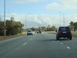
Peelwood Parade:
Old Coast Rd (NR1) as it approaches Peelwood Pde at Erskine, August 2009.
Image © Paul Rands
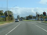
Peelwood Parade:
Old Coast Rd (NR1) at the junction with Peelwood Pde at Erskine, August 2009.
Image © Paul Rands
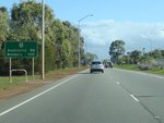
Distance Sign:
RD sign at Erskine after Peelwood Pde, August 2009.
Image © Paul Rands

Casuarina Drive & Bower Drive:
Old Coast Rd (NR1) approaching Casuarina Dr and Bower Dr in Erskine, August 2009.
Image © Paul Rands
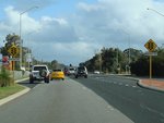
Mercedes Avenue:
Old Coast Rd at Falcon approaching Mercedes Av, August 2009.
Image © Paul Rands
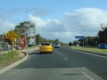
Falcon:
Old Coast Rd (NR1) as it passes through the suburb of Falcon, August 2009.
Image © Paul Rands
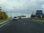
Princeton Drive:
Corner of Old Coast Rd (NR1) and Princeton Dr at Wannanup, near Port Bouvard Bridge, August 2009.
Image © Paul Rands

Port Bouvard Bridge:
Old Coast Rd (NR1) as it crosses the Dawesville Channel via Port Bouvard Bridge, August 2009.
Image © Paul Rands

Services Sign:
Services sign at Dawesville approaching the unnumbered section of Old Coast Rd and Dawesville Bypass (NR1), August 2009.
Image © Paul Rands
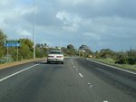
Advance Directional Sign:
ID sign acting as an AD sign approaching Old Coast Rd and Dawesville Bypass (NR1) at Dawesvile, August 2009.
Image © Paul Rands
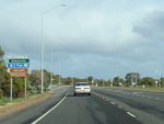
Old Coast Road:
Corner of Old Coast Rd (NR1 and unnumbered) and Dawesville Bypass (NR1) at Dawesville, August 2009.
Image © Paul Rands
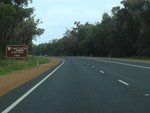
Advance Directional Sign:
Tourist orientated AD sign at Lake Clifton approaching Newnham Rd, August 2009.
Image © Paul Rands
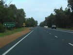
Advance Directional Sign:
AD sign at Lake Clifton approaching Old Bunbury Rd, August 2009.
Image © Paul Rands
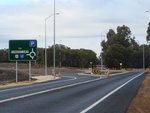
Advance Directional Sign:
AD sign at Lake Clifton approaching Forrest Hwy (SR2), August 2009.
Image © Paul Rands

Intersection Directional Sign:
ID sign assembly at Lake Clifton at the junction with Forrest Hwy (SR2), August 2009.
Image © Paul Rands

Advance Directional Sign:
AD sign at Lake Clifton approaching Peppermint Grove Rd, April 2016.
Image © Paul Rands
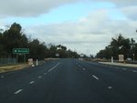
Advance Directional Sign:
AD sign at Lake Clifton approaching Peppermint Grove Rd, August 2009.
Image © Paul Rands
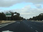
Peppermint Grove Road:
Corner of Forrest Hwy (NR1) and Peppermint Grove Rd at Lake Clifton, August 2009.
Image © Paul Rands
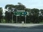
Intersection Directional Sign:
ID sign facing Peppermint Grove Road at Lake Clifton, August 2009.
Image © Paul Rands
Distance Sign:
RD sign after Peppermint Grove Rd at Lake Clifton, August 2009.
Image © Paul Rands

Advance Directional Sign:
AD sign on Forrest Hwy (NR1) at Lake Clifton approaching Johnston Rd and Preston Beach Rd, August 2009.
Image © Paul Rands

Supplemental Advance Directional Sign:
Supplemental AD sign on Forrest Hwy (NR1) at Lake Clifton approaching Johnston Rd and Preston Beach Rd, April 2016.
Image © Paul Rands

Johnston Road & Preston Beach Road:
Forrest Hwy (NR1) approaching Johnston Rd and Preston Beach Rd at Lake Clifton, August 2009.
Image © Paul Rands

Johnston Road & Preston Beach Road:
Forrest Hwy (NR1) at the junction with Johnston Rd and Preston Beach Rd at Lake Clifton, August 2009.
Image © Paul Rands
Radio Stations Sign:
Sign indicating the local radio stations in the area, Myalup, August 2009. This sign has since been removed.
Image © Paul Rands

Slow Vehicles Sign:
Sign indicating slow vehicles in the area, Myalup, April 2016.
Image © Paul Rands

Tourism Sign:
Tourism based sign welcoming motorists Australia's South West region, Myalup, April 2016.
Image © Paul Rands

Advance Directional Sign:
AD sign at Myalup approaching Forestry Rd, April 2016.
Image © Paul Rands

Advance Directional Sign:
AD sign at Myalup approaching Forestry Rd, August 2009.
Image © Paul Rands

Forestry Road:
Corner of Old Coast Rd (NR1) and Forestry Rd at Myalup, August 2009.
Image © Paul Rands
Distance Sign:
RD sign at Myalup after Forestry Rd, August 2009.
Image © Paul Rands

Advance Directional Sign:
AD sign at Myalup approaching Harvey-Myalup Rd and Myalup Beach Rd, April 2016.
Image © Paul Rands

Advance Directional Sign:
AD sign at Myalup approaching Harvey-Myalup Rd and Myalup Beach Rd, August 2009.
Image © Paul Rands

Harvey-Myalup Road & Myalup Beach Road:
Forrest Hwy (NR1) at Myalup approaching Harvey-Myalup Rd and Myalup Beach Rd, August 2009.
Image © Paul Rands

Harvey-Myalup Road & Myalup Beach Road:
Forrest Hwy (NR1) at Myalup at the junction with Harvey-Myalup Rd and Myalup Beach Rd, August 2009.
Image © Paul Rands
1 WA Government, Main Roads Western Australia, Road Information Mapping System.
2 WA Government, Media Statements, Extension of SW dual carriageway to be constructed this year, 30 June 1995.
3 WA Government, Main Roads Western Australia, Network Changes: Rural, 19 March 2013.
4 WA Government, Media Statements, Consultancy awarded for designing section of Old Coast Road (Preston), 19 January 1996.
5 Western Australia Legislative Council, Old Coast Road, Improvements to Ease Traffic Congestion, 9 November 2000.
6 Bunbury Herald, Highway now runs to Eelup roundabout, 17 June 2014.
7 WA Government, Heritage Council of Western Australia, inHerit, Mandurah Bridge.
8 South West Focus Conference, Main Roads WA Linking the South West, May 2007.
9 City of Mandurah, Mandurah Heritage Register, May 2014.
10 Western Roads, Perth to Busselton: Coastal Corridor to the South-West, September 1994.


