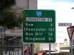
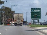
Road Photos & Information: Victoria
Swanston Street, Elgin Street, Johnston Street, Studley Park Road, High Street, Cotham Road, Whitehorse Road and Maroondah Highway (Metropolitan Route 34)
Statistics:
- Length:
- 38 km
- Termini:
- Eastern: Maroondah Hwy (B300) and Anderson St (C401 and unnumbered), Lilydale
- Western: College Cr (MR83) and Cemetery Rd East (MR83), Carlton
- Miscellaneous:
- Declared Names: Swanston St, Elgin St, Johnston St, Johnston St Bridge, Studley Park Rd, High St, Cotham Rd, Whitehorse Rd and Maroondah Hwy
- Suburbs, Towns & Localities Along Route:
- Carlton, Fitzroy, Collingwood, Abbotsford, Kew, Deepdene, Balwyn, Surrey Hills, Mont Albert, Box Hill, Blackburn, Nunawading, Mitcham, Ringwood, Croydon, Chirnside Park and Lilydale
Route Numbering:
- Current: 34
- Multiplexed with: 7 9 13 36 2
- Road Authority Internal Classification: 1
- Arterial 5853 (Fitzroy to Abbotsford)
- Arterial 5854 (Abbotsford to Kew)
- Arterial 5855 (Kew)
- Arterial 5721 (Kew)
- Arterial 5926 (Kew to Balwyn)
- Arterial 5996 (Balwyn to Surrey Hills)
- Arterial 6720 (Surrey Hills to Lilydale)
General Information:
Metropolitan Route 34 is an east-west arterial route in Melbourne's eastern suburbs connecting the Melbourne CBD with the Yarra Valley. The route services residential and commercial areas and features tram lines along it in Carlton and also from Kew to Box Hill.
Multiplexes along the route include:
- Metropolitan Route 7, for 200 m, Croydon.
- Metropolitan Route 9, for 200 m, Ringwood.
- Metropolitan Route 13, for 200 m, Blackburn.
- Metropolitan Route 36, for 200 m, Kew.
- Tourist Drive 2, for 1.5 km, Kew.
History:
- 1840s: Cotham Road reservation established. 2
- 1842: Johnston Street established. 2
- 1853: Route reservation east to Dorking Road (Box Hill) established. Victorian Government offers £300 reward for an establishment of a road to 'Gippsland'. 2
- 1854: William Hull establishes track in which Maroondah Highway today now follows. 2
- 1857: Johnson Street Bridge constructed. 3
- 1858: Johnston Street laminated timber bridge built over the Yarra River, providing property owners in Kew and beyond access to the city. 2
- 1860s: Maroondah Highway begins as 'Barkers Track', a grazier's path from Kew to Box Hill. 2
- 1865: 'Barkers Track' declared a Main Road and named Whitehorse Road. 2
- 1867: Road constructed from Ringwood to Birts Hill, Croydon. 2
- 1874: Toll gates at Kew and Brushy Creek Bridge. 2
- 1876: Johnston Street bridge upgraded to iron with three spans. 2
- 1888: Cable trams in operation along Johnson Street (until 1939). 2
- 1913: The route is declared a 'Main Road' and named 'Healesville Road' through Box Hill and 'Main Healesville Road' east of Box Hill; 'Whitehorse Road' becomes the common local name east of Box Hill. 2
- 1925: Country Roads Board spray seals road through Nunawading. Sealing of the road to Lilydale begins with spray and chip treatment. 2
- 1935: Road to Lilydale is fully sealed. 2
- 1926: Spray and Chip seal between Birts Hill (Yarra Road) and Lilydale. Spray and Chip seal for three kilometres east of Ringwood. 2
- 1936: Concrete pavement for one kilometre in Box Hill. 2
- 1937: Realignment of kink near Middleborough Road. 2
- 1938: Reconstruction of three kilometres through Blackburn, widened to 9 metres. 2
- 1939: Decommissioning of the cable-pulled tram along Johnston Street. 2
- 1948: Maroondah Highway name established east of Union Road, declared as a State Highway. 2
- 1960: Johnston Street declared as a Main Road. 2
- 1961: Duplication from Middleborough Road to Surrey Road. 2
- 1962: Duplication from Surrey Road to Springvale Road. 2
- 1963: Duplication from Box Hill Town Hall to Middleborough Road. 2
- 1964: Duplication works through Ringwood completed. Duplication from Springvale Road to Heatherdale Road. 2
- 1965: Metropolitan Route 34 introduced. 2
- 1968: Duplication from Ringwood to Stirling Road, Croydon. 2
- 1970: Duplication from Stirling Road to Brushy Creek. 2
- 1971: Duplication from Brushy Creek to Lilydale. 2
- 1983: Duplication from Lilydale to Warburton Highway. 2
- 1986: Metropolitan Route 34 extended to Alexandra. 2
- 1989: Metropolitan Route 34 truncated in Carlton. 2
- 1990: Cotham Road proclaimed as a Main Road. 2
- 1993: Whitehorse Road between Burke Road and Union Road declared as a Main Road. 2
- 1998: Metropolitan Route 34 east of Lilydale - Montrose Road replaced by routes B300 and B360. 2
- 2004: Road Management Act 2004 reclassifies Maroondah Highway's State Highway classification to Arterial. All Main Road classifications merge into new Arterial classification. 2
- 2006: Construction of overpass over Eastlink (M3) at Ringwood. 2
- 26 June 2009: Main section of a pedestrian overpass installed over Maroondah Hwy at Ringwood near Eastlink (M3). 4
Carlton to Lilydale
Lilydale to Carlton
1 VIC Government, Department of Transport and Planning Road Maintenance Category - Road List Version: 2, 29 February 2024.
2 Viseth Uch.
3 Engineering History Victoria, Road and Bridge Works.
4 VIC Government, Linking Victoria Authority, News & Releases, Maroondah Highway bridge tower now installed, 30 June 2009.
2 Viseth Uch.
3 Engineering History Victoria, Road and Bridge Works.
4 VIC Government, Linking Victoria Authority, News & Releases, Maroondah Highway bridge tower now installed, 30 June 2009.


