Road Photos & Information: Victoria
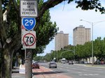
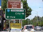
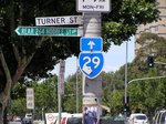
Barkly Street, St Kilda Road, Punt Road, Hoddle Street, Queens Parade and High Street (Metropolitan Route 29)
Statistics:
- Length:
- 27 km
- Termini:
- Northern: High St (C729), Memorial Av (MR58 and unnumbered), Epping
- Southern: Marine Pde (MR33) and Ormond Esp (MR33), Elwood
- Miscellaneous:
- Declared Names: Hoddle Main Rd, Hoddle Hwy, Hoddle Main Rd, Queens Pde, High St, Epping Rd and Epping-Kilmore Rd
- Suburbs, Towns & Localities Along Route:
- Elwood, St Kilda, Windsor, Prahran, South Yarra, Melbourne, East Melbourne, Collingwood, Clifton Hill, Northcote, Thornbury, Preston, Reservoir, Thomastown, Lalor and Epping
Route Numbering:
- Current: 29
- Multiplexed with: 3 58
- Road Authority Internal Classification: 1
- Arterial 5147 (Northcote)
- Arterial 5205 (Northcote to Thornbury)
- Arterial 5515 (Epping)
- Arterial 5817 (Reservoir to Epping)
- Arterial 5850 (Elwood to St Kilda and Clifton Hill to Northcote)
- Arterial 6080 (Clifton Hill)
General Information:
Metropolitan Route 29 is a major arterial route linking Melbourne's bayside, CBD and northern suburbs. It also connects with 3 freeway routes: Citylink (M1), Eastern Fwy (M3) and Metropolitan Ring Round (M80).
The route is a mix of undivided and divided road, which along some sections features tramlines, and passes through residential, commercial and industrial zones.
Multiplexes along the route include:
- Metropolitan Route 3, for 170 m, St Kilda.
- Metropolitan Route 58, for 850 m, Epping.
History:
- 11 September 1848: High Street officially gazetted as a road. It is one of the oldest roads in Victoria, the oldest being Heidelberg Road. 2
- 1854-1877: Tolling imposed on High Street. The first toll house was near Merri Creek where Hoddle Street intersects with Queens Parade, but this was found to be unsuitable and the toll house was relocated to south west corner of High and Westgarth streets. Another location included the corner of High Street and Murray Road, Preston. In 1863 this gate was moved further north to near the Preston Arms Hotel. 3
- 1860s: Renaming of Plenty Road to High Street. 2
- 1946: Installation of the first traffic lights along High Street at the Westgarth Street intersection in Northcote. 2
- 1965: Introduction of Metropolitan Route 29. 1
- 1971: Hoddle Street widened. 4
- 23 May 2005: Transit lane becomes operational along the northbound carriageway of Hoddle St. 5
Elwood to Epping
Epping to Elwood
1 Viseth Uch.
2 Darebin City Council, Darebin Libraries Fact sheet, High Street Northcote.
3 Darebin Historical Encyclopedia, Toll Gates (1854-1877).
4 VIC Government, Picture Victoria, 1971 The Junction Hotel bites the dust.
5 VIC Government, Ministerial Media Releases, New 'T2' Transit Lane System for Hoddle Street, 13 May 2005.


