Road Photos & Information: Victoria
Epping-Kilmore Road (C729)
Statistics:
- Length:
- 42 km
- Termini:
- Northern: Northern Hwy (B75), Kilmore
- Southern: Memorial Av (MR58 and unnumbered) and High St (MR29 / MR58) at Epping
- Suburbs, Towns & Localities Along Route:
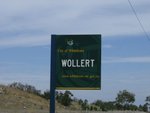
- Kilmore, Wandong, Wallan East, Beveridge, Woodstock, Wollert and Epping
Route Numbering:
- Current: C729
- Multiplexed with: C727
- Former: 29
- Road Authority Internal Classification: 1
- 5515
General Information:
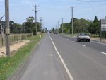
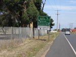
C729 connects the outer northern suburban outskirts of Melbourne with several small rural towns and the Hume Freeway (M31). The route is mainly undivided, with 1 lane in each direction.
Multiplexes along the route include:
- C727, for 300 m, Wallan.
Kilmore to Epping
1 VIC Government, VicRoads, Road Management Plan 2020-2021, 07 December 2020.


