Statistics:
- Length:
- 100 km
- Termini:
- Eastern: Eildon Rd (unnumbered) and Centre Rd (unnumbered), Eildon
- Western: Hume Freeway (M31) and Goulburn Valley Freeway (M39), Seymour
- Suburbs, Towns & Localities Along Route:
- Seymour, Trawool, Granite, Kerrisdale, Homewood, Yea, Molesworth, Cathkin, Koriella, Alexandra, Thornton, Snobs Creek and Eildon
Route Numbering:
- Current: B340
- Multiplexed with: B300
- Former: 168 31 31
- Road Authority Internal Classification: 1
- 6640 (Eildon to Alexandra and Koriella to Seymour)
- 6720 (Alexandra to Koriella)
General Information:
The Goulburn Valley is a rural highway in the mid northeast of Victoria. It's mostly undivided single carriageway, except in Seymour and Yea. The section of the route in the Seymour area is a former Hume Highway alignment.
Multiplexes along the route include:
- B300, for 18 km, between Yea and Cathkin.
History:
- 1982: Hume Highway at Seymour rerouted to bypass the town. 2
- 2007: Funding allocated for safety improvements, such as wire rope safety barriers, guardrail, shoulder sealing and additional delineation. 3
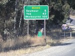
Distance Sign:
RD sign at Seymour after the Hume Fwy (M31) and Goulburn Valley Fwy (M39) interchange. May 2005.
Image © Rob Tilley
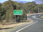
Advance Directional Sign:
AD sign at Seymour approaching Seymour-Avenel Rd (Old Hume Hwy). May 2005.
Image © Rob Tilley

Seymour-Avenel Road:
Corner of Goulburn Valley Hwy (B340) and Seymour-Avenel Rd (Old Hume Hwy) at Seymour, August 2015.
Image © Paul Rands

Entering Seymour:
Goulburn Valley Hwy (B340) as it enters the town of Seymour, August 2015.
Image © Paul Rands

Advance directional Sign:
AD sign at Seymour approaching Seymour-Tooborac Rd (C384). May 2005.
Image © Rob Tilley

Intersection Directional Sign:
ID sign on the corner of Goulburn Valley Hwy (B340) and Seymour-Tooborac Rd (C384) at Seymour. August 2015.
Image © Paul Rands
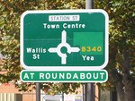
Advance Directional Sign:
AD sign at Seymour approaching the roundabout with Wallis and Station Streets. May 2005.
Image © Rob Tilley
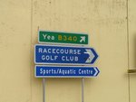
Intersection Directional Sign:
ID sign assembly at Seymour, on the roundabout with Wallis and Station Streets. May 2005.
Image © Rob Tilley

Intersection Directional Sign:
ID sign assembly at Seymour, on the roundabout with Wallis and Station Streets. August 2015.
Image © Paul Rands
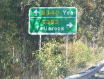
Advance Directional Sign:
AD sign at Trawool approaching Upper Goulburn Road (C383). May 2005.
Image © Rob Tilley
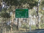
Distance Sign:
RD sign at Trawool, after the C383 junction. May 2005.
Image © Rob Tilley
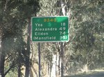
Distance Sign:
RD sign in Kerrisdale. May 2005.
Image © Rob Tilley
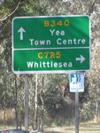
Advance Directional Sign:
AD sign at Yea approaching Whittlesea-Yea Rd (C725). May 2005.
Image © Rob Tilley
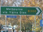
Intersection Directional Sign:
ID sign in Yea at the junction with Melba Hwy (B300). May 2005. The B300 duplex begins at this junction.
Image © Rob Tilley
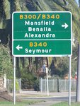
Advance Directional Sign:
AD sign on Melba Hwy (B300) approaching Goulburn Valley Hwy (B340) in Yea, April 2005.
Image © Rob Tilley
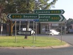
Intersection Directional Signs:
ID signs on the corner Melba Hwy (B300) and Goulburn Valley Hwy (B340) in Yea, April 2005.
Image © Rob Tilley
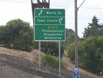
Advance Directional Sign:
AD sign in Seymour approaching the roundabout with Wallis and Station Streets, February 2006.
Image © Rob Tilley
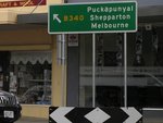
Intersection Directional Sign:
ID sign on the roundabout with Wallis and Station Streets in Seymour, February 2006.
Image © Rob Tilley

Advance Directional Sign:
AD sign approaching Seymour-Tooborac Rd (C384) in Seymour, August 2015.
Image © Paul Rands
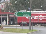
Intersection Directional Sign:
ID sign on the corner of Goulburn Valley Hwy (B340) and Seymour-Tooborac Rd (C384) in Seymour, February 2006.
Image © Rob Tilley
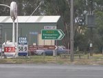
Intersection Directional Sign:
ID sign on the corner of Goulburn Valley Hwy (B340) and Seymour-Tooborac Rd (C384) in Seymour, February 2006.
Image © Rob Tilley

Advance Directional Sign:
AD sign at Seymour approaching the interchange with Hume Fwy (M31) and Goulburn Valley Fwy (M39) (then A39), April 2005.
Image © Rob Tilley

Hume Freeway & Goulburn Valley Freeway Interchange:
End of B340, at the interchange with the Goulburn Valley Fwy (M39) (then A39) and Hume Fwy (M31) at Seymour. April 2005.
Image © Rob Tilley

Hume Freeway & Goulburn Valley Freeway Interchange:
End of B340, at the interchange with the Goulburn Valley Fwy (M39) (then A39) and Hume Fwy (M31) at Seymour. April 2005.
Image © Rob Tilley
1 VIC Government, VicRoads, Road Management Plan 2020-2021, 07 December 2020.
2 Viseth Uch.
3 VIC Government, Minister for Roads & Ports, Media Release, $1.4 Million in Funding to Improve Road Safety on Goulburn Valley Highway, 4 July 2007.


