Statistics:

Length:
135 km
Termini:
Northern: New England Hwy (A3) and D'Aguilar Hwy (A3), Yarraman
Southern: Warrego Hwy (M2 / A2), Blacksoil
Suburbs, Towns & Localities Along Route:
Blacksoil, Pine Mountain, Wanora, Fernvale, Wivenhoe Hill, Moombra, Esk, Ottaba, Toogoolawah, Harlin, Moore, Benarkin, Blackbutt and Yarraman

Route Numbering:

Current: 17
Multiplexed with: 85
Forthcoming Alphanumeric: A17
Road Authority Internal Classification: 1
42A (Blacksoil to Harlin)
40B (Harlin to Yarraman)

General Information:

National Route 17 is a highway located west of Brisbane and forms part of a link from the metropolitan area to the Burnett region of Queensland.

Originally a much longer route, it passes through several small towns, rural areas and bushland. The route is of rural highway standards.

Multiplexes along the route include:
State Route 85, for 36 km, between Esk and Harlin.
Brisbane Valley Tourist Drive, for 84 km, between Moore and Fernvale.

History:

2005: National Route 17 truncated at Yarraman and replaced by A3 with the implementation of the Strategic Tourism Route Numbering scheme. 2
April 2009: Widening of a 1 km section of Brisbane Valley Hwy between Blacksoil and Fernbank at Fairney Brook. 3
2014: National Route 17 replaced by A17 on signs at around the Warrego Hwy (A2) interchange at Blacksoil.

Click or tap here for the former alignment between Yarraman and Rockhampton

Blacksoil to Yarraman

image

Black Kilometre Plate:

Black kilometre plate at Fernvale, July 2004.

Image © Michael Greenslade

image

Advance Directional Sign:

AD sign at Wivenhoe Pocket approaching Wivenhoe-Somerset Rd, July 2004.

Image © Michael Greenslade

image

Reassurance Directional Sign:

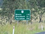
Distance sign at Coominya, July 2004.

Image © Michael Greenslade

image

Advance Directional Sign:

AD sign at Esk approaching Esk-Hampton Rd (SR85), July 2004.

Image © Michael Greenslade

image

Esk-Hampton Road:

Corner of Brisbane Valley Hwy (NR17) and Esk-Hampton Rd (SR85) at Esk, July 2004. The SR85 duplex commences from this junction. Note the missing route number from sign.

Image © Michael Greenslade

image

Intersection Directional Sign:

Non-standard ID sign facing Esk-Hampton Rd (SR85) at Esk, November 2009. The SR85 duplex begins at this junction.
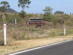
Image © Rob Tilley

image

Black Kilometre Plate:

Black kilometre plate at Esk, July 2004.

Image © Michael Greenslade

image

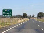
Reassurance Directional Sign:

Distance sign at Esk, July 2004.

Image © Michael Greenslade

image

Black Reassurance Directional Sign:

Distance sign at Toogoolawah, July 2004.

Image © Michael Greenslade

image

Advance Directional Sign:

AD sign at Harlin approaching D'Aguilar Hwy (SR85), July 2004. The SR85 duplex ends at this location and NR17 becomes D'Aguilar Hwy at this location.

Image © Michael Greenslade

image

Distance Sign:

Reassurance directional sign at Harlin, April 2011.

Image © Rob Tilley

image

Distance Sign:

Reassurance directional sign at Harlin, July 2004. This sign has since been removed.

Image © Michael Greenslade

image

Linville Road:

ID sign at the junction with Linville Rd at Moore, April 2011.

Image © Rob Tilley

image

Advance Directional Sign:

AD sign on a windy section of Brisbane Valley Hwy (NR17) at Benarkin approaching the entrance to Benarkin State Forest, April 2011.

Image © Rob Tilley

image

Advance Directional Sign:

AD sign on at Yarraman approaching New England Hwy (A3) and the A3 section of D'Aguilar Hwy, April 2011.

Image © Rob Tilley

image

New England Hwy & D'Aguilar Hwy:

ID sign at the northern terminus of National Route 17, in Yarraman, April 2011.

Image © Rob Tilley

Yarraman to Blacksoil

image

Distance Sign:

Reassurance directional sign at Harlin, July 2004.

Image © Michael Greenslade

image

Advance Directional Sign:

AD sign at Toogoolawah approaching Dingyarra St, July 2004.

Image © Michael Greenslade

image

Advance Directional Sign:

AD sign on D'Aguilar Hwy (SR85) at Harlin approaching Brisbane Valley Hwy (NR17), April 2011. The SR85 duplex begins at his junction.

Image © Rob Tilley

image

Advance Directional Sign:

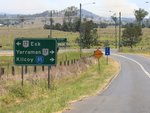
AD sign on Esk-Kilcoy Rd approaching Brisbane Valley Hwy (NR17 / SR85) at Esk, November 2009.
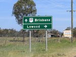
Image © Rob Tilley

image

Intersection Directional Sign:

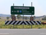
ID sign at Esk facing Esk-Kilcoy Rd, November 2009.
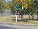
Image © Rob Tilley

image

Distance Sign:

RD sign at Esk, after the Esk-Kilcoy Rd junction, November 2009.
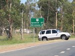
Image © Rob Tilley

image

Supplemental Directional Sign:

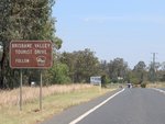
Sign for Brisbane Valley Tourist Drive at Esk, November 2009.
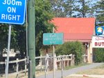
Image © Rob Tilley

image

Esk-Hampton Road:

Corner of Brisbane Valley Hwy (NR17) and Esk-Hampton Rd (SR85) at Esk, November 2009. The SR85 duplex ends at this junction

Image © Rob Tilley

image

Distance Sign:

RD sign as Brisbane Valley Hwy (NR17) leaves Esk, November 2009.
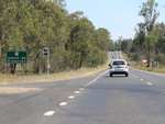
Image © Rob Tilley

image

Coominya Connection Rd & McLean Rd:

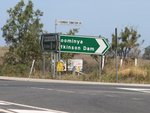
Corner of Brisbane Valley Hwy (NR17), McLean Rd and Coominya Connection Rd at Coominya, November 2009.

Image © Rob Tilley

image

Distance Sign:

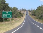
RD sign on Brisbane Valley Hwy (NR17) at Coominya, November 2009.
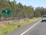
Image © Rob Tilley

image

Lake Wivenhoe:

Brisbane Vly Hwy (NR17) as it crosses Lake Wivenhoe via Wivenhoe Dam, July 2004.

Image © Michael Greenslade

image

Lake Wivenhoe:

Brisbane Vly Hwy (NR17) as it crosses Lake Wivenhoe via Wivenhoe Dam, July 2004.

Image © Michael Greenslade

image

Advance Direction Sign:

AD sign approaching Wivenhoe-Somerset Rd at Wivenhoe Pocket, November 2009.

Image © Rob Tilley

image

Wivenhoe-Somerset Road:

Corner of Brisbane Valley Hwy (NR17) and Wivenhoe-Somerset Rd at Wivenhoe Pocket, November 2009.

Image © Rob Tilley

image

Advance Directional Sign:

AD sign at Fernvale approaching Forest Hill-Fernvale Rd, November 2009.

Image © Rob Tilley

image

Forest Hill-Fernvale Road:

Corner of Brisbane Valley Hwy (NR17) and Forest Hill-Fernvale Rd at Fernvale, November 2009.

Image © Rob Tilley

image

Distance Sign:

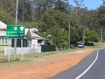
Reassurance directional sign as Brisbane Valley Hwy (NR17) at Fernvale, November 2009.

Image © Rob Tilley

image

End Limited Access Road Sign:

Sign in the Fernvale town centre indicating the end of access construction restrictions to Brisbane Valley Hwy (NR17), November 2009.

Image © Rob Tilley

image

Advance Directional Sign:

AD sign approaching Pine Mountain Rd and Leschkes Rd at Wanora, November 2009.

Image © Rob Tilley

image

Distance Sign:

RD sign at Wanora, November 2009.

Image © Rob Tilley

image

Fingerboard Assembly:

Typical Queensland fingerboards at the Glamorganvale Rd junction in Wanora, November 2009.

Image © Rob Tilley

image

Distance Sign:

RD sign at Wanora, November 2009.

Image © Rob Tilley

image

Advance Directional Sign:

AD sign at Ironbark approaching Warrego Hwy (A2), November 2013, approaching the southern terminus of NR17.

Image © Michael Greenslade

Click or tap here for the continuation of D'Aguilar Highway as A3
1 QLD Government, Department of Transport & Main Roads, Queensland state-controlled roads and region maps, Wide Bay / Burnett District, November 2022.
2 Sam Laybutt (OzRoads).
3 QLD Government, Minister for Main Roads, The Honourable Craig Wallace, Safety improved on Brisbane Valley Highway near Fairney Brook, 20 October 2009.