Road Photos & Information: Queensland
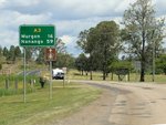
New England Highway, D'Aguilar Highway and Burnett Highway (A3)
Yarraman to Goomeri
Statistics:
- Length:
- 751 km (Yarraman to Goomeri: 81 km)
- Termini:
- Northern: Bruce Hwy (A1), Gracemere
- Southern: New England Hwy (A15 / NR42), Glengallan
- Suburbs, Towns & Localities Along Route:
- South Nanango, Nanango, Glan Devon and Goomeri
Route Numbering:
- Current: A3
- Multiplexed with: 49
- Former: 42
- Road Authority Internal Classification:
- 40B (Yarraman to Nanango)
- 41A (Nanango to Goomeri)
General Information:
A3 is a major route in eastern Queensland, connecting the Darling Downs region to the northern coastal regions of the state. It's also not connected to the M3 / A3 route in Brisbane.
It consists of mostly rural highway roadway, but passes through several of Queensland's important regional centres.
Multiplexes along the route include:
- SR49, for 2 km, Goomeri.
History:
- 28 November 2008: Completion of intersection upgrade with Bunya Hwy (SR49) and Burnett Hwy (A3) at Goomeri. The project involved realigning and widening the road, reshaping of the T-intersection, resurfacing the road and installing new lighting. 2
Yarraman to Goomeri
Goomeri to Yarraman
1 QLD Government, Department of Transport and Main Roads, The State Road Network of Queensland map, 30 June 2022.
2 QLD Government, Department of Transport and Main Roads, Local Links, April 2008, In and around Wide Bay Burnett Region.
2 QLD Government, Department of Transport and Main Roads, Local Links, April 2008, In and around Wide Bay Burnett Region.


