|
|
|
|
|
| M15 A15 | Parry Street, Donald Street, Griffiths Road, Newcastle Road, Thomas Street, Newcastle Link Road, Hunter Expressway & New England Highway (M15 / A15) - Arimdale to Glen Innes |
Statistics:
Route Numbering:


General Information:
M15 / A15 is one the major routes in New South Wales and Queensland. It links the farming regions of NSW to the ports at Newcastle and also to other major roads to Sydney and it's also a link to Brisbane's metropolitan area.
The route consists of single carriageway 2-lane rural highway, through to multi-lane divided sections and motorway standard closer to Newcastle.
History:
The New England Highway originally formed part of the Great Northern Road from Sydney via Wiseman's Ferry to the Queensland border (near Mt Lindesay), taking shape as settlement spread northward from the lower Hunter Valley. By 1851 the Great Northern Road had reached the Gap, two miles beyond Murrurundi. In 1858 it was classified as one of three Main Roads in the colony (Great Western and Great Southern) and extended from Morpeth via Maitland, Singleton, Muswellbrook, Scone, Murrurundi and Tamworth, to Armidale, a distance of about 236 miles. Captain Martindale, Chief Railway Commissioner, who was also responsible for roads, stressed the need for bridges as in many cases long circuits had to be made to find a crossing over a stream. In 1860 arrangements were in progress for building 90 culverts and minor bridges and for forming new sections of road, including a new ascent to Murrurundi Gap, which was previously steep with sharp dangerous turns. In 1865 the section of road between Muswellbrook and Murrurundi was metalled and a deviation suggested between Blandford and Murrurundi to skirt the Page River, obviating two bridges, however, such a deviation was never constructed. With the construction of the Northern Railway line from Newcastle, commenced in the 1850s and reaching Murrurundi in 1872, attention was diverted away from roads and sections of the Great Northern Road were in poor condition. Despite the impact of the railway, roads developed steadily and considerable progress was made in the bridging of rivers and creeks. 2
| Newcastle to Queensland Border | Queensland Border to Newcastle | |||
| Preview: | Description: | Preview: | Description: | |
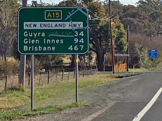 |
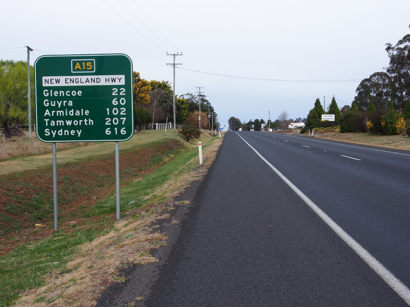
Distance
Sign: RD sign at Tilbuster as you leave the Armidale area, September 2018. Click here for a photo of this location by Michael Gill from September 2008. Image © Dean Sherry |
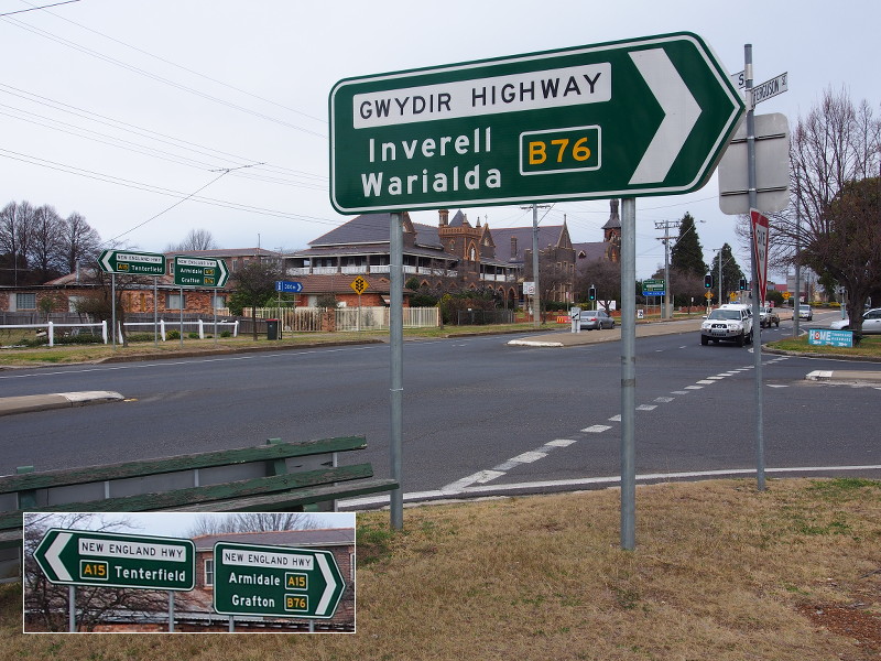 |
Intersection
Directional Sign: ID sign at the Gwydir Hwy (B76) (Ferguson Street) junction with the New England Hwy (A15) in Glen Innes. The B76 duplex begins here. August 2013. Image © Peter Renshaw |
|
 |
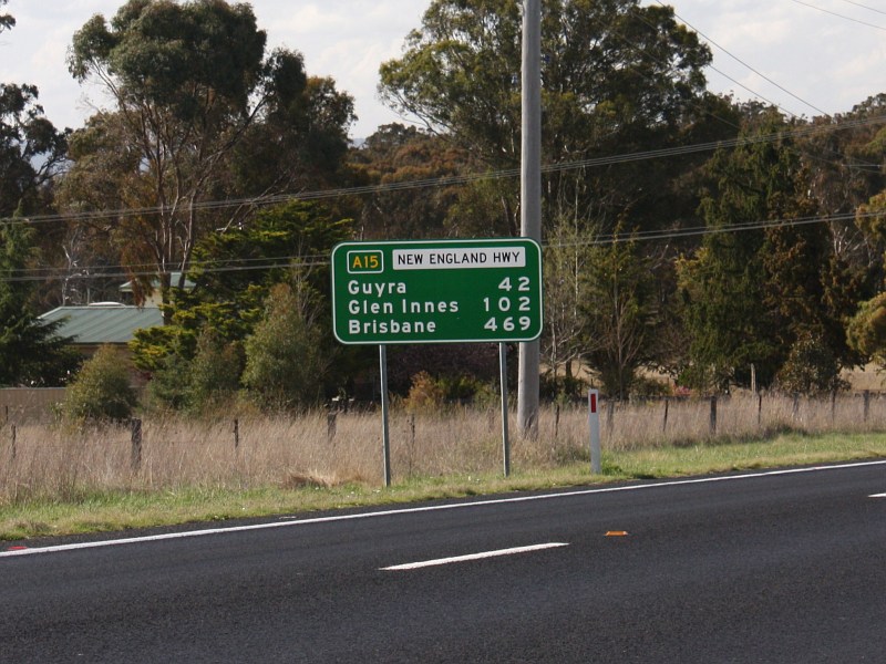
Distance
Sign: RD sign as you leave the town of Glen Innes, August 2013. Image © Peter Renshaw |
|||
| Click here for the continuation of A15 between Tamworth and Armidale | ||||
1 Roads &
Maritime Services, Schedule of Classified Roads and Unclassified Regional
Roads, August 2013
2 Roads & Maritime Services
3 Department of Infrastructure,
Transport, Regional Development and Local Government
Last updated: 15-Oct-2021 20:44
This site © Paul Rands. All rights reserved. Some portions © (copyright) by their respective and credited owners. Permission must be obtained before using any images from this site. For details, please email by clicking here.