Statistics:
- Length:
- 61 km
- Termini:
- Northern: Bridge St and Windsor Rd (A2), Windsor
- Southern: Hume Mwy (M31) and Narellan Rd (B69), Campbelltown
- Miscellaneous:
- Narellan Road continues as B69 at Campbelltown
- Suburbs, Towns & Localities Along Route:
- Windsor, South Windsor, Bligh Park, Londonderry, Berkshire Park, Llandilo, Cranebrook, Cambridge Gardens, Cambridge Park, Kingswood, Penrith, South Penrith, Orchard Hills, Glenmore Park, Mulgoa, Luddenham, Greendale, Bringelly, Cobbity, Oran Park, Harrington Park, Narellan, Smeaton Grange, Narellan Vale, Mt Annan, Currans Hill and Campbelltown.
Route Numbering:
- Current: A9
- Former: 9 40 69 14 18
- Road Authority Internal Classification: 1
- MR154 (Narellan to Windsor)
- MR178 (Campbelltown to Narellan)
General Information:
A9 is a major north-south route on Sydney's outer western fringe. It passes through residential, commercial and farming areas.
The route is mostly divided arterial road, except between Cranebrook and Windsor.
History:
- 1990s: Widening and duplication works along Parker Street completed around Cambridge Park / Cambridge Gardens.
- 1998: Introduction of Metroad 9, replacing State Route 69 between Windsor and Blairmount near Campbelltown.
- 2006: Installation of Waterworth Dr and Mt Annan Dr Signals, at Mt Annan.
- 16 September 2007: Intersection with the Windsor Flood Evacuation Route (at Forbes Street (now Hawkesbury Valley Way (B59)) and Macquarie Street) opened to traffic by Eric Roozendaal, Minister for Roads. 2
- 26 October 2007: The Narellan / Northern Road extension at Narellan, opened to traffic. This removed the dog leg in A9 through the Narellan town centre. 2
- July 2014: Work commenced on upgrade of Narellan Road between the access road of Campbelltown TAFE College and Hume Motorway (M31) to 6 lanes. 3
Click or tap here for photos of the former alignment of A9.
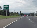
Distance Sign:
RD sign at Mt Annan after the Hume Mwy (M31) and Narellan Rd (B69) interchange, December 2013.
Image © Paul Rands
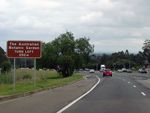
Advance Directional Sign:
AD sign approaching the entrance to The Australian Botanic Garden at Mt Annan, December 2013.
Image © Paul Rands
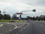
Australian Botanic Garden:
Narellan Rd (A9) at the entrance to the Australian Botanic Garden at Mt Annan, December 2013.
Image © Paul Rands

UPDATED Advance Directional Sign:
AD sign at Narellan Vale approaching Camden Bypass (which was once part of the Hume Hwy), January 2022. Click or tap here for a photo of this location by Paul Rands from December 2013.
Image © Paul Rands

UPDATED Camden Bypass:
Narellan Rd (A9) at the Camden Bypass interchange at Narellan Vale, January 2022. Click or tap here for a photo of this location by Paul Rands from December 2013.
Image © Paul Rands

NEW Camden Bypass:
Narellan Rd (A9) passing under the Camden Bypass at Narellan, January 2022.
Image © Paul Rands

UPDATED Advance Directional Sign:
AD sign approaching Camden Valley Way (formerly Hume Hwy) at Narellan, January 2022.
Image © Paul Rands
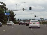
Camden Valley Way:
Intersection directional sign at the junction with Camden Valley Way at Narellan, December 2013. A9 becomes The Northern Road at this intersection.
Image © Paul Rands
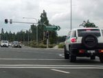
Camden Valley Way:
Intersection directional sign at the junction with Camden Valley Way at Narellan, December 2013. A9 becomes The Northern Road at this intersection.
Image © Paul Rands

UPDATED Advance Directional Sign:
AD sign approaching The Old Northern Rd at Narellan, January 2022.
Image © Paul Rands

NEW The Old Northern Road:
Corner of The Northern Rd (A9) and The Old Northern Rd at Narellan, January 2022.
Image © Paul Rands

UPDATED Distance Sign:
RD sign at Narellan after the junction with The Old Northern Rd, December 2013.
Image © Paul Rands

NEW Advance Directional Sign:
AD sign at Harrington Pk approaching Cobbity Rd, January 2022.
Image © Paul Rands

NEW Cobbity Road:
Corner of The Northern Rd (A9) and Cobbity Rd at Harrington Park, January 2022.
Image © Paul Rands

NEW Distance Sign:
Reassurance directional sign at Harrington Park, January 2022.
Image © Paul Rands

NEW Advance Directional Sign:
AD sign at Cobbity approaching Peter Brock Dr, January 2022.
Image © Paul Rands

NEW Advance Directional Sign:
AD sign at Bringelly approaching Bringelly Rd interchange, January 2022.
Image © Paul Rands

NEW Bringelly Road Interchange:
The Northern Rd (A9) at Bringelly at Bringelly Rd interchange, January 2022.
Image © Paul Rands

NEW Bringelly Road Interchange:
The Northern Rd (A9) at Bringelly at Bringelly Rd interchange, January 2022.
Image © Paul Rands

NEW Advance Directional Sign:
The Northern Rd (A9) at Bringelly approaching Dart Rd and Badgerys Ck Rd, January 2022.
Image © Paul Rands

NEW Reassurance Directional Sign:
Distance sign at Bringelly, January 2022.
Image © Paul Rands

NEW Advance Directional Sign:
AD sign approaching Wilmington Rd (former A9) at Luddenham, January 2022.
Image © Paul Rands

NEW Wilmington Road:
Corner of The Northern Rd (A9) and Wilmington Rd (former A9) at Luddenham, January 2022.
Image © Paul Rands

NEW Reassurance Directional Sign:
Distance sign at Luddenham, January 2022.
Image © Paul Rands

NEW Advance Directional Sign:
AD sign at Luddenham approaching Wilmington Rd (former A9) and Elizabeth Dr, January 2022.
Image © Paul Rands

NEW Wilmington Road and Elizabeth Drive intersection:
Corner of The Northern Rd (A9), Wilmington Rd (former A9) and Elizabeth Dr at Luddenham, January 2022.
Image © Paul Rands

NEW Reassurance Directional Sign:
Distance sign at Luddenham, January 2022.
Image © Paul Rands

NEW Advance Directional Sign:
AD sign at Luddenham approaching Littlefields Rd and Gates Rd, January 2022.
Image © Paul Rands

NEW Reassurance Directional Sign:
RD sign at Mulgoa after Littlefields Rd and Gates Rd, January 2022.
Image © Paul Rands

NEW Advance Directional Sign:
AD sign approaching Glenmore Pkwy and Wentworth Rd at Glenmore Park, January 2022.
Image © Paul Rands

NEW Glenmore Parkway & Wentworth Road:
Corner of The Northern Rd (A9), Glenmore Pkwy and Wentworth Rd at Glenmore Park, January 2022.
Image © Paul Rands

UPDATED Advance Directional Sign:
AD sign at Glenmore Park, approaching Western Mwy (M4), January 2022. Click or tap here for a photo of this location by Paul Rands from December 2013.
Image © Paul Rands

UPDATED Western Motorway Interchange:
Corner of The Northern Rd (A9) and Western Mwy (M4) at Glenmore Park, January 2022. Click or tap here for a photo of this location by Paul Rands from December 2013.
Image © Paul Rands

NEW Western Motorway Interchange:
Corner of The Northern Rd (A9) and Western Mwy (M4) at South Penrith, January 2022.
Image © Paul Rands

NEW Reassurance Directional Sign:
Distance sign at South Penrith, January 2022.
Image © Paul Rands

NEW Reassurance Directional Sign:
Distance sign at South Penrith, January 2022.
Image © Paul Rands

NEW Advance Directional Sign:
AD sign on Parker St (A9) at South Penrith, approaching Jamison Rd, January 2022.
Image © Paul Rands

NEW Jamison Road:
Corner of Parker St (A9) and Jamison Rd at South Penrith, January 2022.
Image © Paul Rands

NEW Advance Directional Sign:
AD sign at Penrith approaching Derby St, January 2022.
Image © Paul Rands

NEW Derby Street:
Corner of Parker St (A9) and Derby St, Penrith, January 2022.
Image © Paul Rands

NEW Advance Directional Sign:
AD sign approaching Great Western Hwy (A44) and High St (A44) in Penrith, January 2022.
Image © Paul Rands

NEW Great Western Highway & High Street:
Corner of Parker St (A9), Great Western Hwy (A44) and High St (A44) in Penrith, January 2022.
Image © Paul Rands

NEW Reassurance Directional Sign:
Distance sign on Parker St (A9) in Penrith, January 2022.
Image © Paul Rands

NEW Reassurance Directional Sign:
Distance sign on Parker St (A9) in Penrith, January 2022.
Image © Paul Rands

NEW Dunheved Road:
Corner of Parker St (A9) and Dunheved Rd, Penrith, January 2022.
Image © Paul Rands

NEW Advance Directional Sign:
AD sign on Parker St (A9) in Penrith, approaching Andrews Rd, January 2022.
Image © Paul Rands

NEW Andrews Road:
Corner of Parker St (A9), The Northern Rd (A9) and Andrews Rd in Penrith. A9 reverts to The Northern Rd name at this location, January 2022.
Image © Paul Rands

NEW Advance Directional Sign:
AD sign at Cranebrook approaching Londonderry Rd and Cranebook Rd. A9 turns right at this location, January 2022.
Image © Paul Rands

NEW Advance Directional Sign:
AD sign at Windsor, approaching Day St, January 2022.
Image © Paul Rands

NEW Macquarie Street & Fitzgerald Street:
Corner of Macquarie St and Fitzgerald St, Windsor, January 2022.
Image © Paul Rands

NEW Advance Directional Sign:
AD sign approaching Kable St, Windsor, January 2022.
Image © Paul Rands

NEW Advance Directional Sign:
AD sign approaching Bridge St and Windsor Rd (A2), Windsor, January 2022.
Image © Paul Rands

NEW Bridge Street & Windsor Road:
Corner of Macquarie St, Bridge St and Windsor Rd (A2), Windsor. This is the northern terminus of A9, January 2022.
Image © Paul Rands
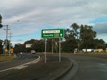
Intersection Directional Sign:
ID sign at the roundabout with Cranebrook Rd & Londonderry Rd at Cranebrook, July 2010.
Image © Paul Mech
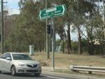
Intersection Directional Sign:
ID sign facing Ninth Av at Llandilo, December 2013.
Image © Paul Rands
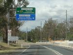
Advance Directional Sign:
AD sign at Cranebrook approaching Andrews Rd, December 2013.
Image © Paul Rands
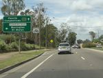
Advance Directional Sign:
AD sign approaching Dunheved Rd at Cambridge Gardens, December 2013.
Image © Paul Rands
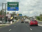
Advance Directional Sign:
AD sign at Kingswood approaching Great Western Hwy (A44) and High St (A44), December 2013.
Image © Paul Rands
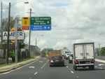
Supplemental Advance Directional Sign:
Supplemental AD sign at Kingswood approaching Great Western Hwy (A44) and High St (A44), December 2013.
Image © Paul Rands
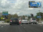
Great Western Highway & High Street:
The Northern Rd (A9) at the intersection with Great Western Hwy (A44) and High St (A44) at Kingswood, December 2013.
Image © Paul Rands
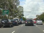
Distance Sign:
Reassurance directional sign outside Nepean Hospital at Kingswood, December 2013.
Image © Paul Rands
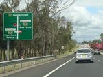
Advance Directional Sign:
AD sign approaching Western Mwy (M4) interchange at Orchard Hills, December 2013.
Image © Paul Rands
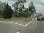
Western Motorway:
The Northern Rd (A9) at the interchange with Western Mwy (M4) at Orchard Hills, December 2013.
Image © Paul Rands
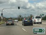
Western Motorway:
The Northern Rd (A9) at the interchange with Western Mwy (M4) at Orchard Hills, December 2013.
Image © Paul Rands
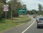
Distance Sign:
RD sign at Orchard Hills, December 2013.
Image © Paul Rands
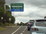
Advance Directional Sign:
AD sign at Narellan approaching The Old Northern Rd, December 2013.
Image © Paul Rands
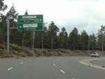
Advance Directional Sign:
AD sign at Narellan approaching The Old Northern Rd, December 2013.
Image © Paul Rands
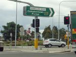
Camden Valley Way:
Corner of The Northern Rd (A9), Narellan Rd (A9) and Camden Valley Way at Narellan, December 2013.
Image © Paul Rands
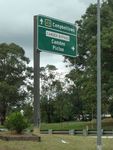
Camden Valley Way:
Corner of The Northern Rd (A9), Narellan Rd (A9) and Camden Valley Way at Narellan, December 2013.
Image © Paul Rands
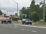
Camden Bypass:
Corner of Narellan Rd (A9) and Camden Bypass at Narellan, December 2013.
Image © Paul Rands
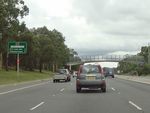
Distance Sign:
RD sign at Currans Hill, December 2013.
Image © Paul Rands
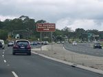
Advance Directional Sign:
AD sign at Currans Hill approaching the entrance to The Australian Botanic Garden, December 2013.
Image © Paul Rands

Advance Directional Sign:
AD sign approaching the interchange with Hume Mwy (M31) and Narellan Rd (B69) at Currans Hill, December 2013.
Image © Paul Rands

Hume Highway Interchange:
Narellan Rd (A9) at the Hume Hwy (M31) interchange at Currans Hill, December 2013. Narellan Rd becomes B69 at this junction.
Image © Paul Rands

Hume Highway Interchange:
Narellan Rd (A9) at the Hume Hwy (M31) interchange at Currans Hill, December 2013. Narellan Rd becomes B69 at this junction.
Image © Paul Rands

Hume Highway Interchange:
Narellan Rd (A9) at the Hume Hwy (M31) interchange at Currans Hill, December 2013. Narellan Rd becomes B69 at this junction.
Image © Paul Rands

Hume Highway Interchange:
Narellan Rd (A9) at the Hume Hwy (M31) interchange at Currans Hill, December 2013. Narellan Rd becomes B69 at this junction.
Image © Paul Rands
1 NSW Government, Transport for NSW, Schedule of Classified Roads And State and Regional Roads, July 2022.
2 Roads and Maritime Services
3 Roads and Maritime Services, Projects, Sydney West, Narellan Road Upgrade, Stage 1


