Statistics:
- Length:
- 34 km
- Termini:
- Northern: Hume Mwy (M31) and Narellan Rd (A9), Campbelltown
- Southern: Princes Mwy (M1), Maddens Plains (Bulli Tops)
- Suburbs, Towns & Localities Along Route:
- Maddens Plains, Cataract, Appin, Gilead, Rosemeadow, St Helens Park, Ambarvale, Bradbury and Campbelltown
Route Numbering:
- Current: B69
- Former: 69
- Road Authority Internal Classification: 1
- MR177 (Maddens Plains to Campbelltown)
- MR178 (Appin Road to Hume Highway (M31) interchange, Campbelltown)
General Information:
B69 is mostly the same except around the Campbelltown area where it's generally 4-lane and 6-lane divided arterial road. It services residential, commercial and agricultural areas, but also pass through national park and state forests and connects the southwestern outskirts of Sydney with the city of Wollongong.
History:
- 1980s: Alignment improvements between Bulli Tops and Appin.
- October 1996: The railway level crossing on Narellan Rd, Campbelltown eliminated when an overpass opened to traffic. 2
- November 2013: State Route 69 replaced by B69.

Advance Directional Sign:
AD sign at the Hume Mwy (M31) and Narellan Rd (A9) interchange at Campbelltown, December 2013.
Image © Paul Rands
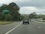
Reassurance Directional Sign:
Distance sign at Campbelltown after the Hume Hwy (M31) and Narellan Rd (A9) interchange, December 2013.
Image © Paul Rands

Advance Directional Sign:
AD sign at Campbelltown approaching Blaxland Rd and Gilchrist Dr, December 2013.
Image © Paul Rands

Advance Directional Sign:
AD sign approaching Moore-Oxley Bypass, The Parkway and Appin Rd (B69), December 2013. B69 turns right at this junction.
Image © Paul Rands

Intersection Directional Sign:
ID sign at the junction with Moore-Oxley Bypass, The Parkway and Appin Rd (B69), December 2013. B69 turns right at this junction.
Image © Paul Rands

Intersection Directional Sign:
ID sign at the junction with Moore-Oxley Bypass, The Parkway and Appin Rd (B69), December 2013. B69 turns right at this junction.
Image © Paul Rands

Distance Sign:
Reassurance directional sign on Appin Rd (B69) at Bradbury, December 2013.
Image © Paul Rands

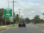
Advance Directional Sign:
AD sign at Bradbury approaching Therry Rd, December 2013.
Image © Paul Rands
Advance Directional Sign:
AD sign at Appin approaching Wilton Rd, December 2013. B69 turns left at this junction.
Image © Paul Rands
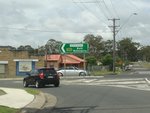
Wilton Road:
Corner of Appin Rd (B69) and Wilton Rd at Appin, December 2013. B69 turns left at this junction.
Image © Paul Rands
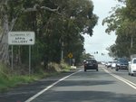
Advance Directional Sign:
AD sign approaching Illawarra St in Appin, December 2013.
Image © Paul Rands
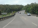
Georges River:
Appin Rd (B69) as it crosses Georges River via Kings Falls Bridge at Appin, December 2013.
Image © Paul Rands
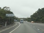
Advance Directional Sign:
AD sign at Appin approaching Lysaght Rd, December 2013.
Image © Paul Rands
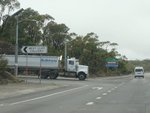
Lysaght Road:
Corner of Appin Rd and Lysaght Rd at Appin, December 2013.
Image © Paul Rands
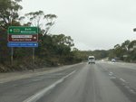
Advance Directional Sign:
AD sign approaching Baden Powell Sr at Appin, December 2013.
Image © Paul Rands

Intersection Directional Sign:
ID sign assembly at the corner of Appin Rd (B69) and Baden Powell Dr at Cataract, December 2013.
Image © Paul Rands
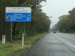
Tourism Distance Sign:
Tourism destination distance sign at Cataract, December 2013.
Image © Paul Rands
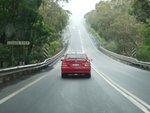
Loddon River:
Appin Rd (B69) as it crosses Loddon River at Cataract, December 2013.
Image © Paul Rands
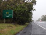
Advance Directional Sign:
AD sign approaching the interchange with Princes Mwy (M1) and Old Princes Hwy at Maddens Plains (Bulli Tops), December 2013.
Image © Paul Rands
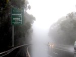
Advance Directional Sign:
AD sign approaching the interchange with Princes Mwy (M1) and Old Princes Hwy at Bulli Tops, December 2013.
Image © Paul Rands
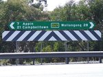
Intersection Directional Sign:
ID sign with alphanumeric route number at Cataract facing Baden Powell Dr, August 2009.
Image © Richard Wardle
1 NSW Government, Transport for NSW, Schedule of Classified Roads And State and Regional Roads, July 2022.
2 Campbelltown City Council, Campbelltown City Library, Level crossing at Camden Road, Campbelltown adjacent to its replacement bridge under construction.


