|
|
|
|
|
Located in the East Gippsland region, Mallacoota is a small coastal town, and is a popular holiday spot for boating, fishing, walking the wilderness coast, swimming, birdwatching, and surfing.
Before European settlement, the area was part of the territory of the Bidawal people. European settlers started to arrive in the 1830s. A small timber lighthouse was built on nearby Gabo Island in 1854, and the existing granite lighthouse was completed in 1862. By the 1880s commercial fishing was well established and at the same time the first tourists started to arrive. Gold was discovered in 1894.
It is one of the most isolated towns in the state of Victoria, 25 kilometres off the Princes Highway, 6 hours from Melbourne and 7 hours from Sydney. The region is known for its wild flowers, abalone industry, the inlet estuary consisting of Top Lake and Bottom Lake, and Croajingolong National Park that surround it.
| Preview: | Description: |
 |
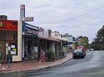
Mallacoota Town Centre: Maurice Av (C617) in Mallacoota, 2003. Image © Jamie Scuglia |
 |
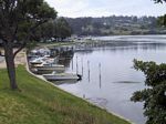
Bottom Lake: View of Bottom Lake at Mallacoota, 2003. Image © Jamie Scuglia |
1 Australian Bureau of Statistics, 2016 Census QuickStats
Last updated: 01-Dec-2019 23:58
This site © Paul Rands. All rights reserved. Some portions © (copyright) by their respective and credited owners. Permission must be obtained before using any images from this site. For details, please email by clicking here.