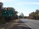
Road Photos & Information: Western Australia
Australind Bunbury Tourist Drive (Tourist Drive 260)
Statistics:
- Length:
- 26 km
- Termini:
- Northern: Forrest Hwy (NR1), Leschenault
- Southern: Bussell Hwy (SR10), Withers
- Roads that form the route:
- Washington Av, Ocean Dr, Clifton St, Koombana Dr, Estuary Dr and Old Coast Rd
- Suburbs, Towns & Localities Along Route:
- Withers, South Bunbury, Bunbury, Vittoria, East Bunbury, Pelican Point, Australind and Leschenault
Route Numbering:
- Current: 260
- Former: 1
- Road Authority Internal Classification: 1
- H059 (Vittoria)
General Information:
Located in the state's southwest, Tourist Drive 260 follows a north-south route mostly along the coastal and waterfront areas around the Bunbury CBD and surrounding suburbs.
The route provides impressive views of the Indian Ocean, and access to several attractions including beaches, parks and playgrounds, Maidens Reserve, Big Swamp Parkland, Bunbury Lighthouse, Dolphin Discovery Centre
History:
- 1988: Australind Bypass completed. 2 As a result, National Route 1 relocated to the new alignment.
Withers to Leschenault
1 WA Government, Main Roads Western Australia, Road Information Mapping System.
2 South West Focus Conference, Main Roads WA Linking the South West, May 2007.
2 South West Focus Conference, Main Roads WA Linking the South West, May 2007.

