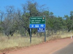
Road Photos & Information: Western Australia
Lake Argyle Tourist Drive (Tourist Drive 256)
Statistics:
- Length:
- 34 km
- Termini:
- Northern: Victoria Hwy (NH1), Lake Argyle
- Southern: Lake Argyle Rd (unnumbered) and Lake Arygle Tourist Village entrance, Lake Argyle
- Suburbs, Towns & Localities Along Route:
- Lake Argyle
Route Numbering:
- Current: 256
- XX
General Information:
Lake Argyle Road is a rural road used to access the Ord River Irrigation Scheme and is also known as Parker Road. It's an undivided 2 lane rural road used primarily as a tourist route.
Lake Argyle is one of the world's largest man-made lakes. The route takes in the breathtaking scenery and unique wildlife of this great expanse of water, which is located in the rugged landscape of the Kimberley.
History:
- 1972: Official opening of Lake Argyle / Ord River Dam. 1
1 WA Government, Kimberley Development Commission.
