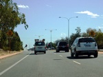
Road Photos & Information: Western Australia
Ocean Reef Road and Gnangara Road (State Route 84)
Statistics:
- Length:
- 24 km
- Termini:
- Eastern: West Swan Rd (SR52), Henley Brook
- Western: Marmion Av (SR71) and Ocean Reef Rd (unnumbered), Heathridge
- Suburbs, Towns & Localities Along Route:
- Heathridge, Beldon, Edgewater, Woodvale, Wanneroo, Pearsall, Wangara, Gnangara, Landsdale, Cullacubardee, Lexia, Ellenbrook, Aveley and Henley Brook
Route Numbering:
- Current: 84
- Former: 83
- Road Authority Internal Classification: 1
- H069 (Heathridge to Lexia)
General Information:
Ocean Reef Drive is a suburban arterial road in Perth's northern suburbs and consists mostly of dual carriageway multi-laned roadway, except at the eastern end, where there is a couple of undivided carriageway sections with one lane in each direction and provision for duplication.
History:
- 1972: A proposed extension of Ocean Reef Road was noted on the Metropolitan Regional Scheme at the western end near Ocean Reef and Iluka between Hodges Drive and Shenton Avenue. 2 3
- 21 February 1979: The western road reserve for the Ocean Reef Road extension around Ocean Reef and Iluka was identified as an Important Regional Roads reservation. 3
- 2 July 1988: Interchange with Mitchell Freeway opened. 4
- June 1992: Opening of a new bridge over Mitchell Freeway (SR2). 5
- 1 December 1993: The western road reserve for the Ocean Reef Road extension around Ocean Reef and Iluka was removed from the Metropolitan Regional Scheme, as Marmion Avenue / West Coast Highway (SR71) was performing a similar function. 4
- December 1999: Opening of the Mitchell Freeway (SR2) ramps north of Ocean Reef Road at Heathridge / Edgewater. 6
- 2001: Installation of a roundabout at the corner of Ocean Reef Road / Oceanside Promenade at Mullaloo, plus the installation of pedestrian facilities at traffic signals at the corner of Marmion Avenue / Ocean Reef Road at Ocean Reef. 7
- 2003: Construction of a right turn slip lane from Ocean Reef Road into Lenore Road, a left turn slip lane from Lenore Road into Ocean Reef Road, and extension of the left turn lane from Ocean Reef Road into Lenore Road. 8
- 2004: Construction of Drumpellier Drive intersection at Ellenbrook. 9
- 2005: Installation of traffic signals at Trappers Drive / Ocean Reef Road. 10
- June 2008: Stage one works of the extension of the non-SR84 section of Ocean Reef Drive, from Hartman Drive to a new road named Prestige Boulevard, began. Stage 2, from Prestige Boulevard to Alexander Drive, is expected to begin in the second half of 2009, with the view of completing the extension by June 2010. 11
- July 2008: A second carriageway along Ocean Reef Road from Wanneroo Road to Hartman Drive opened to traffic. The roadworks included the construction of a new carriageway, new drainage, street lighting, a new dual-use path along the whole length, new line markings, and landscaping. 11
- December 2016: Opening of duplication of an 8 km stretch of Gnangara Road, between Alexander and Drumpellier Drives. 12
- December 2023: State Route 83 decommissioned between Shenton Av, Iluka and Marmion Av, Ocean Reef. 13
Click or tap here for construction photos between Heathridge and Henley Brook
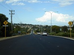
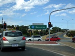
Heathridge to Henley Brook

Trailblazer Assembly:
Trailblazer assembly at Wanneroo, approaching Wanneroo Rd (SR60), April 2016. This was once the eastern terminus of State Route 84. Click or tap here for a photo of this location by Paul Rands from February 2009.
Image © Paul Rands
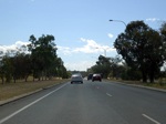
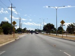
Henley Brook to Heathridge
1 WA Government, Main Roads Western Australia, Road Information Mapping System.
2 Citizenscape, Ocean Reef Drive Extension Case Study, 31 March 2009.
3 City of Joondalup, Letter from Manager of Infrastructure Management & Ranger Services, Department of Planning of Infrastructure, 23 December 2003.
4 WA Government, Main Roads Western Australia, Dates of Major Changes To The Road Network List.
5 WA Government, Media Statements, Changes to Mitchell Freeway, 19 June 1992.
6 WA Government, Media Statements, Official opening of extension of Mitchell Freeway from Ocean Reef Rd to Hodges Drive, 23 December 1999.
7 WA Government, Government Media Office Ministerial Media Statements, State Government provides $13 million for 'black spot' road projects, 12 January 2001.
8 WA Government, Main Roads Western Australia, National Black Spot Programme Approved Projects Year 2002 / 2003 List.
9 WA Government, Media Statements, Funding partnership delivers new road access to Ellenbrook, 18 February 2004.
10 City of Joondalup, 2005 Annual Report.
11 City of Wanneroo, What's Happening in the City of Wanneroo, February-March 2009.
12 WA Government, Media Statements, Major road upgrade in City of Swan set to open, 21 November 2016.
13 WA Government, Main Roads Western Australia, Western Australian State Routes 2024.
