Statistics:
- Length:
- 15 km
- Termini:
- Northern: Great Northern Hwy (NH1), Belhus
- Southern: Great Eastern Hwy (NR1 and NR1 / SR51) and Meadow St (unnumbered), Guildford
- Suburbs, Towns & Localities Along Route:
- Guildford, Caversham, West Swan, Henley Brook and Belhus
Route Numbering:
- Current: 52
General Information:
State Route 52 is mostly undivided and generally consists on 1 lane in each direction for its entire length, and passes through one of Perth's oldest suburbs, Guildford, and eventually into Perth's wine country.
History:
- 1854: Barkers Bridge over the Swan River in Guildford completed. The bridge was built by convict labour. The bridge helped provide access to farming land in the Avon Valley. 1
- 1974: Concrete deck slab laid on Barkers Bridge. 2
- 1959: Construction of bridge over Ellen Brook at Belhus. 3
- February 1997: Works commence on replacing the concrete slab on Barkers Bridge at Guildford. Other work included replacing the timber guardrail with a stronger steel guardrail, replacing the concrete footpath with timber decking and carrying out minor repairs to the bridge's support structure. 2
- January 2018: Upgrade of bridge on West Swan Road over Ellen Brook at Belhus. Work involved replacing existing traffic barriers, bridge beams and piles, reinforcement of the existing bridge deck, and construction of retaining walls and embankments. 3

AD Sign:
Advance directional sign approaching Middle Swan Road and Reid Highway (SR3) at Caversham. November 2008.
Image © Paul Rands

Reid Highway / Middle Swan Road Intersection:
Approaching the intersection with Reid Hwy and Middle Swan Rd in Caversham. November 2008.
Image © Paul Rands
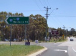
Intersection Directional Sign:
ID sign on the corner of West Swan Rd (SR52) Henry St and Gnangara Rd (formerly SR83, now SR84) at Henley Brook, November 2008. This junction is now controlled with a roundabout.
Image © Paul Rands
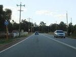
Trailblazer:
SR52 trailblazer at Henley Brook after the Gnangara Rd (SR84) intersection, June 2009.
Image © Paul Rands
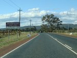
Advance Directional Sign:
Special Swan Valley Wine Region advance directional sign approaching Millhouse Rd in Belhus, June 2009.
Image © Paul Rands
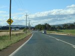
Approaching Millhouse Road:
West Swan Rd (SR52) approaching Millhouse Rd, June 2009.
Image © Paul Rands
Millhouse Road:
Corner of West Swan Rd (SR52) and Millhouse Rd in Belhus, June 2009.
Image © Paul Rands

Approaching Great Northern Highway:
West Swan Rd (SR52), approaching Great Northern Hwy (NH95 / NR1) at Belhus, June 2009. This warning sign has since been removed.
Image © Paul Rands

Advance Directional Sign:
AD sign on West Swan Rd (SR52) at Belhus, approaching Great Northern Hwy (NH95 / NR1), April 2016. SR52 ends at this junction. Click or tap here for a photo of this location by Paul Rands from June 2009.
Image © Paul Rands

End State Route 52:
End SR52 trailblazer at Belhus near Great Northern Hwy (NH95 / NR1) intersection, April 2016.
Image © Paul Rands

Great Northern Highway:
West Swan Rd (SR52) at the Great Northern Hwy (NH95 / NR1) junction at Belhus, April 2016.
Image © Paul Rands

Trailblazer:
SR52 trailblazer at Belhus, April 2016.
Image © Paul Rands
Approaching Millhouse Road:
West Swan Rd (SR52) approaching Millhouse Rd at Belhus, June 2009.
Image © Paul Rands

Millhouse Road:
Corner of West Swan Rd (SR52) and Millhouse Rd in Belhus, April 2016. Click or tap here for a photo of this location by Paul Rands from June 2009.
Image © Paul Rands
Horse & Buggy Warning Sign:
Unusual warning sign for horses and buggies, Belhus, June 2009.
Image © Paul Rands

Approaching Gnangara Road:
West Swan Rd (SR52) approaching Gnangara Rd (SR84) at Belhus, April 2016.
Image © Paul Rands

Gnangara Road & Henry Street:
Corner of West Swan Rd (SR52), Gnangara Rd (SR84) and Henry St in Belhus, April 2016, April 2016.
Image © Paul Rands

Gnangara Road & Henry Street:
Corner of West Swan Rd (SR52), Gnangara Rd (SR84) and Henry St in Belhus, April 2016. Click or tap here for a photo of this location by Paul Rands from June 2009.
Image © Paul Rands
Trailblazer:
SR52 trailblazer at Henley Brook after the Gnangara Rd (SR84) and Henry St intersection, June 2009.
Image © Paul Rands
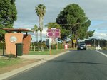
Swan Street:
Corner of West Swan Rd (SR52) and Swan St in Henley Brook, June 2009.
Image © Paul Rands
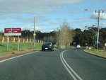
Advance Directional Sign:
Special Swan Valley Wine Region advance directional sign approaching John St in Henley Brook, June 2009.
Image © Paul Rands
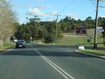
John Street:
Corner of West Swan Rd (SR52) and John St in Henley Brook, June 2009.
Image © Paul Rands
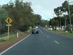
Approaching Henley Street:
West Swan Rd (SR52) approaching Henley St in Henley Brook, June 2009.
Image © Paul Rands
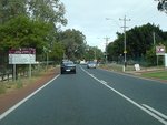
Advance Directional Sign:
Special Swan Valley Wine Region advance directional sign approaching Henley St in Henley Brook, June 2009.
Image © Paul Rands
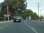
Henley Street:
Corner of West Swan Rd (SR52) and Henley St in Henley Brook, June 2009.
Image © Paul Rands
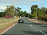
Henley Brook:
West Swan Rd (SR52) as it passes through Henley Brook, June 2009.
Image © Paul Rands
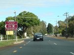
Forest Road:
Corner of West Swan Rd (SR52) and Forest Rd in Henley Brook, June 2009.
Image © Paul Rands
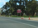
Woollcott Avenue:
Corner of West Swan Rd (SR52) and Woollcott Av in West Swan, June 2009.
Image © Paul Rands
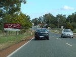
Advance Directional Sign:
Special Swan Valley Wine Region advance directional sign approaching York St in West Swan, June 2009.
Image © Paul Rands
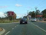
Edward Street:
Corner of West Swan Rd (SR52) and Edward St in West Swan, June 2009.
Image © Paul Rands
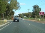
George Street:
Corner of West Swan Rd (SR52) and George St in West Swan, June 2009.
Image © Paul Rands
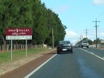
Advance Directional Sign:
Special Swan Valley Wine Region advance directional sign approaching Harrow St in West Swan, June 2009.
Image © Paul Rands
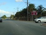
Harrow Street:
Corner of West Swan Rd (SR52) and Harrow St in West Swan, June 2009.
Image © Paul Rands
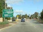
Advance Directional Sign:
AD sign on West Swan Rd (SR52) aproaching Middle Swan Rd (SR3) and Reid Hwy (SR3) at West Swan, June 2009.
Image © Paul Rands
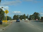
Approaching Reid Highway & Middle Swan Road:
West Swan Rd (SR52) approaching Middle Swan Rd (SR3) and Reid Hwy (SR3) at West Swan, June 2009.
Image © Paul Rands
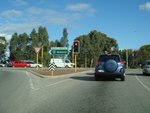
Middle Swan Road & Reid Highway:
Corner of West Swan Rd (SR52), Reid Hwy (SR3) and Middle Swan Rd (SR3) at West Swan, June 2009.
Image © Paul Rands
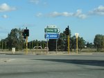
Middle Swan Road & Reid Highway:
Corner of West Swan Rd (SR52), Reid Hwy (SR3) and Middle Swan Rd (SR3) at West Swan, June 2009.
Image © Paul Rands
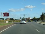
Bertram Road:
Corner of West Swan Rd (SR52) and Bertram Rd in Caversham, June 2009.
Image © Paul Rands
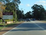
Advance Directional Sign:
Special Swan Valley Wine Region advance directional sign on West Swan Rd (SR52) approaching Bernara Rd (SR76) at Caversham, June 2009.
Image © Paul Rands
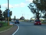
Trailblazer Assemlby:
Trailblazers on West Swan Rd (SR52) approaching Bernara Rd (SR76), June 2009.
Image © Paul Rands
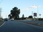
Bernara Road:
Corner of West Swan Rd (SR52) and Bernara Rd (SR76) at Caversham, June 2009.
Image © Paul Rands
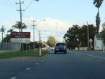
Advance Directional Sign:
Special Swan Valley Wine Region advance directional sign approaching De Burgh Rd in Caversham, June 2009.
Image © Paul Rands
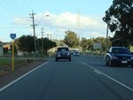
Trailblazer:
SR52 trailblazer on West Swan Rd (SR52) at Caversham, June 2009.
Image © Paul Rands
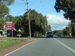
Hamersley Road:
Corner of West Swan Rd (SR52) and Hamersley Rd in Caversham, June 2009.
Image © Paul Rands
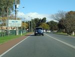
Leaving Swan Valley:
West Swan Rd (SR52) as it leaves the Swan Valley tourism region, Caversham, June 2009.
Image © Paul Rands
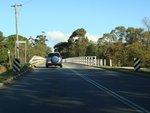
Swan River:
West Swan Rd (SR52) as it crosses the Swan River via Barkers Bridge at Caversham, June 2009.
Image © Paul Rands
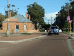
Swan Street:
Corner of Meadow St (SR52) & Swan St in Guildford, June 2009. When TD203 duplexed SR52, it turned left here.
Image © Paul Rands
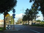
End State Route 52:
Trailblazer on Meadow St (SR52) in Guildford showing the end of SR52, as it approaches Guildford Rd (SR51) and the unnumbered section of Meadow St, June 2009.
Image © Paul Rands
1 WA Government, Heritage Council of Western Australia.
2 WA Government, Media Statements, Barkers Bridge over Swan River at Guildford to be refurbished, 10 February 1997.
3 WA Government, Media Statements, Joint media statement - Bridge in Belhus to receive major upgrade, 31 January 2018.


