Statistics:
- Length:
- 22 km
- Termini:
- Northern: Great Eastern Hwy (NR1 / NH94), Shepperton Rd (SR30), Canning Hwy (NR1 / SR6) and Albany Hwy (unnumbered), East Perth
- Southern: High St (SR7), Fremantle
- Suburbs, Towns & Localities Along Route:
- Fremantle, East Fremantle, North Fremantle, Mosman Park, Cottesloe, Peppermint Grove, Claremont, Karrakatta, Nedlands, Crawley, Northbridge, East Perth and Burswood
Route Numbering:
- Current: 5
- Road Authority Internal Classification: 1
- H014
General Information:
The route consists of several roads connected together to form SR5. The Stirling Hwy section is mostly multi-laned and has a long history and passes through some of Perth's older suburbs. It's named after former WA premier, Sir James Stirling. SR5 is incorporated into the large interchange known as the Narrows Interchange located in Northbridge, just on the western edge of the Perth CBD.
Mounts Bay Road is named after Mounts Bay, the body of water in the Swan River Estuary that was infilled for the construction of the Narrows Interchange, and the road follows the boundary of the bay at the Narrows. It follows the Swan River estuary and forms the southern and southeastern boundary for Kings Park.
Riverside Drive skirts around the southwestern edge of the Perth CBD and forms part of SR5, and consists of a single carriageway alignment of 4 lanes. It acts as a bypass of the CBD from the Narrows Interchange to the Causeway.
Also included in the route is The Causeway. The Causeway is the name of two bridges which span the Swan River in Western Australia at the eastern end of Perth Water. They link the City of Perth and Town of Victoria Park. The two bridges are joined at Heirisson Island, which is approximately midway across the river, to make a continuous crossing. The Causeway crossing actually dates back to the mid 1800s.
History:
- 1800s: The Stirling Hwy section of SR5, began its life as a rough track between Perth and Fremantle.
- 1858: The road was completed after convicts, transported from the United Kingdom, were put to work on the Perth to Fremantle track.
- 1872: The road was declared a public highway. 2
- 1930: The Perth-Fremantle Road became Stirling Highway, after the first Governor of Western Australia, Admiral Sir James Stirling.
- 1934: Upgrade to then modern highway standard: Broadway, Nedlands to Weld Street, Nedlands.
- 1935: Upgrade to then modern highway standard: Weld Street, Nedlands to Bay View Terrace, Claremont.
- 1936: Upgrade to then modern highway standard: Bay View Terrace, Claremont to Anstey Street, Claremont.
- 1937: Upgrade to then modern highway standard: Anstey Street, Claremont to Johnston Street, Peppermint Grove.
- 1938: Upgrade to then modern highway standard: Johnston Street, Peppermint Grove to Leighton Crossing, North Fremantle.
- 1939: Upgrade to then modern highway standard: Leighton Crossing, North Fremantle to Fremantle, including the Fremantle Traffic Bridge.
- 1948: A major public works program commenced to rebuild the Causeway. This project gave employment to many recently returned World War II veterans.
- 1951: The roundabouts that were once located at either end were modelled and shown at an exhibition in Perth Town Hall by the National Safety Council of WA.
- 1974: Opening a new crossing over the Swan River located slightly to the east of the Fremantle Traffic Bridge. Named the Stirling Bridge, it was opened by then Premier of Western Australia, Sir Charles Court. The highway was rerouted to the new bridge, and terminated at Canning Hwy (SR6).
- 1980s: Rebuilding of the approach roads onto the bridges of the Causeway.
- 26 November 1985: Opening of an extension further south from Canning Highway to High Street (SR7). 3
- December 2012: Construction commenced on the Elizabeth Quay project along the Swan River adjacent to Riverside Dr and the Perth CBD. This would eventually alter the route of State Route 5.
Click or tap here for the former alignment between Fremantle and Burswood
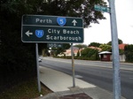
Black AD Sign:
Old black advance directional sign on the corner of the Stirling Hwy and Boreham St in Cottesloe, as you approach the Eric St (SR71) intersection. August 2008.
Image © Paul Rands
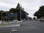
Black ID Sign:
Old black intersection directional sign on the corner of the Stirling Hwy and Eric St in Cottesloe. August 2008.
Image © Paul Rands
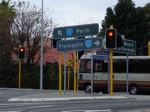
Black ID Sign:
Old black intersection directional sign on the corner of the Stirling Hwy and Eric St in Cottesloe. August 2008.
Image © Paul Rands
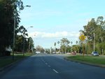
Approaching Hackett Drive:
Mounts Bay Road (SR5) as it approaches Hackett Dr at Crawley, July 2009.
Image © Paul Rands
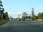
Hackett Drive Intersection:
Corner of Mounts Bay Rd (SR5) and Hacket Dr at Crawley, July 2009.
Image © Paul Rands
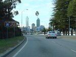
Advance Directional Sign:
AD sign approaching the parking area of the Old Swan Brewery at Kings Park, July 2009.
Image © Paul Rands

Advance Directional Sign Assembly:
Standard Green and Freeway Green ID sign assembly approaching the Point Lewis Rotary near Kings Park. July 2009. This sign still remains in service despite SR5 now veering right at this location. Click or tap here for a photo of this location by Paul Rands from February 2008, featuring a black sign.
Image © Paul Rands
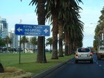
Advance Directional Sign:
AD sign approaching Victoria Av, Perth, July 2009.
Image © Paul Rands
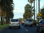
Approaching Victoria Avenue:
Riverside Dr in Perth as it approaches Victoria Av, July 2009.
Image © Paul Rands
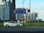
Intersection Directional Sign:
ID sign at the corner of Riverside Dr (SR5) and Victoria Av in Perth, July 2009.
Image © Paul Rands
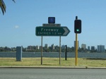
Intersection Directional Sign:
Freeway Green ID sign with SR5 topknot facing Victoria Avenue traffic in Perth. February 2008.
Image © Paul Rands
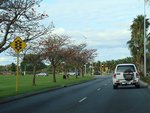
Approaching Plain Street:
Riverside Dr (SR5) approaching Plain St (SR65) at East Perth, July 2009.
Image © Paul Rands
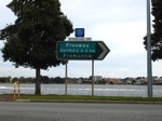
Intersection Directional Sign:
Black & Freeway Green ID sign with SR5 topknot facing Plain Street (SR65) traffic in Perth. August 2008.
Image © Paul Rands
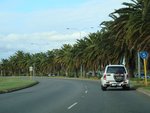
Trailblazer:
SR5 trailblazer after the Plain St (SR65) intersection at East Perth, July 2009.
Image © Paul Rands

Advance Directional Sign:
AD sign at East Perth approaching Hay St, Adelaide Tce and Causeway (SR5), July 2009.
Image © Paul Rands

Hay Street, Adelaide Terrace & Causeway Junction:
ID sign assembly at East Perth at the corner of Hay St, Adelaide Tce and Causeway (SR5), July 2009.
Image © Paul Rands

Hay Street, Adelaide Terrace & Causeway Junction:
ID sign assembly at East Perth at the corner of Hay St, Adelaide Tce and Causeway (SR5), July 2009.
Image © Paul Rands
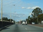
Causeway:
Looking southeast on Causeway as it crosses the Swan River and Heirisson Island in East Perth, July 2009.
Image © Paul Rands

Advance Directional Sign:
AD sign on Heirisson Island in East Perth, approaching Great Eastern Hwy (NH94 / NR1), Albany Hwy and Shepperton Rd (SR30), July 2009.
Image © Paul Rands
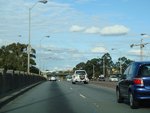
Causeway:
Looking southeast on Causeway as it crosses the Swan River and Heirisson Island in Burswood, July 2009.
Image © Paul Rands

Great Eastern Hwy, Shepperton Rd & Albany Hwy Interchange:
Causeway (SR5) as it at the Great Eastern Hwy (NH94 / NR1), Shepperton Rd (SR30) and Albany Hwy interchange at Burswood, July 2009. This is the end of SR5.
Image © Paul Rands
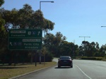
Advance Directional Sign:
AD sign on the Canning Hwy at Burswood approaching the interchange with Shepperton Road (SR30) and The Causeway (SR5). December 2007.
Image © Paul Rands
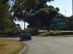
Exit Gore:
Looking southwest at Burswood as you exit Canning Hwy, to connect with Shepperton Rd and The Causeway, December 2007.
Image © Paul Rands
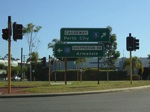
Intersection Directional Sign:
Looking southwest on the corner of Shepperton Rd (SR30) and The Causeway (SR5) at Burswood, this is the terminus for the 2 routes. December 2007.
Image © Paul Rands

AD Sign:
Advance directional sign at the Canning Hwy (SR6 / NR1) interchange at Burswood, August 2008.
Image © Paul Rands
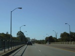
Crossing The Swan River:
Heading northwest as you cross the Swan River via the Causeway, December 2007.
Image © Paul Rands
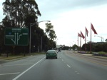
Advance Directional Sign:
Sign explaining the lane allocations after the Causeway. Looking northwest on Heirisson Island at Burswood. August 2008.
Image © Paul Rands
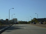
Crossing The Swan River:
Heading northwest as you cross the Swan River via the Causeway in East Perth, December 2007.
Image © Paul Rands
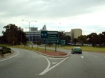
Corner of Riverside Dr & Adelaide Tce:
Looking northwest in East Perth, at the end of the Causeway at the intersection with Riverside Drive (SR5) and Adelaide Terrace, August 2008.
Image © Paul Rands
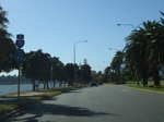
Trailblazer Assembly:
Riverside Drive approaching Plain Street (SR65), December 2007.
Image © Paul Rands
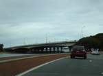
Kwinana Freeway:
Mounts Bay Road (SR5) as it passes under the Kwinana Fwy (SR2) in Perth. August 2008.
Image © Paul Rands
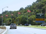
Black ID Sign:
Westbound as Riverside Drive meets Mounts Bay Road alongside Kings Park at the Point Lewis Rotary. February 2008.
Image © Paul Rands
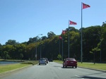
Mounts Bay Road:
Typical conditions as you travel westbound on Mounts Bay Road. February 2008.
Image © Paul Rands
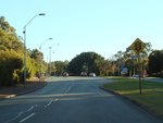
Approaching Winthrop Avenue:
Westbound on Mounts Bay Road approaching Winthrop Avenue at Crawley. June 2009.
Image © Paul Rands
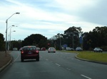
Winthrop Avenue:
Westbound on Mounts Bay Road approaching Winthrop Avenue at Crawley. August 2008.
Image © Paul Rands
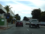
Stirling Hwy:
Looking southwest on Stirling Highway as it makes its way through Nedlands. August 2008.
Image © Paul Rands
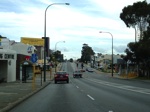
Dalkeith Road Intersection:
Stirling Highway as you approach Dalkeith Road in Nedlands, August 2008.
Image © Paul Rands
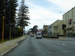
Entering Claremont:
Stirling Hwy at the Leura Av junction as you enter Claremont. August 2008.
Image © Paul Rands
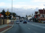
Peppermint Grove:
Stirling Hwy as you approach Leake Street in Peppermint Grove. August 2008.
Image © Paul Rands
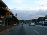
Mosman Park:
Stirling Highway as it passes through the shopping precinct in Mosman Park near Glyde Street. August 2008.
Image © Paul Rands

Advance Directional Sign:
Southbound AD sign approaching the Queen Victoria Street (SR12) junction in North Fremantle. August 2008.
Image © Paul Rands

Queen Victoria Street Intersection:
Looking southbound at the Queen Victoria St (SR12) junction in North Fremantle. August 2008.
Image © Paul Rands
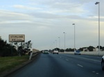
Stirling Bridge:
Crossing the Swan River via the Stirling Bridge at North Fremantle. August 2008.
Image © Paul Rands
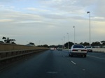
Stirling Bridge Deck:
Crossing the Swan River via the Stirling Bridge at North Fremantle. August 2008.
Image © Paul Rands
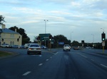
Canning Highway:
Corner of Stirling Hwy (SR5) and Canning Hwy (SR6) at East Fremantle. August 2008.
Image © Paul Rands
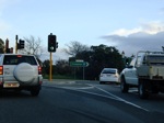
End SR5:
Southwestern terminus of State Route 5 - High Street in East Fremantle. August 2008.
Image © Paul Rands
1 WA Government, Main Roads Western Australia, Road Information Mapping System.
2 Town of Cottesloe.
3 WA Government, Main Roads Western Australia, Metropolitan Route History List, June 2008.


