Road Photos & Information: Western Australia
South Western Highway
Harvey to Bunbury
Statistics:
- Length:
- 154 km (Harvey to Bunbury: 46 km)
- Termini:
- Northern: Armadale Rd (SR14) and Albany Hwy (SR30), Armadale
- Southern: Robertson Dr (NR1 / SR10) and Picton Rd (unnumbered), Glen Iris
- Miscellaneous:
- Continues as NR1 from Bunbury
- Suburbs, Towns & Localities Along Route:
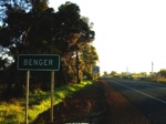
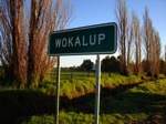
- Wokalup, Benger, Brunswick Junction, Roelands, Waterloo, Picton East, Picton and Glen Iris (Bunbury)
Route Numbering:
- Current: 20
- Former: 1
- Road Authority Internal Classification: 1
- H009
General Information:
State Route 20 is a north-south route connecting the southwestern suburbs of Perth with Western Australia's third largest city, Bunbury.
Once the primary thoroughfare connecting Perth to the southwest, this route links a multitude of small towns that owe their existence to the 19th-century construction of the railway line that closely parallels much of State Route 20's length.
The route is rural highway standard for most of it, and services residential, commercial, light industrial and agricultural areas.
History:
- 1 July 1853: Colonial Secretary Frederick Barlee announced a new proposal for a Perth–Pinjarra–Bunbury route along the foothills of the Darling Scarp. 2
- 1864: Work commences on construction of the route announced in 1853 by two gangs of convicts.
- 1876: Construction completed of the route announced in 1853.
- July 1941: The name South Western Highway officially adopted. 3
- 1980s: National Route 1 rerouted via Old Coast Road, SR20 introduced to the former NR1 alignment between Armadale and Bunbury.
- 2006: Two additional passing lanes added to the highway north of Brunswick Junction. 4
- April 2022: Work commenced on construction of the interchange with Bunbury Outer Ring Road (BORR) at Waterloo, near the roadhouse. 5
- 2024: State Route 107 decommissioned between Bunbury and Roelands, extinguishing the duplex with State Route 20. 6
Bunbury to Harvey

Advance Directional Sign:
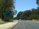
AD sign at Picton approaching Willinge Dr (formerly Picton-Boyanup Rd). April 2016. Click or tap here for a photo of this location by Paul Rands from December 2007.
Image © Paul Rands

Willinge Drive Intersection:
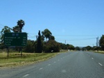
Looking northeast at the Willinge Dr (formerly Picton-Boyanup Rd) intersection. April 2016. Click or tap here for a photo of this location by Paul Rands from December 2007.
Image © Paul Rands
Harvey to Bunbury

Brunswick River:
Crossing the Brunswick River in Brunswick Jct. Southbound, April 2016. Click or tap here for a photo of this location by Paul Rands from December 2007.
Image © Paul Rands

Advance Directional Sign:
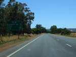
AD sign approaching Government Road, Roelands. Southbound, April 2016. Click or tap here for a photo of this location by Paul Rands from December 2007.
Image © Paul Rands

Corner of South Western Hwy & Coalfields Hwy:
Burekup at the intersection with SR107, Coalfields Hwy. Southbound, April 2016. Click or tap here for a photo of this location by Paul Rands from December 2007.
Image © Paul Rands

Collie River:
Crossing the Collie River in Burekup. Southbound, April 2016. Click or tap here for a photo of this location by Paul Rands from December 2007.
Image © Paul Rands

Waterloo Road Intersection:
Southbound through the junction with Waterloo Road in Waterloo, April 2016. Click or tap here for a photo of this location by Paul Rands from December 2007.
Image © Paul Rands

Distance Sign:
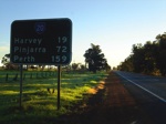
Southbound RD sign at Waterloo, April 2016. Click or tap here for a photo of this location by Paul Rands from December 2007.
Image © Paul Rands

Bunbury Town Sign:
Entering Bunbury area at the suburb of Picton, April 2016. Click or tap here for a photo of this location by Paul Rands from December 2007.
Image © Paul Rands

AD Sign:
Advance directional sign approaching Willinge Dr (formerly Picton-Boyanup Rd) at Picton, April 2016. Click or tap here for a photo of this location by Paul Rands from December 2007.
Image © Paul Rands

Willinge Dr Intersection:
ID sign at Willinge Dr (formerly Picton-Boyanup Rd) in the industrial suburb of Picton, April 2016. Click or tap here for a photo of this location by Paul Rands from December 2007.
Image © Paul Rands
2 NK Perry, History and Present Potentialities of the Old Coast Road from Mandurah to Bunbury.
3 South Western Advertiser, Armadale-Kelmscott Road Board, 25 July 1941.
4 WA Government, Department of Infrastructure and Planning.
5 WA Government, Main Roads Western Australia, Projects & Initiatives, Bunbury Outer Ring Road, Previous Publications, Construction Update, April 2022.
6 WA Government, Main Roads Western Australia, Western Australian State Routes 2024.

