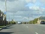
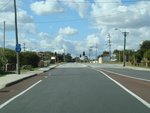
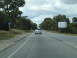
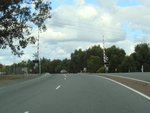
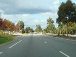
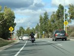
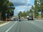
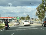
Statistics:

Length:
12 km
Termini:
Eastern: Albany Highway (SR30) and South Western Highway (SR20), Armadale
Western: Cockburn Road (SR12) and Hampton Road (SR12), Hamilton Hill
Suburbs, Towns & Localities Along Route:
Hamilton Hill, Coolbellup, Bibra Lake, South Lake, Yangebup, Cockburn Central, Atwell, Jandakot, Piara Waters, Forrestdale, Haynes, Seville Grove and Armadale

Route Numbering:

Former: 14

General Information:

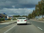
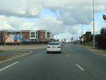
State Route 14 is an arterial road linking the Armadale area to Fremantle. It's a mix of dual and single carriageway road, which services, industrial, residential, semi-rural and commercial areas.

History:

2011: State Route 14 rerouted at western end via Spearwood Av due to turning restrictions on Rockingham Rd in Hamilton Hill. 2

This page concentrates on the former alignment between Hamilton Hill and Cockburn Central

Map Key: Purple Line = Pre-2011 Alignment. Orange Line = Current Alignment.

Hamilton Hill to Cockburn Central

image

Trailblazer:

SR14 trailblazer at Hamilton Hill after the Hampton Rd and Cockburn Rd (SR12) intersection, June 2009.

Image © Paul Rands

image

Advance Directional Sign:

AD sign missing an SR14 shield, Rockingham Rd, approaching Forrest Rd (SR14), June 2009.

Image © Paul Rands

image

Forrest Road & Rockingham Road Junction:

Corner of Rockingham Rd and Forrest Rd at Hamilton Hill, June 2009. SR14 turned left at this junction.

Image © Paul Rands

image

Trailblazer:

SR14 trailblazer at Hamilton Hill the Carrington St intersection, June 2009.

Image © Paul Rands

image

Advance Directional Sign:

AD sign at Hamilton Hill approaching Stock Rd (NR1), June 2009.

Image © Paul Rands

image

Intersection Directional Sign:

ID sign at the Stock Rd (NR1) junction at Hamilton Hill, June 2009.

Image © Paul Rands

image

Intersection Directional Sign:

ID sign at the Stock Rd (NR1) junction at Hamilton Hill, June 2009.

Image © Paul Rands

image

Trailblazer:

SR14 trailblazer at Coolbellup after the Stock Rd (NR1) junction, June 2009.

Image © Paul Rands

image

Advance Directional Sign:

AD sign at Coolbellup approaching North Lake Rd and Gwilliam Dr, June 2009. SR14 turned right at this junction onto North Lake Rd.

Image © Paul Rands

image

North Lake Road & Gwilliam Drive Intersection:

Forrest Rd at Coolbellup at the junction with North Lake Rd and Gwilliam Dr, June 2009. SR14 turned right at this junction onto North Lake Rd.

Image © Paul Rands

image

North Lake Road & Gwilliam Drive Intersection:

Forrest Rd at Bibra Lake at the junction with North Lake Rd and Gwilliam Dr, June 2009. SR14 turned right at this junction onto North Lake Rd.

Image © Paul Rands

image

Level Crossing:

Railway level crossing on North Lake Rd at Bibra Lake, June 2009.

Image © Paul Rands

image

Approaching Omeo Street:

North Lake Road approaching Omeo Street in South Lake, June 2009.

Image © Paul Rands

image

Approaching Berrigan Drive:

North Lake Rd at South Lake approaching Berrigan Dr, June 2009.

Image © Paul Rands

image

Trailblazers:

SR14 trailblazers at South Lake approaching Berrigan Dr, June 2009.

Image © Paul Rands

image

Berrigan Drive Junction:

North Lake Rd at the jucntion with Berrigan Dr in South Lake, June 2009.

Image © Paul Rands

image

Trailblazer:

SR14 trailblazer after Berrigan Dr in South Lake, June 2009.

Image © Paul Rands

image

Signal Terrace:

Corner of Midgegaroo Av and Signal Tce in Cockburn Central, June 2009.

Image © Paul Rands

image

Approaching Beeliar Drive:

Midgegaroo Av near Buffer Ln, approaching Beeliar Dr, June 2009. SR14 turned left onto Beeliar Dr.

Image © Paul Rands

image

Beeliar Drive Intersection:

Corner of Midgegaroo Av and Beeliar Dr at Cockburn Central, June 2009. SR14 turned left here.

Image © Paul Rands

1 WA Government, Main Roads Western Australia, Road Information Mapping System.
2 Sam Laybutt (Ozroads)