Statistics:
- Length:
- 60 km
- Termini:
- Northern: Busellton Hwy (SR10), Bovell (Busselton)
- Southern: Brockman Hwy (SR10) and Vasse Hwy (SR10), Nannup
- Suburbs, Towns & Localities Along Route:
- Nannup, Barrabup, Cundinup, Yoganup, Jarrahwood, Hithergreen, Yoongarillup, Bovell and Yalyalup
Route Numbering:
- Current: 104
- Road Authority Internal Classification: 1
- M008
General Information:
The State Route 104 section of the Vasse Highway serves as a connector between the charming seaside town of Busselton, its airport, and the southwestern WA town of Nannup.
The highway is two-lane single carriageway, featuring wide shoulders but lacking dedicated overtaking lanes. Nonetheless, ample opportunities for overtaking present themselves along the route. Along its journey, the road meanders through a diverse landscape, traversing national parks and state forests predominantly composed of majestic jarrah and karri forests. Additionally, it cuts through agricultural zones, plus commercial and residential areas within the towns it encounters.
History:
- 1866: Construction, via convict labour, of the Blackwood Bridge over the Blackwood River. 2
- 1890: The Lower Blackwood Road Board (renamed to Nannup Road Board in 1925) was gazetted. On 1 July 1961, it became the Nannup Shire Council following changes to the Local Government Act. 2
- 1967: Replacement of the single lane Blackwood Bridge with its current structure. 2
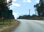
Distance Sign:
RD sign after the Brockman Hwy (SR10) / Vasse Hwy (SR10) junction just outside the Nannup town centre. September 2008.
Image © Paul Rands
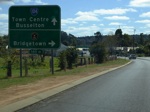
Advance Directional Sign:
AD sign for the Kearney St (TD251) intersection in Nannup. September 2008.
Image © Paul Rands
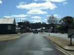
Nannup Town Centre:
Northbound through the town centre of Nannup. September 2008.
Image © Paul Rands
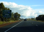
Advance Directional Sign:
Looking southwest on Bussell Highway (SR10) at Busselton, approaching the Vasse Highway (SR104) intersection. July 2008.
Image © Paul Rands
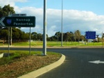
Vasse Highway / Bussell Highway intersection:
ID sign assembly on the corner of Vasse & Bussell Highways in Busselton. July 2008.
Image © Paul Rands
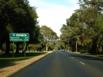
Distance Sign:
RD sign as you head southeast on Vasse Hwy at Busselton, July 2008.
Image © Paul Rands
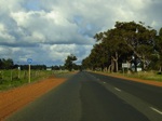
Trailblazer:
SR104 trailblazer, heading southeast on Vasse Hwy at Yoongarillup, July 2008.
Image © Paul Rands
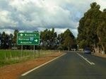
Advance Directional Sign:
Vasse Highway approaching Sues Road at Yoongarillup, SR104 travels for less than 100 metres along Sues Road. July 2008.
Image © Paul Rands
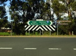
Sues Road Junction:
Intersection directional sign facing Vasse Highway at Yoongarillup, July 2008.
Image © Paul Rands
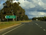
Intersection Directional Sign:
Southbound on Sues Road, on the SR104 dog leg through Yoongarillup, July 2008.
Image © Paul Rands
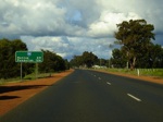
Distance Sign:
Reassurance directional sign as you head southeast on Vasse Hwy, after the Sues Rd junction and Yoongarillup, July 2008.
Image © Paul Rands
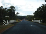
Mill Brook:
Crossing Mill Brook at Hithergreen, July 2008.
Image © Paul Rands
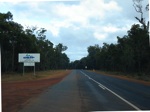
Welcome to the Blackwood River Valley:
Tourism sign on the corner of the Vasse Hwy and Goodwood Rd in Jarrahwood, July 2008.
Image © Paul Rands
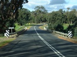
Crossing St Johns Brook:
Travelling southeast on Vasse Hwy at St Johns Brook, July 2008.
Image © Paul Rands
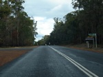
Cundinup Road:
Looking south at Cundinup Road at St Johns Brook. July 2008.
Image © Paul Rands
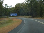
Services Sign:
Services sign as you approach the town of Nannup. July 2008.
Image © Paul Rands
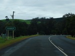
Entering Nannup:
Southbound as you enter the town of Nannup. July 2008.
Image © Paul Rands
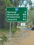
NEW Reassurance Directional Sign:
Distance sign at Nannup, near Mowen Rd, January 2016. Note the incorrect route number.
Image © Terry Siva
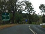
Advance Directional Sign:
Advance directional sign approaching Grange Road / Brockman Highway (TD251), July 2008.
Image © Paul Rands
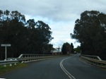
Blackwood River Bridge:
Heading southwest over the Blackwood River at Nannup, July 2008. This bridge was built in 1967, replacing a one lane convict built bridge, which was erected in 1866. 2
Image © Paul Rands
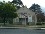
Nannup Road Board Building:
The first brick building in the town, this is the Nannup Road Board building on Warren Road (Vasse Highway) in Nannup. July 2008. This building was the first brick residence in the town, which had significant alterations made during the 1960s. The Lower Blackwood Road Board (renamed to Nannup Road Board in 1925) was gazetted in 1890. On 1 July 1961, it became the Nannup Shire Council following changes to the Local Government Act. 2
Image © Paul Rands
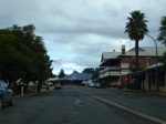
Nannup Town Centre:
Vasse Hwy (SR104) as it passes through the Nannup town centre, July 2008.
Image © Paul Rands
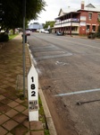
Timber Mile Post:
Old timber mile post outside the Nannup Town Hall, indicating the town's distance from Perth, 182 miles (293 km). The numerals are made from cast iron. July 2008.
Image © Paul Rands
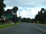
Supplemental Advance Directional Sign:
Southbound supplemental AD sign approaching Terry and Bishop Streets in Nannup, July 2008.
Image © Paul Rands
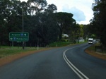
Advance Directional Sign:
Southbound AD sign approaching the terminus of SR104 as it meets SR10 at Nannup, July 2008.
Image © Paul Rands

End State Route 104:
Approaching Nannup Brook and the intersection with Vasse Highway (left) and Brockman Highway (straight) (SR10) at Nannup, July 2008.
Image © Paul Rands
1 WA Government, Main Roads Western Australia, Road Information Mapping System.
2 WA Government, Landgate.


