Statistics:
- Length:
- 161 km
- Termini:
- Eastern: Albany Hwy (SR30) and Woogenellup Rd, Mount Barker
- Western: South Western Hwy (NR1) and Pritchard St, Manjimup
- Suburbs, Towns & Localities Along Route:
- Manjimup, Dingup, Middlesex, Upper Warren, Perup, Lake Muir, Mordalup, Frankland River, Rocky Gully, Perillup, Forest Hill and Mount Barker
Route Numbering:
- Current: 102
- Road Authority Internal Classification: 1
- M024
General Information:
State Route 102 is an important freight route for plantation timber trucks and interstate long vehicles servicing the horticultural areas around Manjimup, it also a major connector for traffic between South Western Highway at Manjimup, and Albany Highway at Mount Barker. 2 The route is a two way, single carriageway rural highway.
History:
- March 2004: Refurbishment of a timber bridge near Mt Barker. 2
- 2006: A 30km section of shoulder reconstruction and seal widening was completed, directly to the west of Mt Barker. 2
- 2007: Completion of the reconstruction, widening and realignment of a 1.5 km section of single lane seal 35 km east of Manjimup (Nyamup to Strachan). 3
- March 2007: Construction commenced on the Mt Barker Northern Bypass. 2
- 2008: Opening of a roundabout at South Western Highway, Muir Highway and Pritchard Road, and completion of the widening between Nyamup to Strachan and reconstruction of the final 4km of single lane seal, 37 km east of Manjimup. 3
- April 2008: Opening of the Mt Barker Northern Bypass. 2
Click or tap here for the former alignment between Manjimup and Mount Barker
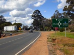
AD Sign:
Advance directional sign on the South Western Hwy (NR1), approaching the roundabout with Muir Hwy, at Manjimup. September 2008.
Image © Paul Rands
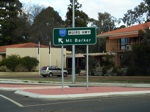
Intersection Directional Sign:
ID sign on the corner of the South Western Hwy (NR1) and Muir Hwy (SR102) at Manjimup, the western terminus of SR102. September 2008.
Image © Paul Rands
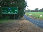
Distance Sign:
RD sign as you leave the town of Manjimup. September 2008.
Image © Paul Rands
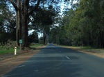
Dingup Area:
Muir Highway as passes through the Dingup area. September 2008.
Image © Paul Rands
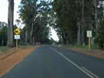
Steep Descent Sign:
Warning sign for the steep and somewhat windy run down the hill at Dingup. September 2008.
Image © Paul Rands
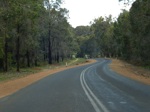
Dingup:
The Muir Hwy as it descends the hill at Dingup. September 2008.
Image © Paul Rands
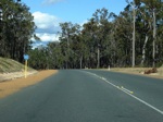
Perup:
Muir Hwy as it makes its way through Perup, September 2008.
Image © Paul Rands
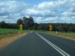
Perup:
The Muir Hwy as it passes through the Perup area. September 2008.
Image © Paul Rands
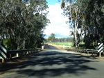
Perup River:
Crossing the Perup River, Perup. September 2008.
Image © Paul Rands
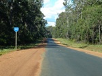
Tone River Mill Area:
SR102 as it makes its way through Perup, near Tone River Mill. September 2008.
Image © Paul Rands
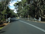
Tone River:
Crossing the Tone River at Lake Muir. September 2008.
Image © Paul Rands
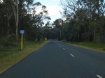
Lake Muir Area:
Muir Hwy as it passes through Lake Muir, approaching Unicup Rd. September 2008.
Image © Paul Rands
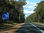
Fatalities Sign:
Sign indicating the number of fatalities on roads in the area. Lake Muir. September 2008.
Image © Paul Rands
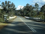
Frankland River:
Muir Hwy as it cross the Frankland River at Rocky Gully. September 2008.
Image © Paul Rands
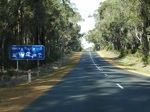
Services Sign:
Services sign at Rocky Gully. September 2008.
Image © Paul Rands
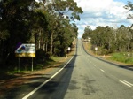
Welcome Sign:
Shire welcome sign as you enter the town of Rocky Gully. September 2008.
Image © Paul Rands
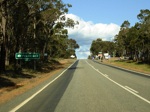
AD Sign:
Advance directional sign approaching the intersection with Frankland-Rock Gully Rd and Crane St in Rocky Gully. September 2008.
Image © Paul Rands
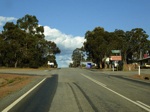
Frankland-Rocky Gully Rd / Crane St Junction:
Muir Hwy approaching Frankland Gully Road and Crane Street intersection in Rocky Gully. September 2008.
Image © Paul Rands
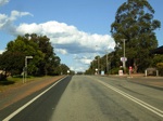
Rocky Gully Town Centre:
The Muir Highway as it passes through Rocky Gully at the junction with Brierly Street. September 2008.
Image © Paul Rands
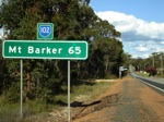
RD Sign:
Distance sign as you leave the town of Rocky Gully. September 2008.
Image © Paul Rands
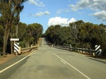
Kent River:
The Muir Hwy as it crosses the Kent River at Perillup. September 2008.
Image © Paul Rands
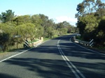
Hay River:
Crossing the Hay River near Forest Hill. September 2008.
Image © Paul Rands
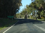
AD Sign:
Advance directional sign approaching the intersection of Muir Hwy, and Denmark-Mt Barker Rd at St Werburghs. September 2008.
Image © Paul Rands
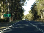
RD Sign:
Reassurance directional sign after the intersection with Denmark-Mt Barker Rd at St Werburghs. September 2008.
Image © Paul Rands
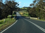
Hay River:
Crossing the Hay River again, this time at St Werburghs. September 2008.
Image © Paul Rands
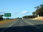
AD Sign:
Advance directional sign approaching Langton Rd (which connects with the old Muir Hwy alignment) at Mt Barker. September 2008.
Image © Paul Rands
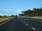
Langton Rd Intersection:
Corner of Muir Hwy and Langton Rd at Mt Barker. September 2008.
Image © Paul Rands
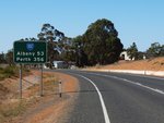
RD Sign:
Distance sign after the Langton Road intersection at Mount Barker. April 2011.
Image © Peter Renshaw

AD Sign:
Advance directional sign approaching the eastern terminus of Muir Hwy (SR102), the Albany Hwy (SR30) at Mt Barker. April 2011.
Image © Peter Renshaw

AD Sign:
Advance directional sign approaching the western terminus of Muir Hwy, the South Western Hwy (NR1) at Manjimup. September 2008.
Image © Paul Rands
1 WA Government, Main Roads Western Australia, Road Information Mapping System.
2 WA Government, Department of the Premier and Cabinet.
3 WA Government, Department of Treasury and Finance.


