|
|
|
|
|
 |
Northam-Toodyay Road, Newcastle Road, Fitzgerald Street, Peel Terrace, York Road, Panmure Road, Balladong Street & Great Southern Highway (State Route 120) |
Statistics:
Route Numbering:


General Information:
The Great Southern Highway name begins at York and connects several Wheatbelt towns with towns in the Great Southern region on Western Australia. It consists of two way, single carriageway rural highway, which passes through several somewhat important country towns. The Great Southern Hwy runs almost parallel to the Albany Hwy (SR30), and lies east of the Albany Hwy. It also runs parallel with the Perth-Albany railway corridor for its entire length.
Multiplexes along the route include:
History:
Click here for images of the former alignment in the Cranbrook area.
| Wagin To Cranbrook | Cranbrook to Wagin | |||
| Preview: | Description: | Preview: | Description: | |
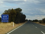 |
Fatal Crash Count Sign: Fatal crash count sign as you enter the Great Southern region at Lime Lake, April 2009. Image © Paul Rands |
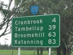 |
Distance Sign: RD sign with black topknot after the Albany Hwy intersection at Cranbrook, July 2014. Image © Terry Siva |
|
 |
SR120 Trailblazer: SR120 trailblazer in the Lime Lake area, April 2009. Image © Paul Rands |
 |
Entering Cranbrook: Entering the town of Cranbrook, April 2009. Image © Paul Rands |
|
 |
2km Winding Road: Sign indicating a winding section of the Great Southern Hwy, near Lime Lake Rd East at Lime Lake, April 2009. Image © Paul Rands |
 |
AD Sign: Advance directional sign approaching Grantham St in Cranbrook, April 2009. Image © Paul Rands |
|
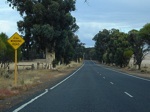 |
2km Winding Road: Sign indicating a winding section of the Great Southern Hwy, at Boyerine, April 2009. Image © Paul Rands |
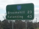 |
Distance Sign: Reassurance directional sign as SR120 leaves Tambellup, July 2014. Image © Terry Siva | |
 |
Winding Road: Sign with 90 km/h speed advisory, indicating a winding section of the Great Southern Hwy, at Boyerine, April 2009. Image © Paul Rands |
|||
 |
Advance Directional Sign: AD sign at Woodanilling approaching Robinson Road, April 2009. Image © Paul Rands |
|||
 |
Approaching Robinson Road Intersection: Great Southern Hwy at Woodanilling, looking south as you approach Robinson Road, April 2009. Image © Paul Rands |
|||
 |
Distance Sign: Southbound RD sign as you leave Woodanilling, April 2009. Image © Paul Rands |
|||
 |
SR120 Trailblazer: SR120 trailblazer in the Marracoonda area, April 2009. Image © Paul Rands |
|||
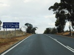 |
Services Sign: Sign indicating available services in Katanning, April 2009. Image © Paul Rands |
|||
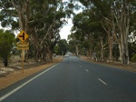 |
Approaching Dumbleyung Truck Route: Looking southeast as you approach Crosby St (Dumbleyung Truck Route) at Katanning, April 2009. Image © Paul Rands |
|||
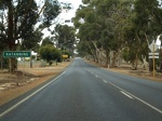 |
Entering Katanning: Looking southeast as you enter Katanning, April 2009. Image © Paul Rands |
|||
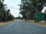 |
Advance Directional Sign: AD sign approaching Kojonup Rd and Clive St in Katanning, April 2009. Image © Paul Rands |
|||
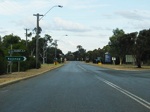 |
Kojonup Road Intersection: Corner of Great Southern Hwy (Moojebing Rd) and Kojonup Rd in Katanning, April 2009. Image © Paul Rands |
|||
 |
Clive Street Intersection: Corner of Great Southern Hwy (Moojebing Rd) and Clive St in Katanning, April 2009. Image © Paul Rands |
|||
 |
Advance Directional Sign: AD sign approaching Bay St in Katanning, April 2009. Image © Paul Rands |
|||
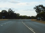 |
Bay Street Junction: Corner of Great Southern Hwy (Moojebing Rd) and Bay St in Katanning, April 2009., April 2009. Image © Paul Rands |
|||
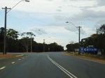 |
Cornwall Street Junction: Corner of Great Southern Hwy (Moojebing Rd) and Cornwall St in Katanning, April 2009., April 2009. Image © Paul Rands |
|||
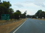 |
RD Sign: Reassurance directional sign as you leave Katanning, April 2009. Image © Paul Rands |
|||
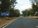 |
Services Sign: Sign indicating the services available in Broomehill, April 2009. Image © Paul Rands |
|||
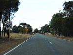 |
Entering Broomehill: Looking southeast in the Broomehill town centre, April 2009. Image © Paul Rands |
|||
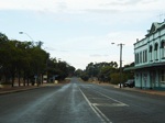 |
Broomehill Town Centre: Looking southeast in the Broomehill town centre, April 2009. Image © Paul Rands |
|||
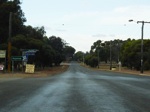 |
Journal Street Intersection: Corner of Great Southern Hwy (SR120) and Journal St in Broomehill, April 2009. Image © Paul Rands |
|||
 |
Advance Directional Sign: AD sign approaching Broomehill-Gnowangerup Road in Broomehill, April 2009. Image © Paul Rands |
|||
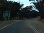 |
Distance Sign: RD sign as you leave Broomehill, April 2009. Image © Paul Rands |
|||
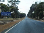 |
Services Sign: Sign indicating the services available in the town of Tambellup, April 2009. Image © Paul Rands |
|||
 |
Entering Tambellup: Entering the town of Tambellup, April 2009. Image © Paul Rands |
|||
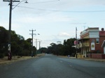 |
Tambellup Town Centre: Looking southeast in Tambellup, April 2009. Image © Paul Rands |
|||
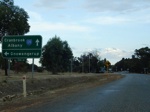 |
Advance directional Sign: AD sign approaching Owen Street in Tambellup, April 2009. Image © Paul Rands |
|||
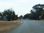 |
Owen Street Intersection: Corner of Great Southern Hwy and Owen St (Tambellup-Gnowangerup Rd) in Tambellup, April 2009. Image © Paul Rands |
|||
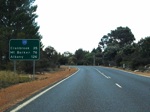 |
Distance Sign: RD sign as you leave Tambellup, April 2009. Image © Paul Rands |
|||
 |
Entering Cranbrook: Entering the town of Cranbrook, looking southwest, April 2009. Image © Paul Rands |
|||
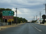 |
Advance Directional Sign: AD sign approaching the Grantham St intersection in Cranbrook, April 2009. The SR120 shield to the right is probably in error, as it's the former SR120 alignment. Image © Paul Rands |
|||
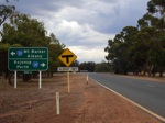 |
AD sign: Advance Directional Sign approaching Albany Hwy (SR30) at Cranbrook, April 2009. This is the southern terminus of SR120. Image © Paul Rands |
|||
| Click here for the continuation of SR120 between Wagin and Pingelly | ||||
1 Main Roads Western Australia
Last updated: 21:32 04/08/2014.
This site © Paul Rands. All rights reserved. Some portions © (copyright) by their respective and credited owners. Permission must be obtained before using any images from this site. For details, please email by clicking here.