Statistics:

Length:
114 km
Termini:
Northern: Great Eastern Highway (NH94) and Coolgardie-Esperance Highway (NH94), Coolgardie
Southern: Coolgardie-Esperance Highway (NH94), Widgiemooltha
Suburbs, Towns & Localities Along Route:
Widgiemooltha, Kambalda, Boulder, South Kalgoorlie, Kalgoorlie, West Kalgoorlie and Coolgardie

Route Numbering:

Current: 94
Multiplexed with: 357
Road Authority Internal Classification: 1
H005 (Coolgardie to Kalgoorlie)
H049 (Kalgoorlie to Widgiemooltha)

General Information:

The Goldfields Highway links Kalgoorlie and Kambalda to the north eastern Goldfields centres of Leonora, Leinster, Wiluna and Meekatharra. 2 The remainder of ALT-NR94, Great Eastern Highway, links Kalgoorlie with wheatbelt towns and the state capital, Perth.

The route is mostly rural highway standard, except around Kalgoorlie where in some sections it's a multi-laned divided road. Urban road conditions prevail in some of the towns along the route.

Multiplexes along the route include:
Tourist Way 357, for 38 km, between Coolgardie and Kalgoorlie. 3

History:

April 1986: Introduction of ALT-NR94 route number as part of a statewide route numbering review. 4
1996: The section of Great Eastern Highway between Gatacre Street and Throssell Street was widened to form a dual carriageway. 2

Click or tap here for the former alignment between Coolgardie and Widgiemooltha

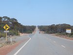
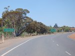
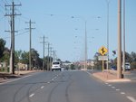
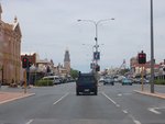
Widgiemooltha to Coolgardie

image

Services Sign:

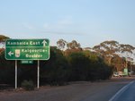
Services sign as Goldfields Hwy (ALT-NR94) enters Kambalda, April 2018. Click or tap here for a photo of this location by Brendan Cherry from November 2012.

Image © Paul Rands

image

Level Crossing:

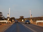
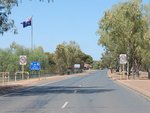
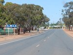
Goldfields Hwy (ALT-NR94) approaching the level crossing in Kambalda, November 2012.

Image © Brendan Cherry

image

Level Crossing:

Goldfields Hwy (ALT-NR94) at the level crossing in Kambalda, November 2012.

Image © Brendan Cherry

image

Advance Directional Sign:

AD sign approaching Durkin Rd at Kambalda, November 2012.

Image © Brendan Cherry

image

Intersection Directional Sign:

ID sign assembly at the corner of Goldfields Hwy (ALT-NR94) and Durkin Rd at Kambalda, April 2018.

Image © Paul Rands

image

Level Crossing:

Goldfields Hwy (ALT-NR94) at the level crossing in Kambalda East, November 2012.

Image © Brendan Cherry

image

Services Sign:

Services AD sign at South Boulder approaching Lane St and Anzac Dr, April 2018.

Image © Paul Rands

image

Advance Directional Sign:

AD sign approaching Anzac Dr (Heavy Vehicle Bypass) and Lane St in South Boulder, April 2018. Note the incorrect National Highway shields. Click or tap here for a photo of this location by Brendan Cherry from November 2012.

Image © Paul Rands

image

Advance Directional Sign:

AD sign on Anzac Dr at South Boulder approaching Lane St and Goldfields Hwy (ALT-NR94), April 2018. Note the incorrect National Highway shields.

Image © Paul Rands

image

Advance Directional Sign:

AD sign on Lane St at South Boulder approaching Anzac Dr and Goldfields Hwy (ALT-NR94), April 2018. Note the incorrect National Highway shields.

Image © Paul Rands

image

Start Golden Quest Discovery Trail:

Beginning of the Golden Quest Discovery Trail touring route, South Boulder, April 2018.

Image © Paul Rands

image

Williamstown Road:

Corner of Goldfields Hwy (ALT-NR94) and Williamstown Rd at Kalgoorlie, April 2018.

Image © Paul Rands

image

Advance Directional Sign:

AD sign on Goldfields Hwy (ALT-NR94) approaching the unnumbered section of Goldfields Hwy and Hannan St (ALT-NR94) at Kalgoorlie, April 2018. Click or tap here for a photo of this location by Brendan Cherry from November 2012.

Image © Paul Rands

image

Intersection Directional Sign:

ID sign on the corner of Goldfields Hwy (ALT-NR94) and the unnumbered section of Goldfields Hwy and Hannan St (ALT-NR94) at Kalgoorlie, November 2012.

Image © Brendan Cherry

image

Kalgoorlie Town Centre:

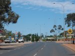
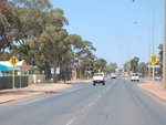
Hannan St (ALT-NR94) near Cassidy St, Kalgoorlie, November 2012.

Image © Brendan Cherry

image

Throssell Street:

Great Eastern Hwy (ALT-NR94) at Throssell St in Kalgoorlie, April 2018.

Image © Paul Rands

image

Throssell Street:

Great Eastern Hwy (ALT-NR94) at Throssell St in Kalgoorlie, April 2018.

Image © Paul Rands

image

Somerville:

Great Eastern Hwy (ALT-NR94) near Centennial Park in Somerville, November 2012.

Image © Brendan Cherry

image

Somerville:

Great Eastern Hwy (ALT-NR94) as it passes through Somerville, November 2012.

Image © Brendan Cherry

image

Hutton Street:

Great Eastern Hwy (ALT-NR94) at Hutton St in Somerville, April 2018.

Image © Paul Rands

image

Ochiltree Street:

Great Eastern Hwy approaching Ochiltree St in Somerville, November 2012.

Image © Brendan Cherry

image

Emin Street and Wingate Street:

Great Eastern Hwy at Somerville approaching Emin St and Wingate St, November 2012.

Image © Brendan Cherry

image

Advance Directional Sign:

AD sign approaching Gatacre Dr, Somerville, April 2018. Click or tap here for a photo of this location by Brendan Cherry from November 2012.

Image © Paul Rands

image

Gatacre Drive:

Great Eastern Hwy approaching Gatacre Dr in Somerville, November 2012.

Image © Brendan Cherry

image

Gatacre Drive:

Corner of Great Eastern Hwy (ALT-NR94) and Gatacre Dr at Somerville, April 2018.

Image © Paul Rands

image

Gatacre Drive:

Corner of Great Eastern Hwy (ALT-NR94) and Gatacre Dr at Somerville, April 2018.

Image © Paul Rands

image

Advance Directional Sign:

AD sign on Gatacre Dr, Somerville, approaching Great Eastern Hwy (ALT-NR94), April 2018.

Image © Paul Rands

image

Approaching Anzac Drive and West Kalgoorlie Road:

Great Eastern Hwy approaching the heavy vehicle bypass, Anzac Dr and also West Kalgoorlie Rd in West Kalgoorlie, November 2012.

Image © Brendan Cherry

image

Advance Directional Sign:

AD sign with route numbers on coverplates approaching Anzac Dr and West Kalgoorlie Rd, West Kalgoorlie, April 2018. Click or tap here for a photo of this location by Brendan Cherry from November 2012.

Image © Paul Rands

image

Anzac Drive & West Kalgoorlie Road:

Great Eastern Hwy (ALT-NR94) at the junction with Anzac Dr and West Kalgoorlie Rd at Yilkari, April 2018.

Image © Paul Rands

image

Advance Directional Sign:

AD sign on Anzac Dr approaching Great Eastern Hwy (ALT-NR94) and West Kalgoorlie Rd at Yilkari, April 2018.

Image © Paul Rands

image

Distance Sign:

RD sign leaving West Kalgoorlie, April 2018. Click or tap here for a photo of this location by Brendan Cherry from November 2012.

Image © Paul Rands

image

Approaching Sharpe Drive:

Great Eastern Hwy approaching Sharpe Dr at Binduli, November 2012.

Image © Brendan Cherry

image

Services Sign:

Services sign as Great Eastern Hwy (ALT-NR94) enters the town of Coolgardie, April 2018. Click or tap here for a photo of this location by Brendan Cherry from November 2012.

Image © Paul Rands

image

Coolgardie:

Great Eastern Hwy as it enters Coolgardie, November 2012.

Image © Brendan Cherry

image

Advance Directional Sign:

AD sign approaching Coolgardie-Esperance Hwy (NH94) and Great Eastern Hwy (NH94) at Coolgardie, April 2018. Click or tap here for a photo of this location by Brendan Cherry from November 2012.

Image © Paul Rands

Coolgardie to Widgiemooltha

image

Reassurance Directional Sign:

Distance sign at Coolgardie, April 2018.

Image © Paul Rands

image

Stray Animals Sign:

Warning for stray animals on road, Coolgardie, April 2018.

Image © Paul Rands

image

Advance Directional Sign:

AD sign at Yilkari approaching Anzac Dr and West Kalgoorlie Rd, April 2018.

Image © Paul Rands

image

Heavy Vehicle Route Advance Directional Sign:

Heavy vehicle route AD sign at Yilkari approaching Anzac Dr and West Kalgoorlie Rd, April 2018.

Image © Paul Rands

image

Anzac Drive & West Kalgoorlie Road:

Great Eastern Hwy (ALT-NR94) at the junction with Anzac Dr and West Kalgoorlie Rd at Yilkari, April 2018.

Image © Paul Rands

image

Advance Directional Sign:

AD sign approaching Gatacre Dr, Somerville, April 2018.

Image © Paul Rands

image

Gatacre Drive:

Corner of Great Eastern Hwy (ALT-NR94) and Gatacre Dr at Somerville, April 2018.

Image © Paul Rands

image

Emin Street and Wingate Street:

Great Eastern Hwy at Somerville approaching Emin St and Wingate St, November 2012.

Image © Brendan Cherry

image

Kalgoorlie Town Centre:

Hannan St (ALT-NR94) at the Wilson St junction in Kalgoorlie, November 2012.

Image © Brendan Cherry

image

Advance Directional Sign:

AD sign on Great Eastern Hwy (ALT-NR94) (Hannan St), Kalgoorlie, approaching Goldfields Hwy (unnumbered and ALT-NR94), April 2018.

Image © Paul Rands

image

Advance Directional Sign:

AD sign on Goldfields Hwy (unnumbered), Kalgoorlie, approaching Great Eastern Hwy (ALT-NR94) (Hannan St) and Goldfields Hwy (ALT-NR94), April 2018.

Image © Paul Rands

image

Intersection Directional Sign:

ID sign assembly on the corner of Goldfields Hwy (unnumbered and ALT-NR94) and Great Eastern Hwy (ALT-NR94) at Kalgoorlie, April 2018.

Image © Paul Rands

image

Intersection Directional Sign:

ID sign assembly on the corner of Goldfields Hwy (unnumbered and ALT-NR94) and Great Eastern Hwy (ALT-NR94) at Kalgoorlie, April 2018. Goldfields Hwy becomes ALT-NR94 here and this is the eastern terminus of Great Eastern Hwy.

Image © Paul Rands

image

Williamstown Road:

Corner of Goldfields Hwy (ALT-NR94) and Williamstown Rd at Kalgoorlie, April 2018.

Image © Paul Rands

image

Intersection Directional Sign:

ID sign facing Williamstown Rd at Kalgoorlie, April 2018.

Image © Paul Rands

image

Burt Street:

Corner of Goldfields Hwy (ALT-NR94) and Burt St, Boulder, April 2018.

Image © Paul Rands

image

Advance Directional Sign:

AD sign approaching Anzac Dr (Heavy Vehicle Bypass) and Lane St in South Boulder, April 2018. Note the incorrect National Highway shield.

Image © Paul Rands

image

Reassurance Directional Sign:

Distance sign at South Boulder, April 2018.

Image © Paul Rands

image

Services Sign:

Services sign at Kambalda, April 2018.

Image © Paul Rands

image

Advance Directional Sign:

AD sign approaching Durkin Rd at Kambalda, April 2018.

Image © Paul Rands

image

Intersection Directional Sign:

ID sign assembly at the corner of Goldfields Hwy (ALT-NR94) and Durkin Rd at Kambalda, April 2018.

Image © Paul Rands

image

Kilometre Plate:

Kilometre plate showing distance to Norseman, at Kambalda, April 2018.

Image © Paul Rands

Click or tap here for the continuation of Great Eastern Hwy as National Highway 94
1 WA Government, Main Roads Western Australia, Road Information Mapping System.
2 WA Government, Main Roads WA.
3 WA Government, Tourism WA, Tourist Drives of Western Australia brochure.
4 Sam Laybutt (Ozroads).