Statistics:
- Length:
- 1579 km (Bindoon to Dalwallinu: 176 km)
- Termini:
- Northern: Great Northern Hwy (NH1) and North West Coastal Hwy (NR1), Mundabullangana (near Port Hedland)
- Southern: Great Eastern Hwy (NH94 and SR51) and Roe Hwy (NH94 / SR3), Midvale
- Suburbs, Towns & Localities Along Route:
- New Norcia, Glentromie, Waddington, Walebing, Bindi Bindi, Miling, Pithara and Dalwallinu
Route Numbering:
- Current: 95
- Multiplexed with: 360
- Former: 95
- Road Authority Internal Classification: 1
- H006 (Middle Swan to Mundabullangana)
General Information:
National Highway 95 links the north of WA with Perth and the port of Fremantle and is the main communication route between Perth and Darwin. It also forms part of the infrastructure that links the Murchison, Pilbara and Kimberley Regions to Perth. 2 Outside of Perth, the route is mostly 2-lane rural highway standard.
Roe Highway:
The Roe Highway section of NH95, is also co-signposted with State Route 3, forming part of a ring road around the eastern and northern suburbs of Perth. It runs from from the junction with the Great Eastern Hwy (NH94 / SR51) at Midvale to the junction with Great Northern Hwy (NH95 / NR1) and Middle Swan Road (SR3) at Middle Swan. The route is arterial road standard, in some parts resembling a freeway.
Great Northern Highway:
The Great Northern Highway services the State's agricultural, pastoral, mining and tourism industries, and is the main route for the flow of goods and services to and from the State's north. In addition to it being a dedicated National Highway, it also serves as the classified Heavy Haulage and Wide/High Load Route to the north of the State, on which approximately 30% of the traffic is heavy vehicles, often carrying over-width loads such as mining machinery. 2
Its total length within Wheatbelt North Region is 277 km and it passes through the Shires of Chittering, Victoria Plains, Moora and Dalwallinu. 2
The NH95 section north of Perth is among the remotest sealed roads in the world.
Multiplexes along the route include:
- Tourist Way 360, for 137 km, between Upper Swan and Walebing.
History:
-
- November 2007: Upgrade works begin on 83 km of Great Northern Highway between Muchea and Bindi Bindi. Works include reconstruction, widening, new passing lanes, intersection upgrades and roadside amenity improvements such as parking bays and rest areas. 2
- November 2015: Upgrades from Batty Bog to Walebing completed. Work included geometry, widening and overtaking opportunity improvements. 3
- November 2016: Construction commences on the reconstruction of the Miling Straight. 4
- 1 May 2017: The 6 km New Norcia Bypass opened to traffic on the eastern side of the town. 5
- April 2018: Construction commenced on the Miling Bypass from Lyons East Road to Miling North Road. 6
- 2018: Miling Straight opened to traffic. Work included building 23 km of new highway, between Miling North Road and Gatti Road, widening and upgrading 3 km of existing highway, construction of additional roadside stopping places, new overtaking lanes, and realignment of Miling North Road to provide a staggered T-intersection with Great Northern Highway to improve highway crossing safety. 4
- April 2018: Commencement of upgrade works at Pithara. Work included upgrading 16 kilometres of highway including construction of 10 kilometres of new road, six kilometres of widening, overlay works, two new overtaking lanes and numerous intersection improvements. 7
Click or tap here for the former alignment between Bindoon to Dalwallinu

Intersection Directional Sign:
ID sign at the junction with Glentromie-Yerecoin Rd at Glentromie, April 2016. Note the incorrect font.
Image © Paul Rands

Trailblazer:
NR95 trailblazer at Glentromie, April 2016.
Image © Paul Rands

Advance Directional Sign:
AD sign at Waddington, approaching Waddington-Wongan Hills Rd, April 2016.
Image © Paul Rands

Reassurance Directional Sign:
Distance sign at Waddington, April 2016.
Image © Paul Rands

Services Sign:
Services sign at Walebing, April 2016.
Image © Paul Rands

Advance Directional Sign:
AD sign at Walebing, approaching Midlands Rd, April 2016. The TW360 duplex ends at this location.
Image © Paul Rands

Intersection Directional Sign:
ID sign assembly at the corner of Gt Northern Hwy (NH95) and Midlands Rd at Walebing, April 2016.
Image © Paul Rands

Advance Directional Sign:
AD sign on Midlands Rd at Walebing, approaching Great Northern Hwy (NH95), April 2016.
Image © Paul Rands

Reassurance Directional Sign:
Distance sign at Walebing, April 2016.
Image © Paul Rands

Advance Directional Sign:
AD sign approaching Te Arakau Rd at Bindi Bindi, April 2016.
Image © Paul Rands

Te Arakau Road:
Great Northern Hwy (NH95) at the Te Arakau Rd at Bindi Bindi, April 2016.
Image © Paul Rands

Advance Directional Sign:
AD sign approaching Miling-Moora Rd at Miling, April 2016.
Image © Paul Rands

UPDATED Intersection Directional Sign:
ID sign facing Miling-Moora Rd at Moora, May 2020. Click or tap here for a photo of this location by Paul Rands from April 2016.
Image © Terry Siva

UPDATED Reassurance Directional Sign:
Distance sign at Miling, May 2020. Click or tap here for a photo of this location by Paul Rands from April 2016.
Image © Terry Siva

NEW Intersection Directional Sign:
ID sign in Pithara at the junction with Northam-Pithara Road (SR115). May 2020.
Image © Terry Siva
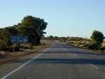
Services Sign:
Services sign as you approach the town of Dalwallinu. April 2009.
Image © Paul Rands
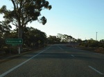
Advance Directional Sign:
AD sign approaching Dalwallinu Road in Dalwallinu, April 2009.
Image © Paul Rands
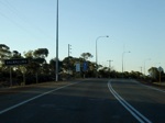
Black Town Name Sign:
Older black coloured town name sign as you enter Dalwallinu, April 2009.
Image © Paul Rands

Advance Directional Sign:
Southbound approaching Johnston Street - the main street of Dalwallinu, which was bypassed in 2002, April 2009.
Image © Paul Rands

Johnston Street Intersection:
Corner of Great Northern Hwy (Dalwallinu Bypass) and Johnston St in Dalwallinu, April 2009.
Image © Paul Rands
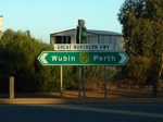
ID Sign:
Intersection directional sign facing Clinch Road in Dalwallinu. April 2009.
Image © Paul Rands
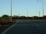
ID Sign:
Intersection directional sign at Johnston St in Dalwallinu, April 2009.
Image © Paul Rands
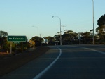
AD Sign:
Advance directional sign approaching Dalwallinu Rd in Dalwallinu. April 2009.
Image © Paul Rands

UPDATED Distance Sign:
RD sign as you leave Dalwallinu, October 2021. Click or tap here for a photo of this location by Paul Rands from DATE.
Image © Terry Siva

NEW Advance Directional Sign:
Southbound approaching Northam-Pithara Road (SR115) at Pithara, April 2009.
Image © Terry Siva

NEW Intersection Directional Sign:
ID sign in Pithara at the junction with Northam-Pithara Road (SR115). April 2009.
Image © Terry Siva
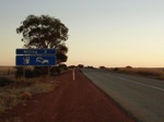
Services Sign:
Services sign as you approach the town of Miling, April 2009.
Image © Paul Rands

Advance Directional Sign:
AD sign approaching Miling-Moora Rd at Miling, April 2016.
Image © Paul Rands

Miling-Moora Road:
Great Northern Hwy (NH95) at the Miling-Moora Rd junction, Miling, April 2016.
Image © Paul Rands

Reassurance Directional Sign:
Distance sign at Miling, April 2016.
Image © Paul Rands

Advance Directional Sign:
AD sign approaching Te Arakau Rd at Bindi Bindi, April 2016.
Image © Paul Rands

Te Arakau Road:
Great Northern Hwy (NH95) at the Te Arakau Rd at Bindi Bindi, April 2016.
Image © Paul Rands

Advance Directional Sign:
AD sign on Te Arakau Rd at Bindi Bindi, approaching Great Northern Hwy (NH95), April 2016.
Image © Paul Rands

Intersection Directional Sign:
ID sign facing Te Arakau Rd at Bindi Bindi, April 2016.
Image © Paul Rands

Reassurance Directional Sign:
Distance sign at Bindi Bindi, April 2016.
Image © Paul Rands

Services Sign:
Services sign at Walebing, April 2016.
Image © Paul Rands

Advance Directional Sign:
AD sign at Walebing, approaching Midlands Rd, April 2016.
Image © Paul Rands

Intersection Directional Sign:
ID sign assembly at the corner of Gt Northern Hwy (NH95) and Midlands Rd at Walebing, April 2016. The TW360 duplex starts here.
Image © Paul Rands

Fingerboard Assembly:
Fingerboard assembly at the corner of Gt Northern Hwy (NH95) and Midlands Rd at Walebing, April 2016.
Image © Paul Rands

Walebing:
Great Northern Highway (NH95) as it passes through the town of Walebing, April 2016.
Image © Paul Rands

Reassurance Directional Sign:
Distance sign at Walebing, April 2016.
Image © Paul Rands

Roadmarking Sign:
Sign indicating special type of wider road marking at Walebing, April 2016.
Image © Paul Rands

Roadmarking Sign:
Sign indicating special type of wider road marking at Walebing, April 2016.
Image © Paul Rands

Roadmarking Sign:
Sign indicating special type of wider road marking at Walebing, April 2016.
Image © Paul Rands

Advance Directional Sign:
AD sign at Waddington, approaching Waddington-Wongan Hills Rd, April 2016.
Image © Paul Rands

Intersection Directional Sign:
ID sign assembly at the junction with Waddington-Wongan Hills Rd at Waddington, April 2016.
Image © Paul Rands

Reassurance Directional Sign:
Distance sign at Waddington, April 2016.
Image © Paul Rands

Intersection Directional Sign:
Fingerboards at the junction with Glentromie-Yerecoin Rd at Glentromie, April 2016.
Image © Paul Rands

Intersection Directional Sign:
ID sign at the junction with Glentromie-Yerecoin Rd at Glentromie, April 2016.
Image © Paul Rands

Trailblazer:
NR95 trailblazer at Glentromie, April 2016.
Image © Paul Rands

NEW Intersection Directional Sign:
ID sign facing Calingiri-New Norcia Rd at New Norcia, January 2020.
Image © Terry Siva
1 WA Government, Main Roads Western Australia, Road Information Mapping System.
2 WA Government, Main Roads Western Australia.
3 WA Government, Main Roads Western Australia, Projects, Great Northern Highway - Batty Bog Road to Walebing Upgrade.
4 WA Government, Main Roads Western Australia, Projects, Miling Straight.
5 WA Government, Main Roads Western Australia, Projects, New Norcia Bypass - Complete.
6 WA Government, Main Roads Western Australia, Projects, Miling Bypass.
7 WA Government, Media Statements, Work underway on two key Great Northern Highway upgrades, 24 April 2018.


