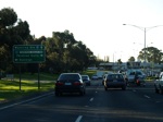
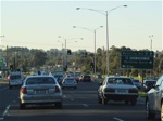
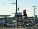
Road Photos & Information: Victoria
Fletcher Road, Dandenong Road, Overton Road, Frankston-Dandenong Road, Lonsdale Street, Foster Street, Stud Road, Boronia Road, Wantirna Road, Whitehorse Road, Warrandyte Road, Ringwood-Warrandyte Road, Yarra Street, Kangaroo Ground-Warrandyte Road, Eltham-Yarra Glen Road and Wattle Glen Road (Metropolitan Route 9)
Statistics:
- Length:
- 63 km
- Termini:
- Northern: Main Hurstbridge Road (MR46) and Heidelburg-Kinglake Road (C746), Wattle Glen
- Southern: Nepean Highway (MR3), Frankston
- Miscellaneous:
- Declared Names: Fletcher Rd, Klauer Rd, Princes Hwy, Dandenong Valley Hwy, Stud Rd, Boronia Rd, Wantirna Rd, Maroondah Hwy, Ringwood-Warrandyte Rd, Warrandyte-Kangaroo Ground Rd, Eltham-Yarra Glen Rd, Kangaroo Ground-St Andrews Rd and Kangaroo Ground-Wattle Glen Rd
- Suburbs, Towns & Localities Along Route:
- Frankston, Frankston North, Seaford, Carrum Downs, Bangholme, Dandenong South, Dandenong, Dandenong North, Rowville, Scoresby, Wantirna South, Wantirna, Heathmont, Ringwood, Ringwood North, Park Orchards, Warrandyte South, Warrandyte, North Warrandyte, Kangaroo Ground and Wattle Glen
Route Numbering:
- Current: 9
- Multiplexed with: 1 34 36 42 44 C726
- Road Authority Internal Classification: 1 2
- Arterial 5159 (Frankston to Seaford)
- Arterial 5433 (Wantirna to Ringwood)
- Arterial 5435 (Kangaroo Ground to Wattle Glen)
- Arterial 5436 (Kangaroo Ground)
- Arterial 5790 (Kangaroo Ground)
- Arterial 5796 (Wantirna)
- Arterial 5806 (Ringwood to Warrandyte)
- Arterial 5810 (Warrandyte to Kangaroo Ground)
- Arterial 5920 (Wantirna)
- Arterial 5974 (Frankston)
- Arterial 6090 (Seaford to Wantirna)
- Arterial 6510 (Dandenong)
- Arterial 6720 (Ringwood)
General Information:
Metropolitan Route 9 covers Melbourne's outer eastern suburbs and varies from divided and undivided roadway which passes through bushland, semi-rural, residential, commercial and industrial areas.
With the opening of Eastlink (M3) the significance of the route is less than it used to be at the southern end, as Eastlink basically parallels MR9 with a full freeway standard road, without at-grade junctions and a higher speed limit, offering a quicker trip from Ringwood to Frankston.
Multiplexes along the route include:
- Alternative National Route 1, for 600 metres, Dandenong.
- Metropolitan Route 34, for 300 m, Ringwood.
- Metropolitan Route 36, for 2 km, Wantirna.
- Metropolitan Route 42, for 2 km, Warrandyte.
- Metropolitan Route 44, for 1 km, Kangaroo Ground.
- C726, for 150 m, Kangaroo Ground.
Frankston to Wattle Glen
1 VIC Government, VicRoads Road Management Plan, 30 October 2004.
2 Viseth Uch.
2 Viseth Uch.
