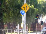
Road Photos & Information: Victoria
Melbourne Road, Williamstown Road, Geelong Street, Geelong Road, Gordon Street, Van Ness Avenue, Raleigh Road, Orford Street, Waverley Street, Buckley Street, Lincoln Road and Bulla Road (Metropolitan Route 37)
Statistics:
- Length:
- 16 km
- Termini:
- Northern: Tullamarine Fwy (M2) and Bulla Rd (unnumbered), Strathmore
- Southern: Ferguson St (MR35) and Melbourne Rd (unnumbered), Williamstown
- Miscellaneous:
- Declared Names: Williamstown Rd, Princes Hwy, Gordon St, Van Ness Av, Ascot Vale-Keilor Rd, Waverley St, Buckley St, Lincoln Rd and Mount Alexander Rd
- Suburbs, Towns & Localities Along Route:
- Williamstown, Newport, Spotswood, Yarraville, Kingsville, Footscray, Maribyrnong, Moonee Ponds, Aberfeldie, Essendon and Strathmore
Route Numbering:
- Current: 37
- Multiplexed with: 38 83
- Former: 79 40
- Road Authority Internal Classification: 1
- Arterial 5462 (Footscray to Maribyrnong)
- Arterial 5494 (Maribyrnong to Ascot Vale)
- Arterial 5581 (Aberfeldie to Essendon)
- Arterial 5822 (Williamstown to Kingsville)
- Arterial 5589 (Essendon)
- Arterial 5824 (Essendon)
- Arterial 5601 (Ascot Vale to Aberfeldie)
- Arterial 6500 (Kingsville to Footscray)
General Information:
Metropolitan Route 37 is an arterial route linking western Port Phillip Bay suburbs with Tullamarine Airport and Melbourne's north west.
The route is a mix of divided and undivided route, and passes through industrial, commercial and residential zones and connects with 2 freeways.
Multiplexes along the route include:
- Metropolitan Route 38, for 800 m, between Maribyrnong and Ascot Vale.
- Metropolitan Route 83, for 500 m , between Kingsville and Footscray.
History:
- 1965: Introduction of Metropolitan Route 37. 2
