Road Photos & Information: Victoria
Grange Road, Loyola Grove, Madden Grove, Wallen Road, Power Street, Denmark Street, Princess Street, Chandler Highway, Grange Road, Darebin Road, Station Street, Albert Street, Boldrewood Parade and Broadway (Metropolitan Route 21)
Statistics:
- Length:
- 17 km
- Termini:
- Northern: High St (MR29), Reservoir
- Southern: Toorak Rd (MR26) and Canterbury Rd (unnumbered), Toorak
- Miscellaneous:
- Declared Names: Grange Rd, Burnley-Kew Rd, Chandler Highway, Grange Rd, Darebin Rd, Fairfield-Reservoir Rd, Plenty Valley Hwy and Broadway
- Suburbs, Towns & Localities Along Route:
- Toorak, Burnley, Hawthorn, Kew, Alphington, Thornbury, Preston and Reservoir
Route Numbering:
- Current: 21
- Multiplexed with: 20 2
- Road Authority Internal Classification: 1
- Arterial 5021 (Toorak to Burnley)
- Arterial 5192 (Alphington to Thornbury)
- Arterial 5737 (Reservoir)
- Arterial 5856 (Burnley to Kew)
- Arterial 5859 (Kew to Alphington)
- Arterial 5860 (Thornbury to Preston)
- Arterial 5876 (Alphington)
- Arterial 6140 (Preston to Reservoir)
General Information:
Metropolitan Route 21 is a suburban arterial route linking Melbourne's eastern suburbs.
The route is a mix of divided and undivided road, passing through commercial, residential and industrial zones, including one of Melbourne's most exclusive suburbs, Toorak. MR21 crosses the Yarra River 3 times.
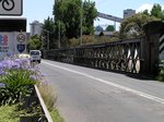
The Chandler Highway section of the route was named after prominant local businessman and politician A. E. Chandler who was instrumental in pushing through the development of the Outer Circle Railway. The bridge that formed part of the railway is now used by Chandler Hwy road traffic. 2
Multiplexes along the route include:
- Metropolitan Route 20, for 500 m, between Burnley and Hawthorn.
- Tourist Drive 2, for 400 m, Alphington.
History:
- February 1889: Construction commenced on Outer Circle Railway Bridge (now Chandler Highway Bridge). 3
- November 1890: Construction of Outer Circle Railway Bridge concluded. 3
- 1927: Outer Circle Railway line closed, leaving the Outer Circle Bridge idle. 2
- 1930: Outer Circle Bridge converted to road traffic. 2
- 1934: Construction begins on MacRobertson Bridge on Grange Rd in Toorak. It was presented by prominent confectionery manufacturer and philanthropist Sir MacPherson Robertson to celebrate the centenary of the Victoria. The bridge is a double-span bridge over the Yarra River constructed of riveted steel segmental arches. The two piers upon which the diagonal steel members are supported are of concrete construction. Citylink (former South-Eastern Freeway) runs below the northern-most span of the bridge. 4
- 1881: Erection of Wallen Road Bridge by Johnson & Co Tyne Foundry. Known originally as Richmond Park Bridge, then Swan Street Bridge before becoming Wallen Road Bridge.
- 1916: Wallen Road Bridge, strengthened and widen to allow the inclusion of tram traffic. 5
- 1936-38: The Wallen Road Bridge was again strengthened. At the same time an additional span was created on the Richmond side to accommodate the Yarra Boulevard (TD2) which was constructed as part of an unemployment relief scheme during the Depression. 5
- 1965: Introduction of Metropolitan Route 21. 1
- 1989: Introduction of Metropolitan Route 20 duplex. 1
Toorak to Reservoir
1 Viseth Uch.
2 Darebin Historical Encyclopedia, Chandler Highway Alphington.
3 VIC Government, Heritage Victoria, Outer Circle Railway line bridge, later Chandler Highway Bridge, over Yarra River.
4 VIC Government, Heritage Victoria, MacRobertson Bridge, Yarra River.
5 VIC Government, Heritage Victoria, Victorian Heritage Database, Wallen Road Bridge, 7 May 2012.
