Statistics:
- Length:
- 285 km
- Termini:
- Eastern: Midland Highway (SR149) and Sayle St (unnumbered), Mt Pleasant (Ballarat)
- Western: SA-VIC Border, Ardno
- Miscellaneous:
- Continues as Casterton Road (SR112) in South Australia
- Suburbs, Towns & Localities Along Route:
- Ardno, Strathdownie, Casterton, Coleraine, Wannon, Hamilton, Dunkeld, Glenthompson, Wickliffe, Lake Bolac, Westmere, Streatham, Carranballac, Skipton, Pittong, Linton, Scarsdale, Smythesdale, Smythes Creek and Ballarat
Route Numbering:
- Current: B160
- Former: 112
- Multiplexed with: 107
- Road Authority Internal Classification: 1
- 6670
General Information:
The Glenelg Highway is a rural highway connecting the city of Ballarat, and towns along the route, to South Australia. Its a mix of 2-lane rural highway standard and also multi-laned divided in the larger towns.
The State Route 112 number was decommissioned as part of the project to switch to alphanumeric route numbering in country Victoria by VicRoads. Prior to the switch over to B160, VicRoads engineers took a series of photos of signs that needed replacing as part of the project. Some of these are presented below.
Multiplexes along the route include:
- State Route 107, for 2 km, Hamliton.
History:
- 1998: Decommissioning of SR112. Introduction of B160 route number. 2
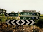
Intersection Directional Sign Assembly:
ID signs on the corner of Glenelg Hwy and Casterton-Penola Rd in Casterton, October 1997.
Image © VicRoads, supplied by Viseth Uch
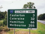
Distance Sign:
Eastbound RD sign after the junction with Casterton-Penola Rd in Casterton. October 1997.
Image © VicRoads, supplied by Viseth Uch
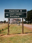
Black Advance Directional Sign:
Black AD sign for traffic travelling southeast on Glenelg Hwy as it approaches the intersection with Henty Hwy / West Boundary Rd in Hamilton, October 1997.
Image © VicRoads, supplied by Viseth Uch
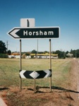
Black ID Sign:
Black intersection directional sign facing traffic travelling southeast, at the junction with Henty Hwy (SR107, now A200) / West Boundary Rd at Hamilton. October 1997.
Image © VicRoads, supplied by Viseth Uch
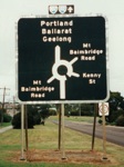
Black Advance Directional Sign:
Black AD sign approaching Mt Baimbridge Rd and Kenny St in Hamilton. October 1997. Looking southeast.
Image © VicRoads, supplied by Viseth Uch
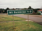
Intersection Directional Sign:
ID sign on the southbound exit of the Mt Baimbridge Rd / Kenny St roundabout in Hamilton. October 1997.
Image © VicRoads, supplied by Viseth Uch

Trailblazer:
Remnant SR112 trailblazer at Streatham on Eurambean-Streatham Rd approaching Neerin Neerin Rd. December 2006.
Image © Rob Tilley
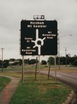
Black Advance Directional Sign:
Black AD sign approaching Mt Baimbridge Rd and Kenny St in Hamilton. October 1997. Looking northwest.
Image © VicRoads, supplied by Viseth Uch
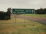
Intersection Directional Sign:
ID sign on the northwest exit of the Mt Baimbridge Rd / Kenny St roundabout in Hamilton. October 1997.
Image © VicRoads, supplied by Viseth Uch
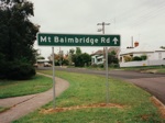
Intersection Directional Sign:
ID sign on the northbound exit of the Mt Baimbridge Rd / Kenny St roundabout in Hamilton. October 1997.
Image © VicRoads, supplied by Viseth Uch

Black Advance Directional Sign:
AD sign on Glenelg Hwy at Hamilton approaching the intersection with Henty Hwy / West Boundary Rd, looking northwest, October 1997.
Image © VicRoads, supplied by Viseth Uch
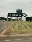
Black ID Sign:
Black intersection directional sign facing traffic travelling northwest, at the junction with Henty Hwy (SR107, now A200) / West Boundary Rd at Hamilton. October 1997.
Image © VicRoads, supplied by Viseth Uch
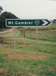
Intersection Directional Sign:
ID sign facing southbound Henty Hwy traffic at the junction with Glenelg Hwy / West Boundary Rd in Hamilton, October 1997.
Image © VicRoads, supplied by Viseth Uch
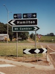
Intersection Directional Sign:
ID sign facing southbound Henty Hwy traffic at the junction with Glenelg Hwy / West Boundary Rd in Hamilton, October 1997.
Image © VicRoads, supplied by Viseth Uch
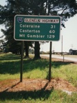
Distance Sign:
RD sign after the Henty Hwy / West Boundary Rd junction at Hamilton, October 1997.
Image © VicRoads, supplied by Viseth Uch
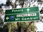
Advance Directional Sign:
AD sign at Casterton approaching the intersection with Casterton-Penola Road, October 1997.
Image © VicRoads, supplied by Viseth Uch
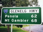
Distance Sign:
Westbound RD sign after the junction with Casterton-Penola Rd in Casterton. October 1997.
Image © VicRoads, supplied by Viseth Uch
1 VicRoads.
2 Viseth Uch.


