Road Photos & Information: Victoria
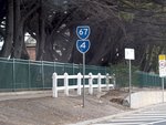
Davey Street, Hastings Road, Moorooduc Highway, Frankston-Flinders Road, Graydens Road, Watts Road and Boneo Road (Metropolitan Route 67) (Decommissioned)
Statistics:
- Length:
- 70 km
- Termini:
- Northern: Nepean Hwy (MR3) and Kananook Blvd Sth (unnumbered), Frankston
- Southern: Point Nepean Rd (MR3), Rosebud
- Miscellaneous:
- Declared Names: Davey-Hastings Road, Frankston-Flinders Road and Rosebud-Flinders Road
- Suburbs, Towns & Localities Along Route:
- Rosebud, Boneo, Flinders, Shoreham, Merricks, Balnarring, Bittern, Hastings, Tyabb, Somerville, Baxter, Frankston South, and Frankston
Route Numbering:
- Current: C777 4 12
- Former: 67
- Multiplexed with: 4 11 12
- Road Authority Internal Classification: 1
- 2110 (Frankston South to Frankston)
- 5167 (Frankston)
- 5750 (Rosebud to Flinders)
- 5757 (Flinders to Frankston)
General Information:
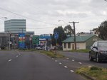
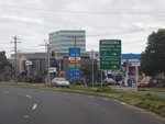
Metropolitan Route 67 was an arterial route linking Frankston with the Mornington Peninsula town of Rosebud. It was a mix of divided and undivided road and passes through mostly residential, rural and commercial areas, with a section passing through industrial areas to the east.
Multiplexes along the route include:
- Metropolitan Route 4, for 400 m, Frankston.
- Metropolitan Route 11, for 3 km, between Frankston and Frankston South.
- Tourist Drive 12, for 600 m, Frankston.
History:
- 1998: Metropolitan Route 67 decommissioned and partially replaced with alphanumeric route number as part of the introduction of the Statewide Route Numbering Scheme. 2
Rosebud to Frankston
1 VicRoads Country Directory, First Edition, 1992-93, maps 94 and 95.
2 Viseth Uch.
2 Viseth Uch.


