Road Photos & Information: Victoria
Baxter-Tooradin Road (C781)
Statistics:
- Length:
- 20 km
- Termini:
- Eastern: South Gipplsand Hwy (M420), Tooradin
- Western: Moorooduc Hwy (C784), Frankston South
- Suburbs, Towns & Localities Along Route:
- Frankston South, Baxter, Langwarrin South, Pearcedale, Devon Meadows, Cannons Creek and Tooradin
Route Numbering:
- Current: C781
- Former:60 1
- Road Authority Internal Classification: 2
- 5764
General Information:
C781 crosses one side of the Mornington Peninsula to the other and is on the outskirts of Melbourne. The route pretty much undivided its entire length and passes through residential, commercial and rural zones.
History:
- 2006: Installation of a roundabout at the junction with Fultons Road and Hawkins Road at Baxter. 3 Also the construction of a roundabout at the intersection of South Gippsland Highway (M420) and Baxter-Tooradin Road, Tooradin. 4
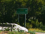
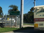
Tooradin to Frankston South
1 Viseth Uch.
2 VIC Government, VicRoads, Road Management Plan 2020-2021, 07 December 2020.
3 VIC Government, Office of the Minister for Transport Media Release, 30 October 2006.
4 VIC Government, VicRoads Contracts and Tenders Site.
2 VIC Government, VicRoads, Road Management Plan 2020-2021, 07 December 2020.
3 VIC Government, Office of the Minister for Transport Media Release, 30 October 2006.
4 VIC Government, VicRoads Contracts and Tenders Site.


