Road Photos & Information: Victoria
Frankston-Flinders Road, Western Port Highway, Rosebud-Flinders Road and Moorooduc Highway (C777)
Statistics:
- Length:
- 65 km
- Termini:
- Northern: Frankston Fwy (M3) and Beach St (unnumbered), Frankston
- Southern: Point Nepean Road (B110), Rosebud West
- Suburbs, Towns & Localities Along Route:
- Rosebud West, Boneo, Fingal, Cape Schanck, Flinders, Shoreham, Point Leo, Merricks, Merricks Beach, Balnarring Beach, Balnarring, Bittern, Hastings, Tyabb, Somerville, Baxter and Frankston
Route Numbering:
- Current: C777
- Multiplexed with: 12
- Former: 11
- Road Authority Internal Classification: 1
- 5750 (Rosebud to Flinders)
- 5757 (Frankston South to Hastings and Hastings to Flinders)
- 6230 (Hastings)
- 6860 (Frankston to Frankston South)
General Information:
C777 is a route serving the Mornington Peninsula connecting several communities along its route. Its mostly undivided and passes through suburban, industrial and semi-rural areas.
Multiplexes along the route include:
- Tourist Drive 12, for 1 km, between Hastings Rd (TD12) and Golf Links Rd (TD12), Frankston.
History:
- 2004: Widening of the Frankston-Flinders Road. 2
- 2007: Installation of traffic signals at the intersection of Frankston-Flinders Road and Stoney Point Road, Bittern. 3
- 2008: Channelisation work at the intersection of Frankston-Flinders Road and Point Leo Road at Shoreham. 3
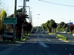
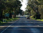
Rosebud West to Frankston
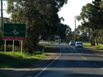
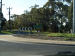
Frankston to Rosebud West
1 VIC Government, VicRoads, Road Management Plan 2020-2021, 07 December 2020.
2 VIC Government, Office of the Minister for Transport Media Release, 15 April 2004.
3 VIC Government, VicRoads Contracts and Tenders Site.
2 VIC Government, Office of the Minister for Transport Media Release, 15 April 2004.
3 VIC Government, VicRoads Contracts and Tenders Site.

