Road Photos & Information: Victoria
Whittlesea-Yea Road (C725)
Statistics:
- Length:
- 59 km
- Termini:
- Northern: Goulburn Valley Hwy (B340), Yea
- Southern: Main Whittlesea Rd (C727), Wallan-Whittlesea Rd (C727) and Laurel St (unnumbered), Whittlesea
- Suburbs, Towns & Localities Along Route: 1
- Whittlesea, Humevale, Kinglake West, Hazeldene, Flowerdale, Break O'Day and Yea
Route Numbering:
- Current: C725
- Road Authority Internal Classification:
- 5793
General Information:
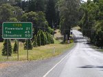
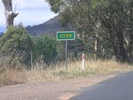
C725 is a rural route northeast of Melbourne. It passes through several small towns and through forested areas.
Whittlesea to Yea
1 VIC Government, VicRoads, Road Management Plan 2020-2021, 07 December 2020.


