Statistics:
- Length:
- 29 km
- Termini:
- Eastern: Gembrook Rd and Gembrook-Launching Place Rd (C424) at Gembrook
- Western: Burwood Hwy (MR26) and Mt Dandenong Rd (C415) at Upper Ferntree Gully
- Suburbs, Towns & Localities Along Route:
- Gembrook, Cockatoo, Avonsleigh, Emerald, Clematis, Menzies Creek, Selby, Belgrave, Tecoma, Upwey and Upper Ferntree Gully
Route Numbering:
- Current: C412
- Multiplexed with: C404 C411
- Former: 26
- Road Authority Internal Classification: 1
- 6750 (Upper Ferntree Gully to Belgrave)
- 5774 (Belgrave to Cockatoo)
- 5770 (Cockatoo)
- 5774 (Cockatoo to Gembrook)
General Information:
C412 is a route servicing the far eastern suburbs of Melbourne and also the Dandenong Range region and surrounding rural areas. It's a mix of divided and undivided road, and in some places is windy as it traverses hilly terrain. The route sees a lot of tourist traffic as there's several tourist attractions location in the region including the Puffing Billy railway.
Multiplexes along the route include:
- C404, for 300 m, Belgrave.
- C411, for 500 m, Cockatoo.
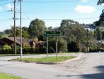
Belgrave-Hallam Road:
Intersection directional sign at the Belgrave-Hallam Rd (C404) roundabout at Belgrave, June 2006.
Image © Rob Tilley
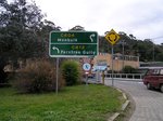
Advance Directional Sign:
AD sign on Belgrave-Gembrook Rd (C404 / C412) at Belgrave approaching the roundabout with Monbulk Rd (C404) and Burwood Hwy (C412) (Main St), June 2006. The C404 duplex ends at this junction.
Image © Rob Tilley
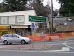
Monbulk Road & Burwood Highway:
The roundabout with Burwood Hwy (Main St) (C412), Monbulk Rd (C404) and Belgrave-Gembrook Rd (C404 / C412), June 2006. C412 turns left at this junction.
Image © Rob Tilley
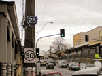
Remnant MR26 Trailblazer:
Remnant MR26 trailblazer in the Belgrave town centre, June 2006.
Image © Rob Tilley
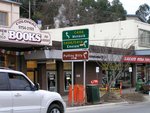
Advance Directional Sign:
AD sign on Burwood Hwy (C412) (Main St) at Belgrave, approaching the roundabout with Monbulk Rd (C404) and Belgrave-Gembrook Rd (C404 / C412), June 2006.
Image © Rob Tilley

Monbulk Road & Belgrave-Gembrook Road:
Burwood Hwy (Main St) (C412) at the roundabout with Monbulk Rd (C404) and Belgrave-Gembrook Rd (C404 / C412), June 2006. C412 turns right at this junction.
Image © Rob Tilley
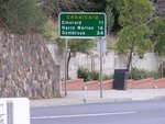
Distance Sign:
RD sign at Belgrave on Belgrave-Gembrook Rd (C404 / C412), June 2006.
Image © Rob Tilley
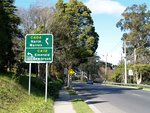
Advance Directional Sign:
AD sign on Belgrave-Gembrook Rd (C404 / C412) at Belgrave approaching the roundabout with Belgrave-Hallam Rd (C404), June 2006. The C404 duplex ends at this junction.
Image © Rob Tilley
Belgrave-Hallam Road:
Intersection directional sign at the Belgrave-Hallam Rd (C404) roundabout at Belgrave, June 2006.
Image © Rob Tilley
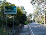
Distance Sign:
RD sign as C412 leaves Belgrave via Belgrave-Gembrook Rd, June 2006.
Image © Rob Tilley
1 VIC Government, VicRoads, Road Management Plan 2020-2021, 07 December 2020.


