Road Photos & Information: Victoria
Lilydale-Monbulk Road, Monbulk Road, Belgrave-Gembrook Road, Belgrave-Hallam Road, Narre Warren North Road and Cranbourne-Narre Warren Road (C404)
Statistics:
- Length:
- 52 km
- Termini:
- Northern: Maroondah Hwy (MR34) and Anderson St (unnumbered), Lilydale
- Southern: South Gippsland Hwy (M420), Cranbourne East
- Suburbs, Towns & Localities Along Route:
- Cranbourne East, Cranbourne North, Narre Warren South, Narre Warren, Narre Warren North, Narre Warren East, Belgrave South, Belgrave, Sherbrooke, Kallista, Monbulk, Silvan, Mt Evelyn and Lilydale
Route Numbering:
- Current: C404
- Multiplexed with: B668 C402 C406 C412
- Former: 63 1
- Road Authority Internal Classification: 2
- 5774 (Belgrave to Narre Warren North)
- 5775 (Monbulk to Belgrave)
- 5776 (Lilydale to Monbulk)
- 5903 (Narre Warren to Cranbourne East)
- 5940 (Narre Warren North to Narre Warren)
General Information:
C404 connects Melbourne's outer north east suburbs with the Mornington Peninsula. It's a mix of single carriageway and dual carriageway roadway and passes through semi-rural, residential, commercial and bushland areas.
Multiplexes along the route include:
- B668 for 100m, Narre Warren South
- C402 for 700 m, Mt Evelyn
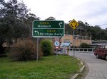
- C406 for 350 m, Monbulk
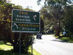
- C412 for 300 m, Belgrave
History:
- 2004: Duplication of Narre Warren-Cranbourne Road between the Princes Highway to Centre Road in Narre Warren. Elimination of level crossing included as part of the works. 3
- 2008: Commencement of Narre Warren-Cranbourne Road Duplication, Narre Warren, from Centre Road to Pound Road. 4
- August 2009: Completion of Narre Warren-Cranbourne Road Duplication, Narre Warren, from Centre Road to Pound Road. 4
- 2009: Extension of the right turning lane from Narre Warren North Road into Maramba Drive in Narre Warren and installing a right turning signal. 5 Safety and alignment improves along Monbulk Road in the Monbulk and Sherbrook areas. 6
Lilydale to Cranbourne East
1 VIC Government, VicRoads Country Directory, First Edition, 1992-1993, ISSN 1037-4876.
2 VIC Government, VicRoads, Road Management Plan 2020-2021, 07 December 2020.
3 VIC Government, Minister for Public Transport, Media Release, Level Crossing Eliminated As New Underpass Opens, 13 October 2004.
4 VIC Government, Department of Transport, Completed Road Projects, Narre Warren-Cranbourne Road Duplication, Narre Warren.
5 VIC Government, Minister for Roads & Ports, $2.9 Million Boost for Road Safety in Narre Warren area, 14 September 2009.
6 VIC Government, Minister for Roads & Ports, $1.6 Million in Road Safety Upgrades for Monbulk, 10 September 2009.


