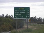
Road Photos & Information: Victoria
Tatura-Undera Road, Murchison-Tatura Road, Murchison-Violet Town Road and Wahring-Murchison East Road (C357)
Statistics:
- Length:
- 48 km
- Termini:
- Northern: Echuca-Maroopna Rd (C355) at Undera
- Southern: Goulburn Valley Fwy (M39) at Wahring
- Suburbs, Towns & Localities Along Route:
- Wahring, Murchison East, Murchison, Dhurringle, Tatura and Undera
Route Numbering:
- Current: C357
- Multiplexed with: C345
- Former: 39
- Road Authority Internal Classification: 1
- 5368 (Undera to Tatura)
- 5372 (Tatura to Murchison)
- 5414 (Murchison to Murchison East)
- 5415 (Murchison East to Wahring)
General Information:
C357 is a rural route in Victoria's Goulburn Valley. The section between Wahring and Murchison East was once part of National Route 39.
Multiplexes along the route include:
- C345, for 1.5 km, between Murchison and Murchison East.
Wahring to Undera
1 VIC Government, VicRoads, Road Management Plan 2020-2021, 07 December 2020.


