Road Photos & Information: Victoria
Ballarat-Buninyong Road (C294)
Statistics:
- Length:
- 10 km
- Termini:
- Northern: Barkly St (unnumbered) and Main Rd (unnumbered), Bakery Hill
- Southern: Midland Hwy (A300) and Warrenheip St (unnumbered) Buninyong
- Suburbs, Towns & Localities Along Route:
- Bakery Hill, Ballarat East, Golden Point, Canadian, Mt Clear, Mt Helen and Buninyong
Route Numbering:
- Current: C294
- Former: 149 1
- Road Authority Internal Classification: 2
- 5182
General Information:
C294 is the former alignment of the Midland Highway, and is a route that runs parallel with the Midland Hwy (A300) between Ballarat and Buninyong, and acts as an alternate route between the 2 towns, and also services east Ballarat and the small towns between Ballarat and Buninyong.
Multiplexes along the route include:
History:
- 1986-1990: Signposted as SR149. 1
- 2007: Installation of traffic signals at the intersection of Buninyong-Ballarat Road and Hocking Avenue, Mount Clear. 3
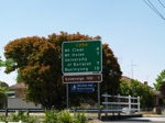
Buninyong to Bakery Hill (Ballarat)
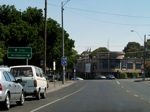
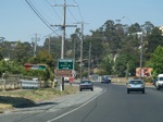
Bakery Hill (Ballarat) to Buninyong
1 Viseth Uch.
2 VIC Government, VicRoads, Road Management Plan 2020-2021, 07 December 2020.
3 City of Ballarat.
2 VIC Government, VicRoads, Road Management Plan 2020-2021, 07 December 2020.
3 City of Ballarat.


