Statistics:
- Length:
- 63 km
- Termini:
- Eastern: Calder Hwy (A79 / B300) and Camp St (unnumbered), Kangaroo Flat
- Western: Pyrenees Hwy (B180) and Tuaggra St (unnumbered), Maryborough
- Suburbs, Towns & Localities Along Route:
- Maryborough, Havelock, Eddington, Laanecoorie, Woodstock West, Shelbourne, Lockwood and Kangaroo Flat
Route Numbering:
- Current: C277
- Road Authority Internal Classification: 1
- 5200
General Information:
C277 is a rural route connecting the town of Maryborough directly to Bendigo, which is a larger town in central Victoria.
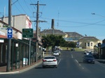
Advance Directional Sign:
Tuaggra Street (C277) in Maryborough, near Alma Street as you approach the traffic lights with High Street and Park Road (C277). C277 turns right at the traffic lights. October 2006.
Image © Rob Tilley
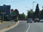
Distance Sign:
Northbound RD sign at Maryborough after the Tuaggra and High Streets intersection. October 2006.
Image © Rob Tilley
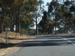
Supplemental AD Sign:
Supplemental advance directional sign approaching the intersection with Maryborough-Dunolly Road in Havelock. October 2006.
Image © Rob Tilley
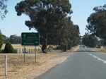
Advance Directional Sign:
Advance directional sign approaching the intersection with Maryborough-Dunolly Road in Havelock. October 2006.
Image © Rob Tilley
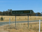
Intersection Directional Sign:
ID sign on the corner of Maryborough-Dunolly Rd (C278) and Bendigo-Maryborough Rd (C277) at Havelock. October 2006.
Image © Rob Tilley
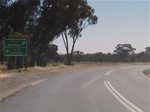
AD Sign:
Advance directional sign at Dunolly-Eddington Road (C276) at Eddington. October 2006.
Image © Rob Tilley
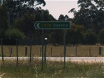
ID Sign:
Intersection directional sign at Dunolly-Eddington Road (C276) at Eddington. October 2006.
Image © Rob Tilley
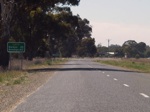
Distance Sign:
Eastbound RD sign after the Dunolly-Eddington Road (C276) intersection, as you enter the town of Eddington. October 2006.
Image © Rob Tilley
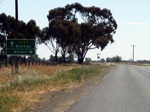
Advance Directional Sign:
AD sign as you approach the intersection with Eddington Road in Eddington. October 2006.
Image © Rob Tilley
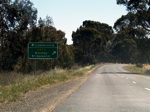
Advance Directional Sign:
AD sign at Laanecoorie approaching the intersection with Weir Road and Eddington Road. October 2006.
Image © Rob Tilley
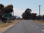
Advance Directional Sign:
AD sign at Laanecoorie approaching the intersection with Bridgewater-Maldon Road (C282). October 2006.
Image © Rob Tilley
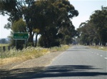
RD Sign:
Reassurance directional sign after the Bridgewater-Maldon Road (C282) junction, and as you leave Laarnecoorie. October 2006.
Image © Rob Tilley
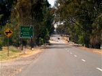
Advance Directional Sign:
AD sign at Lockwood approaching Calder Alternative Highway (A790). October 2006.
Image © Rob Tilley
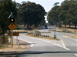
Calder Alternative Highway Intersection:
The staggered junction with Calder Alternative Highway (A790) and caution light at Lockwood. October 2006.
Image © Rob Tilley
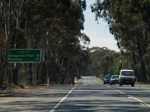
Distance Sign:
RD sign at Lockwood after the intersection with Calder Alternative Highway (A790). October 2006.
Image © Rob Tilley
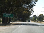
Advance Directional Sign:
AD sign approaching the intersection with Fairview Road in Kangaroo Flat. October 2006.
Image © Rob Tilley
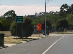
Advance Directional Sign:
AD sign approaching the intersection with Olympic Parade in Kangaroo Flat. October 2006.
Image © Rob Tilley
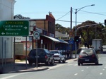
Advance Directional Sign:
AD sign approaching the eastern terminus of C277, the junction with Calder Highway (A79 / A300) at Kangaroo Flat. October 2006.
Image © Rob Tilley
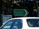
Intersection Directional Sign:
ID sign at the eastern terminus of C277, the junction with Calder Highway (A79 / A300) at Kangaroo Flat. October 2006.
Image © Rob Tilley
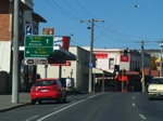
Advance Directional Sign:
AD sign on Park Road (C277) approaching Tuaggra Street (C277) and High Street in Maryborough. October 2006.
Image © Rob Tilley
1 VIC Government, VicRoads, Road Management Plan 2020-2021, 07 December 2020.


