Statistics:
- Length:
- 81 km
- Termini:
- Northern: Glenelg Hwy (B160) and Dunkeld-Cavendish Rd (C188), Dunkeld
- Southern: Princes Highway (A1), Killarney
- Suburbs, Towns & Localities Along Route:
- Killarney, Crossley, Kirkstall, Warrong, Hawkesdale, Minhamite, Penshurst, Croxton East and Dunkeld
Route Numbering:
- Current: C178
- Multiplexed with: B140 C183
- Road Authority Internal Classification: 1
- 5116 (Penshurst to Dunkeld)
- 5117 (Killarney to Kirkstall)
- 5122 (Kirkstall to Penshurst)
- 6780 (Penshurst)
General Information:
C178 is a rural north-south route, which acts as a connector for several small rural communities between the Princes Highway and Glenelg Highway.
Multiplexes along the route include:
- B140 (Hamilton Highway), for 1 km, Penshurst.
- C183, for 150 m, Kirkstall.
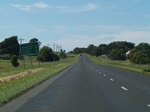
Distance Sign:
RD sign heading northbound at Kirkstall after the intersection with Spencer Road & Penshurst-Warrnambool Road (C183), October 2006.
Image © Rob Tilley
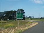
Advance Directional Sign:
Northbound AD sign at Warrong, approaching the intersection with Woolsthorpe-Heywood Road (C176), October 2006.
Image © Rob Tilley
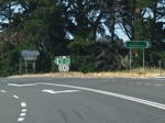
Woolsthorpe-Heywood Road Intersection:
Northbound intersection directional sign at Hawkesdale, approaching the intersection with Woolsthorpe-Heywood Road (C176), October 2006.
Image © Rob Tilley
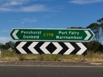
Intersection Directional Sign:
ID sign facing eastbound traffic at the staggered intersection with Woolsthorpe-Heywood Road (C176) at Hawkesdale, October 2006.
Image © Rob Tilley
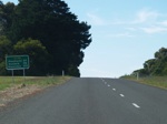
Distance Sign:
Northbound RD sign after the intersection with Woolsthorpe-Heywood Road (C176) at Hawkesdale, October 2006.
Image © Rob Tilley
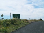
Advance Directional Sign:
Northbound AD sign approaching Macarthur-Hawkesdale Road at Hawkesdale, October 2006.
Image © Rob Tilley
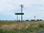
Intersection Directional Sign:
Northbound ID sign at the junction with Macarthur-Hawkesdale Road at Hawkesdale, October 2006.
Image © Rob Tilley
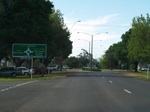
Advance Directional Sign:
AD sign for the roundabout at the junction of Hamilton Highway (B140) and Bell Street (C185) at Penshurst, October 2006.
Image © Rob Tilley
1 VIC Government, VicRoads, Road Management Plain 2020-2021, 07 December 2020.


