Statistics:
- Length:
- 75 km
- Termini:
- Northern: Maroona-Glenthompson Road and Mortlake-Ararat Road (B180), Maroona
- Southern: Hamilton Highway (B140), Mortlake
- Suburbs, Towns & Localities Along Route:
- Mortlake, Woorndoo, Lake Bolac, Rossbridge and Maroona
Route Numbering:
- Current: C148
- Road Authority Internal Classification: 1
- 5100
General Information:
C148 is a rural connector road, joining Mortlake to Maroona, and eventually Ararat via B180.
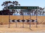
Intersection Directional Sign Assembly:
ID sign assembly at Rossbridge at the junction with Rossbridge-Streatham Rd (C182), December 2006.
Image © Rob Tilley
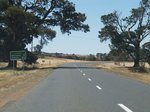
Distance Sign:
Northbound RD sign after the Rossbridge-Streatham Rd (C182) intersection at Rossbridge, December 2006.
Image © Rob Tilley
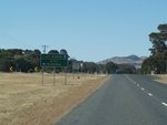
Advance Directional Sign:
AD sign at Maroona approaching Maroona-Glenthompson Rd (B180), December 2006. The sign incorrectly shows C148 going straight ahead, when it in fact terminates at Maroona-Glenthompson Rd.
Image © Rob Tilley
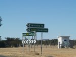
Intersection Directional Sign Assembly:
ID sign assembly at Maroona, at the junction with Maroona-Glenthompson Rd, December 2006. C148 ends at this junction despite what the signage says.
Image © Rob Tilley
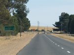
Distance Sign:
Southbound RD sign at Maroona after the junction with Maroona-Glenthompson Rd (B180), December 2006.
Image © Rob Tilley
1 VIC Government, VicRoads, Road Management Plan 2020-2021, 07 December 2020.


