Statistics:
- Length:
- 115 km
- Termini:
- Eastern: Princes Dr (C104), Morwell
- Western: Bass Hwy (M420), Bass
- Suburbs, Towns & Localities Along Route:
- Bass, Anderson, Kilcunda, Dalyston, Wonthaggi, Inverloch, Leongatha South, Leongatha, Berrys Creek, Mirboo North, Delburn, Driffield and Morwell
Route Numbering:
- Current: B460
- Multiplexed with: A440 92
- Former: A420 181 182
- Road Authority Internal Classification: 1
- 6170 (Bass to Leongatha)
- 6180 (Leongatha to Morwell)
General Information:
The Strzelecki Highway is named after Pawel Edmund Strzelecki, a Polish explorer who traversed South Gippsland in the 1800's. The Bass Highway is named after nearby Bass Strait.
The Bass Highway runs from Bass to Leongatha, and the Strzelecki Highway runs from Leongatha to Morwell.
Multiplexes along the route include:
- A440, for 100 m, Leongatha.
- TD92 (Bunurong Coastal Drive), for 40 km, between Kilcunda to Inverloch.
History:
- 1998: SR181 and SR182 decommissioned following the introduction of B460 route number. 2
- 2006: The Morwell end of the highway was deviated westwards as part of the Hazelwood Power Station West Field open cut mine expansion. 3
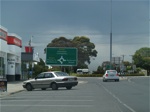
AD Sign:
Advance directional sign on Graham St (C435) in Wonthaggi approaching the Bass Hwy (B460) (McKenzie St / Graham St) roundabout. November 2006.
Image © Rob Tilley
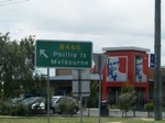
Intersection Directional Sign:
ID sign in the roundabout on the corner of Bass Hwy (McKenzie St) (B460) and Graham St (C435) in Wonthaggi, November 2006.
Image © Rob Tilley
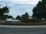
Intersection Directional Sign:
ID sign on the northbound leg of the roundabout on the corner of Bass Hwy (McKenzie St) (B460) and Graham St (C435) in Wonthaggi, November 2006.
Image © Rob Tilley
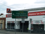
Intersection Directional Sign:
ID sign on the westbound leg of the roundabout on the corner of Bass Hwy (McKenzie St) (B460) and Graham St (C435) in Wonthaggi, November 2006.
Image © Rob Tilley
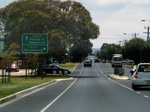
Advance Directional Sign:
AD sign approaching Korumburra Rd (C437) in Wonthaggi, November 2006.
Image © Rob Tilley
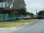
Korumburra Road Intersection:
Corner of Bass Hwy (B460) at Korumburra Rd (C437) at Wonthaggi, November 2006.
Image © Rob Tilley
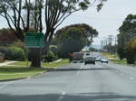
Distance Sign:
RD sign in Wonthaggi after Korumburra Rd, November 2006.
Image © Rob Tilley
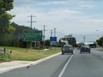
AD Sign:
Advance directional sign approaching South Dudley Rd in Wonthaggi, November 2006.
Image © Rob Tilley
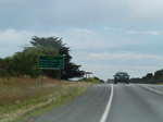
Distance Sign:
Reassurance directional sign as you leave Wonthaggi, November 2006.
Image © Rob Tilley
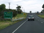
AD Sign:
Advance directional sign at Dalyston approaching Dalyston-Glen Forbes Rd (former C438), November 2006.
Image © Rob Tilley
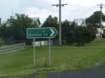
ID Sign:
Intersection directional sign at Dalyston at the junction with Dalyston-Glen Forbes Rd (former C438), November 2006.
Image © Rob Tilley
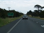
Distance Sign:
RD sign as you leave Dalyston, November 2006.
Image © Rob Tilley
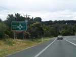
Advance Directional Sign:
AD sign for the Phillip Island Road (now unnumbered (formerly B420)) intersection, at Anderson. November 2006. A420 has since been renumbered to B460.
Image © Rob Tilley
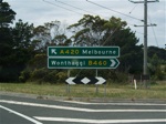
Phillip Island Road:
Corner of Bass Highway (B460) and Phillip Island Road (now unnumbered (formerly B420)), November 2006. A420 has since been renumbered to B460.
Image © Rob Tilley

Advance Directional Sign:
AD sign on Strzelecki Hwy (B460) approaching Morwell-Thorpedale Rd (C464) at Driffield, December 2013.
Image © Michael Greenslade

Advance Directional Sign:
AD sign on Strzelecki Hwy (B460) approaching Driffield-Yinnar Rd at Driffield, December 2013.
Image © Michael Greenslade
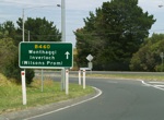
Intersection Directional Sign:
ID sign at Anderson after the Phillip Island Rd (B420) / Bass Hwy (A420) roundabout. November 2006.
Image © Rob Tilley
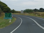
Distance Sign:
RD sign after the Phillip Island Rd (B420) / Bass Hwy (A420) roundabout at Anderson. November 2006.
Image © Rob Tilley
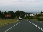
Begin TD92:
Tourist sign at Kilcunda announcing the beginning of Tourist Drive 92. November 2006.
Image © Rob Tilley
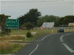
AD Sign:
Advance directional sign at Dalyston approaching Dalyston-Glen Forbes Rd (former C438), November 2006.
Image © Rob Tilley
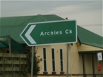
ID Sign:
Intersection directional sign at Dalyston at the junction with Dalyston-Glen Forbes Rd (former C438), November 2006.
Image © Rob Tilley
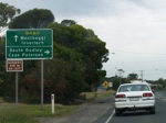
Advance Directional Sign:
AD sign at Wonthaggi approaching Lower Powlett Road. November 2006.
Image © Rob Tilley
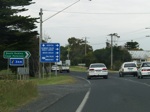
Lower Powlett Road Intersection:
Corner Bass Hwy (B460) and Lower Powlett Rd in Wonthaggi, November 2006.
Image © Rob Tilley
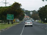
Advance Directional Sign:
AD sign approaching Korumburra Rd (C437) in Wonthaggi, November 2006.
Image © Rob Tilley
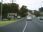
Korumburra Road Intersection:
Corner of Bass Hwy (B460) at Korumburra Rd (C437) at Wonthaggi, November 2006.
Image © Rob Tilley
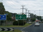
Advance Directional Sign:
AD sign approaching the roundabout on the corner of Bass Hwy (McKenzie St) (B460) and Graham St (C435) in Wonthaggi, November 2006.
Image © Rob Tilley
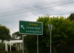
Intersection Directional Sign:
ID sign on the eastbound leg of the roundabout on the corner of Bass Hwy (McKenzie St) (B460) and Graham St (C435) in Wonthaggi, November 2006.
Image © Rob Tilley
1 VIC Government, VicRoads, Road Management Plan 2020-2021, 07 December 2020.
2 Viseth Uch.
3 International Power.


