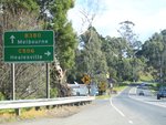
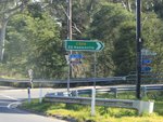
Road Photos & Information: Victoria
Warburton Highway (B380)
Statistics:
- Length:
- 35 km
- Termini:
- Eastern: Donna Buang Rd (C507), Woods Point Rd (C511) and Upper Blackwood Av (unnumbered) and Ellis St (unnumbered), Warburton
- Western: Maroondah Hwy (B300), Lilydale
- Suburbs, Towns & Localities Along Route:
- Warburton, Millgrove, Wesburn, Yarra Junction, Launching Place, Woori Yallock, Seville East, Seville, Wandin North and Lilydale
Route Numbering:
- Current: B380
- Multiplexed with: C411
- Former: 174
- Road Authority Internal Classification: 1
- 6100
General Information:
B380 is a semi-rural route east of Melbourne, that passes through mostly residential, rural and commercial areas. It's mostly an undivided road.
Paralleling the Yarra River for several kilometres, it is of several routes that is popular with tourists as they explore the Yarra Ranges.
Multiplexes along the route include:
- C411, for 100 m, Woori Yallock
Warburton to Lilydale
1 VIC Government, VicRoads, Road Management Plan 2020-2021, 07 December 2020.

