Statistics:
- Length:
- 285 km
- Termini:
- Eastern: Midland Hwy (A300) and Sayle St (unnumbered), Sebastopol
- Western: SA Border, Strathdownie
- Miscellaneous:
- Continues as B160 (Glenelg Hwy) in South Australia
- Suburbs, Towns & Localities Along Route: 1
- 6670
Route Numbering:
- Current: B160
- Multiplexed with: A200 C172
- Former: 107 112
- Road Authority Internal Classification:
- Ballarat, Smythes Ck, Smythesdale, Scarsdale, Linton, Pittong, Skipton, Carranballac, Streatham, Westmere, Lake Bolac, Wickliffe, Glenthompson, Dunkeld, Hamilton, Wannon, Coleraine, Casterton and Strathdownie
General Information:
The Glenelg Highway is a rural highway connecting the city of Ballarat, and towns along the route, to South Australia. Its a mix of 2-lane rural highway standard and also multi-laned divided road in the larger towns.
Multiplexes along the route include:
- A200, for 3 km, Hamilton.
- C172, for 800 m, Skipton.
History:
- 1998: Decommissioning of SR112. Introduction of B160 route number. 2

French Street & Station Street:
Glenelg Hwy (B160) at the junction with French St and Station St, Hamilton, January 2017.
Image © Huang Milton Collection

Intersection Directional Sign:
ID sign on the corner of Glenelg Highway (B160), Station and French Streets in Hamilton, December 2006.
Image © Rob Tilley

Advance Directional Sign:
AD sign at Hamilton approaching Hamilton Hwy (B140) and Hiller Ln, January 2017.
Image © Huang Milton Collection

Hamilton Highway & Hiller Lane:
Glenelg Hwy (B160) at the junction with Hamilton Hwy (B140) and Hiller Ln at Hamilton, January 2017.
Image © Huang Milton Collection

Timber Fingerboard Assembly:
Timber fingerboards at the Hamilton Hwy (B140) and Hiller Ln junction, Hamilton, January 2017.
Image © Huang Milton Collection

Trailblazer:
B160 trailblazer facing Carnham-Streatham Rd at Streatham, January 2017.
Image © Huang Milton Collection

Intersection Directional Sign:
ID sign facing Carnham-Streatham Rd at Streatham, January 2017.
Image © Huang Milton Collection
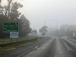
Advance Directional Sign:
AD sign approaching the roundabout with Wiltshire Ln (C307) at Delacombe, July 2013.
Image © Rob Tilley
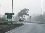
Supplemental Advance Directional Sign:
Supplemental AD sign (with old NH8 route number) approaching the roundabout with Wiltshire Ln (C307) at Delacombe, July 2013.
Image © Rob Tilley
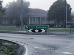
Intersection Directional Sign:
ID sign on the roundabout with Wiltshire Ln (C307) at Delacombe, July 2013.
Image © Rob Tilley

Advance Directional Sign:
AD sign approaching the roundabout with Wiltshire Ln (C307) at Delacombe, July 2013.
Image © Rob Tilley

Supplemental Advance Directional Sign:
Supplemental AD sign (with old NH8 route number) approaching the roundabout with Wiltshire Ln (C307) at Delacombe, July 2013.
Image © Rob Tilley
Trailblazer:
B160 trailblazer facing Wiltshire Ln (C307) in Delacombe, July 2013.
Image © Rob Tilley
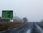
Reassurance Directional Sign:
Distance sign as Glenelg Hwy (B160) passes through Smythes Creek, July 2013.
Image © Rob Tilley

Advance Directional Sign:
AD sign at Streatham approaching Ross Bridge-Streatham Rd (C182), January 2017.
Image © Huang Milton Collection

Reassurance Directional Sign:
Distance sign at Streatham, January 2017.
Image © Huang Milton Collection

Supplemental Advance Directional Sign:
Supplemental AD sign at Lake Bolac approaching Mortlake-Ararat Rd (C148), January 2017.
Image © Huang Milton Collection

Advance Directional Sign:
AD sign at Lake Bolac approaching Mortlake-Ararat Rd (C148), January 2017.
Image © Huang Milton Collection

Mortlake-Ararat Road:
Corner of Glenelg Hwy (B160) and Mortlake-Ararat Rd (C148) at Lake Bolac, January 2017.
Image © Huang Milton Collection

Reassurance Directional Sign:
Distance sign at Lake Bolac, January 2017.
Image © Huang Milton Collection

Advance Directional Sign:
AD sign at Wickliffe approaching Willaura-Wickliffe Rd, January 2017.
Image © Huang Milton Collection

Advance Directional Sign:
AD sign at Glenthompson approaching McLennan St and Pyrenees Hwy (B180), January 2017.
Image © Huang Milton Collection

Intersection Directional Sign:
ID sign at the corner of McLennan St and Pyrenees Hwy (B180) at Glenthompson, January 2017.
Image © Huang Milton Collection

Intersection Directional Signs:
ID signs at the corner of McLennan St and Pyrenees Hwy (B180) at Glenthompson, January 2017.
Image © Huang Milton Collection

Reassurance Directional Sign:
Distance sign at Glenthompson, January 2017.
Image © Huang Milton Collection

Blackwood-Dunkeld Road:
Glenelg Hwy (B160) at the junction with Blackwood-Dunkeld Rd at Dunkeld, January 2017.
Image © Huang Milton Collection

Advance Directional Sign:
AD sign at Dunkeld approaching Templeton St & Victoria Valley Rd (C216), January 2017.
Image © Huang Milton Collection

Advance Directional Sign:
AD sign at Dunkeld approaching Penshurst-Dunkeld Rd (C178) and Dunkeld-Cavendish Rd (C188), January 2017.
Image © Huang Milton Collection

Penshurst-Dunkeld Road & Dunkeld-Cavendish Rd:
Glenelg Hwy (B160) at the junction with Penshurst-Dunkeld Rd (C178) and Dunkeld-Cavendish Rd (C188) at Dunkeld, January 2017.
Image © Huang Milton Collection

Reassurance Directional Sign:
Distance sign at Dunkeld, January 2017.
Image © Huang Milton Collection
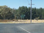
Intersection Directional Sign Assembly:
ID sign assembly facing southbound traffic on Ross Creek-Haddon Road in Nintingbool. December 2006.
Image © Rob Tilley

Advance Directional Sign:
AD sign at Hamilton approaching Hamilton Hwy (B140) and Hiller Ln, January 2017.
Image © Huang Milton Collection

Hamilton Highway & Hiller Lane:
Glenelg Hwy (B160) at the junction with Hamilton Hwy (B140) and Hiller Ln at Hamilton, January 2017.
Image © Huang Milton Collection

Timber Fingerboard Assembly:
Timber fingerboards at the Hamilton Hwy (B140) and Hiller Ln junction, Hamilton, January 2017.
Image © Huang Milton Collection
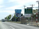
Advance Directional Sign:
AD sign as you enter the town of Hamilton, after the Hamilton Hwy (B140) intersection. December 2006.
Image © Rob Tilley

Tourism Sign:
Tourism sign as Glenelg Hwy (B160) makes its way through Hamilton, January 2017.
Image © Huang Milton Collection
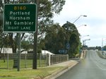
Supplemental AD Sign:
Supplemental advance directional sign at Hamilton, as you approach the bridge over Grange Burn and the Apex Drive intersection. December 2006.
Image © Rob Tilley
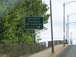
AD Sign:
Advance directional sign as you cross the railway bridge at Hamilton, December 2006.
Image © Rob Tilley
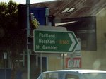
Intersection Directional Sign:
ID sign on the corner of Glenelg Highway (B160), Station and French Streets in Hamilton, December 2006.
Image © Rob Tilley
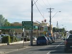
Advance Directional Sign:
AD sign approaching Portland Rd in Hamilton. December 2006.
Image © Rob Tilley
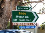
Intersection Directional Sign:
ID sign on the corner of Portland Rd in Hamilton. December 2006.
Image © Rob Tilley
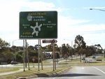
AD Sign:
Diagrammatic advance directional sign approaching the roundabout with Henty Hwy, Kenny St and Mt Bainbridge Rd in Hamilton, December 2006. The A200 duplex begins from this intersection.
Image © Rob Tilley
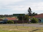
Intersection Directional Sign:
ID sign on the Henty Hwy leg of the roundabout with Henty Hwy (A200), Kenny St and Mt Bainbridge Rd in Hamilton, December 2006.
Image © Rob Tilley
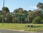
Intersection Directional Sign:
ID sign on the Glenelg Hwy leg of the roundabout with Henty Hwy (A200), Kenny St and Mt Bainbridge Rd in Hamilton, December 2006.
Image © Rob Tilley
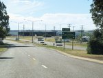
AD Sign:
Advance directional sign approaching the Henty Hwy (A200) intersection on the outskirts of Hamilton, December 2006. The A200 duplex ends at this intersection.
Image © Rob Tilley
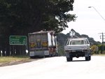
Distance Sign:
RD sign as you leave the town of Hamilton, December 2006.
Image © Rob Tilley
1 VIC Government, VicRoads, Road Management Plan 2020-2021, 07 December 2020.
2 Viseth Uch.


