Statistics:
- Length:
- 230 km
- Termini:
- Eastern: Corio-Waurn Ponds Rd (A10) and Geelong-Portalington Rd (Ryrie St) (C123)
- Western: Glenelg Hwy (B160) and Hiller Ln (unnumbered), Hamilton
- Suburbs, Towns & Localities Along Route:
- Geelong, Fyansford, Inverleigh, Wingeel, Cressy, Berrybank, Lismore, Derrinallum, Darlington, Mortlake, Hexham, Caramut, Penshurst, Tarrington and Hamilton
Route Numbering:
- Current: B140
- Multiplexed with: C146 C178
- Former: 106 1
- Road Authority Internal Classification: 2
- 6780
General Information:
The Hamilton Highway is entirely single carriageway, with 2 lanes in each direction. It is a rural highway standard road, connecting the coastal town of Geelong to the state's mid west and eventually South Australia via Glenelg Hwy (B160) from Hamilton.
Multiplexes along the route include:
- C146, for 1 km, Cressy.
- C178, for 1 km, Penshurst.
History:
- 1931: Construction of Deviation Road commences with unemployment labour during the Great Depression. The route was cut into the hillside, the surface was originally of concrete construction. 3
- 1933: Deviation Road opens to traffic, 54 years after the first petition by Fyansford residents for such a road. 3
- 1998: SR106 decommissioned. Introduction of B140 route number. 1

Fingerboard Assembly:
Fingerboards on the corner of Glenelg Hwy (B160) and Hamilton Hwy (B140) at Hamilton, January 2017. Click or tap here for a photo of this location by Rob Tilley from October 2006.
Image © Huang Milton Collection

Reassurance Directional Sign:
Distance sign on the outskirts of Hamilton, January 2017.
Image © Huang Milton Collection

Advance Directional Sign:
Faded AD sign approaching Petschels Ln, Hamilton, January 2017.
Image © Huang Milton Collection

Petschels Lane:
Corner of Hamilton Hwy (B140) and Petschels Ln at Hamilton, January 2017.
Image © Huang Milton Collection

Entering Tarrington:
Hamilton Hwy (B140) as it enters the town of Tarrington, January 2017.
Image © Huang Milton Collection

Trailblazer:
Trailblazer on Hamilton Hwy (B140) at Tabor, January 2017.
Image © Huang Milton Collection

Entering Penshurst:
Hamilton Hwy (B140) as it enters the town of Penshurst, January 2017.
Image © Huang Milton Collection

Advance Directional Sign:
AD sign at Penshurst approaching Penshurst-Warrnambool Rd (C178) and Bell St (C185), January 2017.
Image © Huang Milton Collection

Penshurst-Warrnambool Road & Bell Street:
Hamilton Hwy (B140) at the roundabout with Penshurst-Warrnambool Rd (C178) and Bell St (C185) in Penshurst, January 2017. The C178 duplex begins here.
Image © Huang Milton Collection

Advance Directional Sign:
AD sign at Penshurst approaching Scales St, January 2017.
Image © Huang Milton Collection

Advance Directional Sign:
AD sign at Penshurst approaching Penshurst-Dunkeld Rd (C178), January 2017.
Image © Huang Milton Collection

Trailblazer:
Trailblazer at the corner of Hamilton Hwy (B140) and Racecourse Rd, Penshurst, January 2017.
Image © Huang Milton Collection

Reassurance Directional Sign:
Distance sign at Penshurst, January 2017.
Image © Huang Milton Collection

Trailblazer:
B140 trailblazer on the outskirts of Penshurst, January 2017.
Image © Huang Milton Collection

Advance Directional Sign:
AD sign approaching Glenthompson-Caramut Rd and Caramut-Chatsworth Rd at Caramut, January 2017.
Image © Huang Milton Collection

Glenthompson-Caramut Road & Caramut-Chatsworth Road:
Hamilton Hwy (B140) at the junction with Glenthompson-Caramut Rd and Caramut-Chatsworth Rd at Caramut, January 2017.
Image © Huang Milton Collection

Entering Caramut:
Hamilton Hwy (B140) as it enters the town of Caramut, January 2017.
Image © Huang Milton Collection

Advance Directional Sign:
AD sign at Caramut approaching Warrnambool-Caramut Rd (C174), January 2017.
Image © Huang Milton Collection

Warrnambool-Caramut Road:
Corner of Hamilton Hwy (B140) and Warrnambool-Caramut Rd at Caramut, January 2017.
Image © Huang Milton Collection
Distance Sign:
RD sign leaving the Lismore area. March 2008.
Image © Michael Gill

Advance Directional Sign:
AD sign at Fyansford approaching Fyansford-Gehringhap Rd (C137), December 2012.
Image © Tim Cole

Reassurance Directional Sign:
Distance sign at Fyansford, December 2012.
Image © Tim Cole

Advance Directional Sign:
AD sign at Fyansford approaching Princes Fwy (M1), July 2009.
Image © Tim Cole

Moorabool River:
Hamilton Hwy (B140) as it crosses Moorabool River at Fyansford, January 2017.
Image © Huang Milton Collection

Advance Directional Sign:
AD sign at Fyansford approaching Hyland St (C118), December 2012.
Image © Tim Cole

Hyland Street:
Corner of Hamilton Hwy (B140) and Hyland St (C118) at Fyansford, December 2012.
Image © Tim Cole

Trailblazer:
B140 trailblazer at Newtown, December 2012.
Image © Tim Cole

Advance Directional Sign:
AD sign approaching Shannon Av (C136) at Newtown, December 2012.
Image © Tim Cole

Trailblazer:
Trailblazer after the Shannon Av junction in Newtown, December 2012.
Image © Tim Cole

Advance Directional Sign:
AD sign at Newtown approaching Pakington St, December 2012.
Image © Tim Cole

Advance Directional Sign:
AD sign at Newtown approaching Corio-Waurn Ponds Rd (A10) and Ryrie St (C123), December 2012. Note the remnant M1 route number.
Image © Tim Cole

Advance Directional Sign:
AD sign at Fyansford approaching Princes Fwy (M1), July 2009.
Image © Tim Cole
Intersection Directional Sign:
ID sign on the corner of Windemere Rd and Spring Ck Rd at Murgheboluc. December 2006. Sign is facing southbound traffic on Spring Ck Rd.
Image © Rob Tilley
Intersection Directional Sign:
ID sign on the corner of Windemere Rd and Spring Ck Rd at Murgheboluc. December 2006. Sign is for traffic turning onto Spring Ck Rd.
Image © Rob Tilley
Advance Directional Sign:
AD sign approaching the intersection with Dundas St (C145) in Inverleigh. December 2006.
Image © Rob Tilley
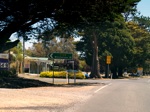
Dundas Street:
The intersection with Dundas St (C145) in Inverleigh. December 2006.
Image © Rob Tilley
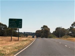
Distance Sign:
RD sign as you leave Inverleigh, December 2006.
Image © Rob Tilley
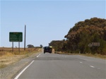
Distance Sign:
RD sign at Barunah Plains after the junction with Inverleigh-Shellford Rd, December 2006.
Image © Rob Tilley
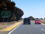
Advance Directional Sign:
AD sign approaching Colac-Ballarat Rd (C146) at Cressy, December 2006.
Image © Rob Tilley
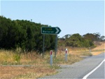
Intersection Directional Sign:
ID sign at the junction with Colac-Ballarat Rd (C146) at Cressy, October 2006.
Image © Rob Tilley
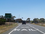
Advance Directional Sign:
AD sign approaching the intersection with Colac-Ballarat Rd (C146) at Cressy, December 2006.
Image © Rob Tilley
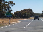
Intersection Directional Sign:
ID sign assembly at the junction with Colac-Ballarat Rd (C146) at Cressy, October 2006.
Image © Rob Tilley
Distance Sign:
RD sign leaving the town of Cressy, December 2006.
Image © Rob Tilley
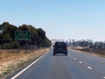
Advance Directional Sign:
AD sign at Duverny approaching Foxhow Rd (C164), December 2006.
Image © Rob Tilley
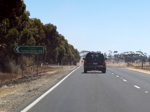
Foxhow Road Junction:
Intersection directional sign approaching Foxhow Rd (C164) at Duverny. December 2006.
Image © Rob Tilley
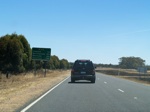
Distance Sign:
RD sign after the intersection with Foxhow Rd (C164) at Duverny. December 2006.
Image © Rob Tilley
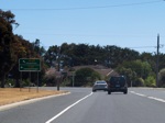
Advance Directional Sign:
AD sign approaching the intersection with Camperdown-Lismore Rd (C165) at Lismore. December 2006.
Image © Rob Tilley
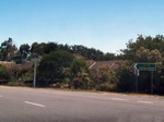
ID Sign & Fingerboards:
Signage at the intersection with Camperdown-Lismore Rd (C165) at Lismore. December 2006.
Image © Rob Tilley
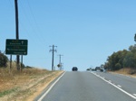
AD Sign:
Advance directional sign for the Camperdown-Skipton Rd (C172) junction at Lismore, December 2006.
Image © Rob Tilley
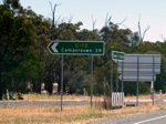
ID Sign:
Intersection directional sign at the Camperdown-Skipton Rd (C172) junction at Lismore, December 2006.
Image © Rob Tilley
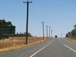
Distance Sign:
RD sign as you leave the Lismore area, December 2006.
Image © Rob Tilley
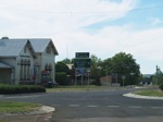
ID Sign Assembly:
Intersection directional sign looking northbound at Penshurst on the corner of Bell St (B140) and Penshurst-Warrnambool Rd (C178) (Martin St), October 2006.
Image © Rob Tilley
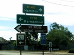
ID Sign Assembly:
Intersection directional sign looking westbound at Penshurst on the corner of Bell St (B140) and Macarthur-Penshurst Rd (C178), October 2006.
Image © Rob Tilley
Distance Sign:
RD sign as you leave Penshurst, October 2006.
Image © Rob Tilley
AD Sign:
Advance directional sign at Hamilton approaching Petschels Lane, October 2006.
Image © Rob Tilley
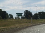
ID sign:
Intersection directional sign at Hamilton at the intersection with Petschels Lane, October 2006.
Image © Rob Tilley
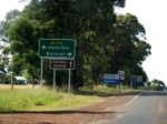
Advance Directional Sign:
AD sign on Hamilton Highway approaching Glenelg Highway (B160) at Hamilton. October 2006.
Image © Rob Tilley
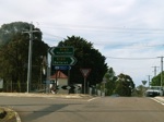
End B140:
Glenelg Hwy (B160) and Hiller Ln, the western terminus of Hamilton Highway at Hamilton, October 2006.
Image © Rob Tilley
1 Viseth Uch.
2 VIC Government, VicRoads, Road Management Plan 2020-2021, 07 December 2020.
3 A Journey to Destiny 1890-1990 100 Years of Cement Manufacturing at Fyansford by Australian Cement Limited, John McNeil, 1990.


