Statistics:
- Length:
- 76 km (Geelong to Queenscliff: 33 km) (Portsea to Mornington: 43 km)
- Termini:
- Eastern: Nepean Hwy (MR3), Main St (C782) and Mornington-Tyabb Rd (C782), Mornington
- Western: Corio-Waurn Ponds Rd (A10), Geelong
- Suburbs, Towns & Localities Along Route:
- (Western Section) Geelong, East Geelong, Newcomb, Moolap, Leopold, Wallington, Marcus Hill, Point Lonsdale and Queenscliff
- (Eastern Section) Portsea, Sorrento, Blairgowrie, Rye, Tootgarook, Rosebud West, Rosebud, McCrae, Dromana, Mount Martha and Mornington
Route Numbering:
- Current: B110
- Multiplexed with: C787 C788
- Former: 3 91
- Road Authority Internal Classification: 1
- 4034 (Portsea to Dromana)
- 5751 (Dromana to Tuerong)
- 6660 (Tuerong to Mornington)
- 6730 (Geelong to Queenscliff)
General Information:
B110 connects Geelong with Melbourne's Mornington Peninsula and is split into 2 segments which are linked by a vehicular ferry due to the topography of the opening of Port Phillip Bay.
The western section of B110 is a mix of divided and undivided route servicing the business centre of Geelong, as well as commercial, residential and rural areas. Some of the eastern section of the route is freeway standard together with multi-lane arterial road standard, single carriageway 2-lane undivided road, and services semi-rural, residential and commercial areas.
Multiplexes along the route include:
- C787, for 3 km, between Dromana and Mount Martha.
- C788, for 2 km, Dromana.
History:
- 1960s: The planning for the greater Mornington Peninsula Freeway began in the 1960s in the then Metropolitan Planning Scheme. 2
- 1990s: Mornington Peninsula Fwy between Safety Beach and Mt Martha was constructed.
- 1998: SR3 and SR91 replaced by B110 due to the introduction of the Statewide Route Numbering Scheme (SRNS). 3
- 17 November 1999: Construction commences on converting the intersection of Bellarine Hwy & Banks Rd at Marcus Hill to staggered junction begins. 4
- April 2000: Completion of the works at the intersection of Bellarine Hwy & Banks Rd at Marcus Hill. 4
- 2013: Removal of MR11 duplex, with the opening of Peninsula Link roadworks. B110 re-routed from Mornington Peninsula Fwy to Nepean Hwy through Dromana.
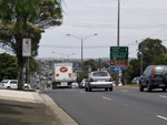
Advance Directional Sign:
AD sign on Corio-Waurn Ponds Rd (former Princes Hwy) (A10) in Geelong. September 2006. M1 was replaced by A10 in January 2009, coinciding with the opening of the Geelong Bypass.
Image © Rob Tilley

Advance Directional Sign:
AD sign on Moorabool St in Geelong, approaching Bellarine Hwy (McKillop St) (B110), June 2016.
Image © Tim Cole

NEW Advance Directional Sign:
AD sign on Hotham Rd at Sorrento, approaching Point Nepean Rd (B110), September 2006. This sign has since been replaced.
Image © Rob Tilley

NEW Advance Directional Sign:
AD sign near Watts Rd, approaching Ocean Beach Rd and Constitution Hill Rd at Sorrento, September 2006.
Image © Rob Tilley

NEW Intersection Directional Sign:
ID sign at the junction with Ocean Beach Rd and Constitution Hill Rd at Sorrento, September 2006. B110 turns left at this location.
Image © Rob Tilley
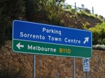
Intersection Directional Sign:
ID sign facing ferry terminal on The Esplanade at Sorrento. September 2006.
Image © Rob Tilley

NEW Dundas Street:
Corner of Point Nepean Rd (B110) and Dundas St, Rye, September 2006.
Image © Rob Tilley

NEW Reassurance Directional Sign:
Distance sign in the Rye town centre, after Dundas St, September 2006.
Image © Rob Tilley

NEW Advance Directional Sign:
AD sign on Point Nepean Rd (B110), approaching Elizabeth Av at Rosebud West, September 2006. The MR11 shield has since been replaced with M11.
Image © Rob Tilley

UPDATED Elizabeth Avenue:
Point Nepean Rd (B110) at the Elizabeth Av junction, Rosebud West, June 2016. Click or tap here for a photo of this location by Rob Tilley from September 2006.
Image © Rob Tilley

Elizabeth Avenue:
Point Nepean Rd (B110) at the Elizabeth Av junction, Rosebud West, June 2016.
Image © Rob Tilley

Advance Directional Sign:
AD sign approaching Boneo Road (C777) in Rosebud. June 2016. Click or tap here for a photo of this location by Rob Tilley from September 2006.
Image © Rob Tilley

Boneo Road Intersection:
Pt Nepean Rd as it passes Boneo Rd (C777) in Rosebud. June 2016. Click or tap here for a photo of this location by Rob Tilley from September 2006.
Image © Rob Tilley

Distance Sign:
RD sign after the Boneo Rd intersection in Rosebud, June 2016.
Image © Rob Tilley
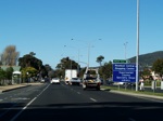
Approaching Ninth Avenue:
Advance directional sign for the Ninth Av intersection in Rosebud, September 2006.
Image © Rob Tilley
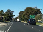
Advance Directional Sign:
AD sign approaching Jetty Rd in Rosebud. September 2006.
Image © Rob Tilley
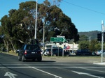
Jetty Road Intersection:
Looking northeast at Rosebud through the Jetty Rd junction, September 2006.
Image © Rob Tilley
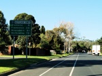
Distance Sign:
Remnant SR3 Nepean Hwy reassurance directional sign on what is now known at Pt Nepean Rd (B110) at Rosebud after the Jetty Rd intersection, September 2006.
Image © Rob Tilley
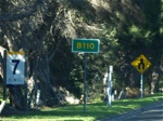
Trailblazer:
B110 trailblazer near Adams Rd in Rosebud just before the divided road ends, September 2006.
Image © Rob Tilley
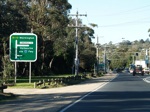
Diagrammatic AD Sign:
Advance directional sign at McCrae approaching Lonsdale Street, September 2006.
Image © Rob Tilley
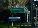
ID Sign:
Intersection directional sign at the Lonsdale St intersection, September 2006.
Image © Rob Tilley
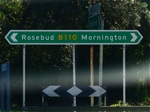
Intersection Directional Sign:
ID sign facing Lonsdale St traffic in McCrae, September 2006.
Image © Rob Tilley
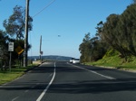
Point Nepean Hwy at Dromana:
B110 as it passes through the Anthony's Nose area. September 2006.
Image © Rob Tilley
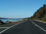
Point Nepean Hwy at Dromana:
B110 as it passes through the Anthony's Nose area. September 2006.
Image © Rob Tilley
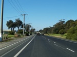
Dromana:
B110 in the Dromana area near Latrobe Reserve. September 2006.
Image © Rob Tilley
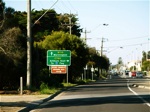
Advance Directional Sign:
AD sign approaching McCulloch St (C789) in Dromana, September 2006.
Image © Rob Tilley
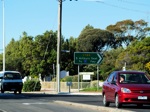
McCulloch St Intersection:
Intersection directional sign at the McCulloch St (C789) junction in Dromana. September 2006.
Image © Rob Tilley
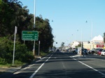
Distance Sign:
RD sign after the McCulloch St intersection in Dromana, September 2006.
Image © Rob Tilley
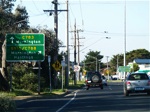
Advance Directional Sign:
AD sign for the Marine Drive (C783) and Nepean Highway (B110) intersection, Dromana. September 2006.
Image © Rob Tilley
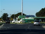
Corner of Marine Dr & Nepean Hwy:
ID sign assembly on the corner of Marine Drive (C783) and Nepean Highway (B110), September 2006. Since this photo was taken, traffic signals have been added to this intersection.
Image © Rob Tilley
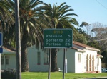
Distance Sign:
RD sign at Dromana after the Nepean Hwy (B110) / Marine Dr (C783) intersection. September 2006.
Image © Rob Tilley
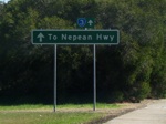
Old AD Sign:
Old advance directional sign showing SR3 / Nepean Highway on Lonsdale St (looking northwest) in McCrae. September 2006. This sign has since been replaced with a B110 / Point Nepean Road sign.
Image © Rob Tilley
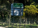
Distance Sign:
RD sign on Lonsdale Street in McCrae, looking northwest approaching Point Nepean Road (B110). September 2006.
Image © Rob Tilley
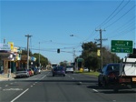
Advance Directional Sign:
AD sign approaching Jetty Rd in Rosebud, September 2006.
Image © Rob Tilley
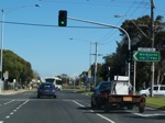
Jetty Road Intersection:
ID sign on the corner of Jetty Rd in Rosebud, September 2006.
Image © Rob Tilley
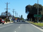
Advance Directional Sign:
AD sign approaching Boneo Rd (C777) in Rosebud. September 2006.
Image © Rob Tilley
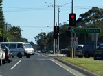
Boneo Rd Intersection:
ID sign on the corner of Boneo Road (C777) in Rosebud, September 2006.
Image © Rob Tilley
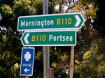
Intersection Directional Sign:
ID sign assembly facing Boneo Rd traffic in Rosebud, September 2006.
Image © Rob Tilley

Distance Sign:
RD sign and general view along Pt Nepean Rd after the Boneo Rd intersection, Rosebud West, June 2016.
Image © Rob Tilley

Advance Directional Sign:
AD sign approaching Elizabeth Av at Rosebud West, June 2016.
Image © Rob Tilley

Advance Directional Sign:
AD sign at Rosebud West pointing the direction to Portsea, June 2016.
Image © Rob Tilley

Approaching Truman Road:
AD sign assembly at Rosebud West approaching Truemans Road, June 2016.
Image © Rob Tilley

Trailblazer:
Remnant MR3 trailblazer facing Truemans Rd at Rosebud West, June 2016.
Image © Rob Tilley
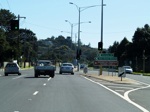
Intersection Directional Sign:
ID sign for the Dundas St intersection, Rye. September 2006.
Image © Rob Tilley
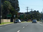
Distance Sign:
RD sign after Dundas St in Rye, September 2006.
Image © Rob Tilley
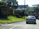
AD Sign:
Advance directional sign approaching The Esplanade in Sorrento, September 2006.
Image © Rob Tilley
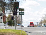
Trailblazer:
Route number trailblazer, facing northbound traffic on Yarra Street in Geelong. September 2006.
Image © Rob Tilley
1 VIC Government, VicRoads, Road Management Plan 2020-2021, 07 December 2020.
2 VIC Government, Department of Sustainability and Environment.
3 Viseth Uch.
4 VIC Government, Office for the Minister for Transport.


